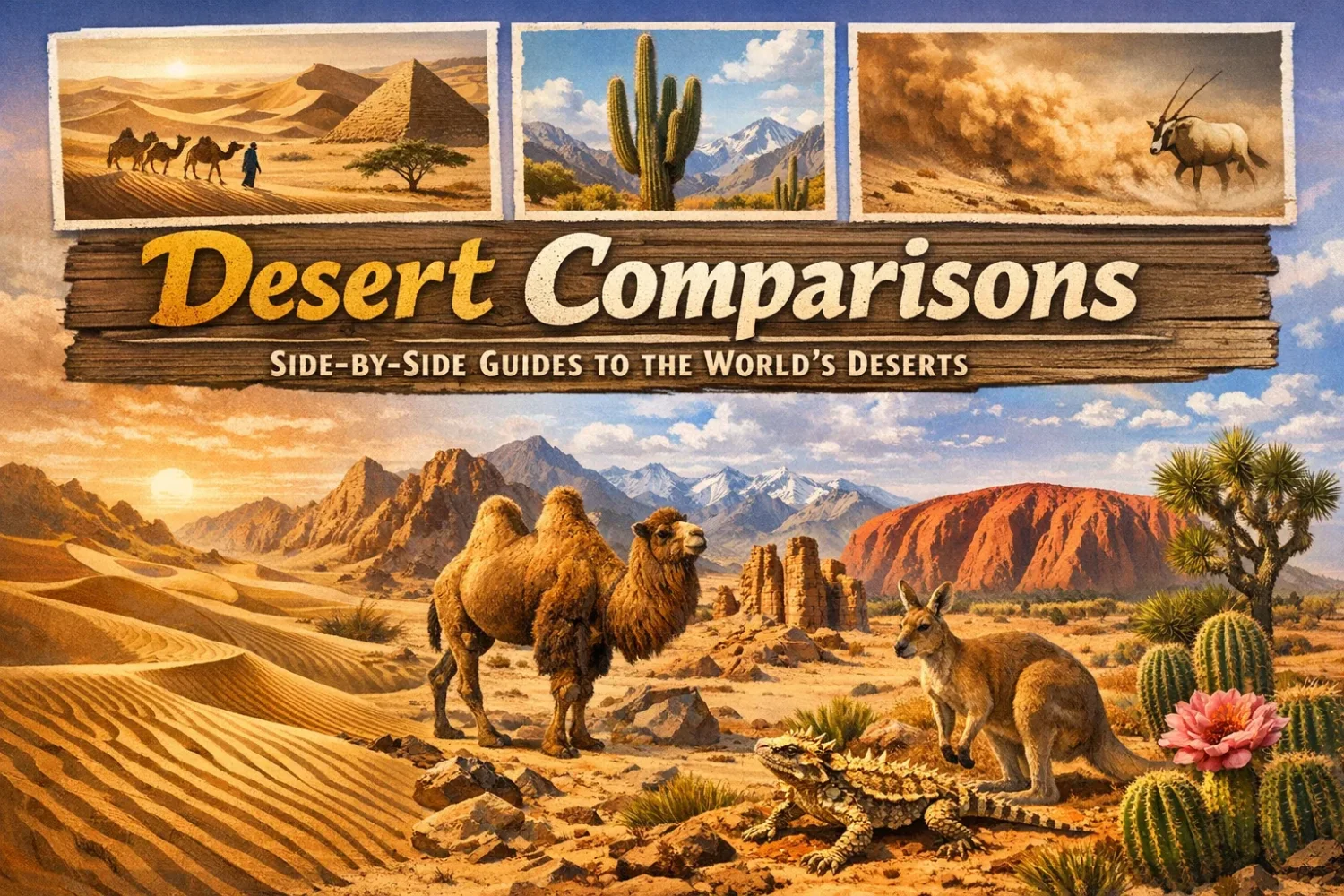
1 inventions in Desert Comparisons
Deserts do not split neatly into one image. Many people picture only dunes, blazing sun, and a horizon made of sand. Real deserts are much less uniform. Some are ruled by heat, some by cold, some by fog, and some by mountain rain shadow. One desert can hold giant dune fields, while the next is mostly gravel, salt pans, or bare rock. Put side by side, they stop looking like versions of the same place.
That is why desert comparison matters. It helps separate surface appearance from climate process. The Sahara and Arabian deserts are both hot, yet their scale and landforms feel very different. The Mojave and Great Basin sit next to each other in the American West, yet one is known for Joshua trees and the other for sagebrush and snowy winters. The Atacama and Namib are both famous for dryness, but the role of coastal fog is not the same in each.
A useful comparison always asks the same set of things: How much moisture arrives? When does it arrive? Does it arrive as rain, snow, or fog? What kind of ground holds the landscape together? And finally, what kind of plants and animals can actually live there? Once those questions stay in view, the desert map of the world becomes easier to read.
Many physical geographers use about 250 millimetres of mean annual precipitation as a common upper desert limit, though local definitions vary and some cold or fog-fed drylands blur that line. So a desert is not defined by heat first. It is defined by lack of moisture. Heat changes the feel of the place, but dryness creates the desert.
How Desert Comparison Works
Desert pages often compare only size or famous animals. That leaves out the thing that most strongly shapes the land: the route moisture takes before it fails to arrive. The Sahara owes its dryness mainly to subtropical high pressure. The Great Basin sits behind the Sierra Nevada and loses incoming Pacific moisture before it can reach the basin floors. The Atacama and Namib both live beside cold ocean currents, where cool air near the surface and warmer air above it can make clouds and fog but not much rain. Antarctica, colder than all of them, stays dry because frigid air holds very little water vapour.
That is also why a desert comparison should never stop at annual rainfall totals. Two places can both be dry and still function in very different ways. The Sonoran Desert gets more rain than the Mojave in many areas, but what really sets it apart is its two-season rainfall pattern: winter rain plus summer monsoon storms. The Mojave depends more on winter moisture and cool-season growth windows. Tiny timing changes, big ecological results.
Surface type matters too. A desert that looks sandy from a postcard may be mostly reg, gibber plain, or rock-strewn plateau. The Gobi is the classic example. It is one of the great deserts of Earth, but much of it is not a sea of dunes. It is bare rock, gravel, basin floor, and broken upland. The same is true across large parts of the Sahara and Arabian Desert. Sand gets attention. Gravel and stone often control the actual terrain.
| Comparison Lens | Hot Desert | Cold Desert | Coastal Fog Desert | Polar Desert |
|---|---|---|---|---|
| Dryness Source | Subtropical high pressure, sinking air | Rain shadow, continental interior, high elevation | Cold ocean current and temperature inversion | Air too cold to hold much moisture |
| Typical Moisture Form | Brief rain bursts, rare storms | Light rain, winter snow, some fog | Fog, mist, low cloud, very little rain | Mostly snow, very low liquid-water equivalent |
| Thermal Pattern | Hot days, often large day-night range | Cold winters, cool nights, wide seasonal swing | Milder coast, less thermal drama near sea | Persistent cold, short cool summer at best |
| Common Ground Surface | Ergs, regs, hammadas, wadis, alluvial fans | Gravel basins, rocky plains, sage steppe, salt flats | Dunes, gravel plains, salt pans, coastal terraces | Ice sheet, bare rock, polar barrens |
| Plant Signal | Sparse shrubs, ephemeral herbs, drought-rooted trees near water | Shrubs, bunchgrasses, sagebrush, cold-tolerant scrub | Fog-fed plants, lichens, succulents, highly local growth | Mosses, lichens, algae, very limited vascular plants |
| Famous Examples | Sahara, Arabian, Sonoran | Gobi, Great Basin, Patagonia | Atacama, Namib | Antarctic interior, Arctic polar barrens |
Terms That Make Desert Comparisons Easier
- Erg: a large sand sea or broad dune field built from loose wind-moved sand.
- Reg: a stony or gravel-covered desert plain, often armored by desert pavement.
- Hamada: a bare rock plateau or hard rocky desert surface.
- Rain Shadow: a dry zone formed on the leeward side of a mountain barrier after moist air loses water on the windward side.
- Fog Desert: a desert where fog supplies part of the usable moisture even when rain is nearly absent.
- Playa: a dry lake bed or salt pan that fills only after unusual rainfall or runoff.
- Alluvial Fan: a fan-shaped sediment spread where streams leave mountains and lose energy.
- Monsoon: a seasonal wind-and-rain shift that can deliver short, strong summer storms to desert margins or interiors.
- Desert Pavement: a tightly packed layer of coarse gravel and stones left after fine material is removed.
Reference Table for the Main Deserts on This Page
| Desert Or Region | Approximate Size Or Extent | Typical Annual Moisture | Thermal Character | Signature Surface | Well-Known Life Forms |
|---|---|---|---|---|---|
| Sahara | About 8.6 million sq km | About 76 mm on average in broad northern sectors | Very hot days, large day-night range | Regs, hammadas, ergs, oasis depressions | Date palm at oases, acacia, addax, dromedary |
| Gobi | About 1.3 million sq km | Roughly <50 mm in the west to over 200 mm in the northeast | Cold winter, hot summer, very continental | Bare rock, gravel plains, basins, limited dune fields | Saxaul, wormwood, Bactrian camel, gazelles |
| Atacama | Narrow belt about 1,000–1,100 km long | Some sectors under 2 mm; many places get almost none | Cooler than many tropical deserts | Salt pans, gravel, volcanic slopes, fog-bound coast | Tamarugo, llareta, lichens, highly local bloom flora |
| Namib | About 1,900 km along the Atlantic coast | Coast almost rainless, with heavy fog influence | Mild coast, hotter inland margins | Great dunes, gravel plains, dry river channels | Welwitschia, lichens, geckos, beetles, oryx |
| Arabian Desert | About 2.3 million sq km | Usually under 100 mm on average, but locally variable | Extreme summer heat, some winter cool | Sand seas, gravel plains, lava fields, wadis | Acacia, saltbush, dromedary, Arabian oryx in protected zones |
| Patagonian Desert | About 673,000 sq km | About 90–430 mm, with strong drying by the Andes rain shadow | Cool, windy, semiarid to arid | Plateaus, mesas, shrub-steppe, gravel plains | Low shrubs, bunchgrasses, guanaco, rhea |
| Mojave | More than 65,000 sq km | About 50–150 mm | Hot summer, cool to cold winter nights | Basins, alluvial fans, salt flats, rocky slopes | Joshua tree, creosote, kit fox, desert tortoise |
| Sonoran | About 310,800 sq km | About 75–380 mm, locally more on uplands | Very hot, with rare frost in low areas | Wash systems, bajadas, rocky hills, cactus plains | Saguaro, palo verde, ironwood, Gila monster |
| Great Basin Desert | About 492,000 sq km | Often 150–300 mm, much of it as winter snow | Cold desert with snowy winters | Intermontane basins, sagebrush valleys, playas | Sagebrush, saltbush, pronghorn, jackrabbit |
| Australian Outback Context | Not one desert; broad inland arid and semiarid region | Arid zone often 250 mm or less; deserts cover nearly 20% of Australia | Mostly hot arid to semiarid interior | Sand ridges, gibber plains, shrublands, salt lakes | Spinifex, mulga, reptiles, marsupials adapted to dry country |
One mistake shows up again and again in desert writing: treating sandiness as the same thing as desertness. It is not. Many of the driest places on Earth are gravel plains, rock plateaus, saline basins, or cold, wind-scoured steppe. Sand is only one desert expression. A very photogenic one, yes. But only one.
Core Desert Comparisons
Sahara Vs Gobi Desert: Size, Climate, Animals, and Terrain
| Measure | Sahara | Gobi |
|---|---|---|
| Approximate Area | About 8.6 million sq km | About 1.3 million sq km |
| Climate Type | Hot subtropical and tropical desert | Cold continental desert and semidesert |
| Typical Moisture | Broad average near 76 mm in northern sectors | Less than 50 mm in drier western parts to over 200 mm in wetter northeast |
| Thermal Range | Hot days, cool to cold nights | Around -40°C winter lows to over 45°C summer highs in some areas |
| Dominant Surface Image | Mixed: regs, hammadas, ergs, basins | Mostly rock, gravel, and bare ground; fewer large sand seas |
| Iconic Life | Dromedary, addax, fennec fox, oasis date palm | Bactrian camel, gazelles, saxaul, wormwood |
The first difference is scale. The Sahara is a continental giant. It stretches across almost the whole breadth of northern Africa and remains the largest hot desert on Earth. The Gobi is immense too, but it is far smaller and far more enclosed by uplands and mountain systems. In a straight visual comparison, the Sahara feels open and sweeping; the Gobi feels segmented, basin-like, and more structurally tied to surrounding highlands.
Climate separates them even more clearly. The Sahara is the textbook hot desert, shaped by dry descending air and very low rainfall. The Gobi belongs to the cold desert family. It gets harsh winters, sharp seasonal swings, and severe continental temperature ranges. A Sahara day can roast and then cool quickly after sunset, but the Gobi pushes that contrast much further across the year. Winter there bites hard. Summer can still turn fierce.
Surface type is where many readers get surprised. The Sahara has famous ergs, but only about a quarter of its surface is made of sand sheets and dunes. Large sectors are reg, serir, or hammada. The Gobi goes even farther in that direction. Much of it is bare rock and gravel, not rolling dune country. If someone imagines both deserts as endless soft sand, the image misses the ground truth.
Plant life follows moisture pattern and soil. The Sahara holds sparse shrubs, ephemeral herbs after rain, acacia in selected zones, and date palms where groundwater allows oasis agriculture. The Gobi supports saxaul, wormwood, hardy shrubs, and grasses in moister pockets. Not lush, of course, but often more steppe-linked than people expect. In parts of the eastern Gobi, the land softens toward semidesert and steppe transition.
Animal imagery also tells the climate story. The Sahara is linked with the dromedary, desert foxes, antelopes, and oasis birds. The Gobi is the home ground of the wild and domestic Bactrian camel tradition, built for cold as much as drought. That one comparison says a lot. One hump versus two matters less here than what the animals are adapted to survive: heat-dominant dryness in the Sahara, cold-and-dry exposure in the Gobi.
So the shortest clean reading is this: the Sahara wins on size and heat, while the Gobi stands out for cold, rockier terrain, and a wider seasonal swing. The Sahara is the larger hot desert archetype. The Gobi is the classic reminder that a desert can freeze, snow, and still be fully desert.
Atacama Vs Namib Desert: The Driest Coastal Desert Systems Compared
| Measure | Atacama | Namib |
|---|---|---|
| Setting | Pacific coast of northern Chile, beside the Andes | Atlantic coast of southwestern Africa, beside the Great Escarpment |
| Length | About 1,000–1,100 km north to south | About 1,900 km along the coast |
| Moisture Pattern | Extremely low rainfall, some sectors under 2 mm | Coast almost rainless, heavy dependence on fog and marine air |
| Dryness Driver | Cold Humboldt Current, Pacific high pressure, coastal range plus Andes barrier | Cold Benguela Current, marine inversion, coastal fog belt |
| Ground Character | Salt flats, gravel, volcanic basins, dry plateaus | Dune seas, gravel plains, dry riverbeds, coastal terraces |
| Iconic Life | Tamarugo, llareta, bloom flora, microbial extremes | Welwitschia, fog-linked lichens, beetles, geckos, oryx |
These two deserts are often grouped together because both live at the far dry edge of nonpolar desert climates. Yet they do not feel alike once you compare how they are built. The Atacama is a narrow Pacific desert pushed between the coast and the Andes. The Namib is a long Atlantic coastal belt with dramatic dunes, gravel plains, and river corridors that rarely carry surface water all the way to the sea.
The Atacama is the more hyperarid of the pair in common dryland discussion. Some areas receive less than 2 millimetres of precipitation a year, and parts of the desert have gone extraordinarily long stretches with little to no measurable rain. Its dryness comes from stacked controls: the cold Humboldt Current, persistent subsiding air from the Pacific high, and topographic shielding by both the coastal mountains and the Andes. That double barrier matters a lot. The desert is not just dry by latitude. It is dry by atmospheric setup and mountain geometry.
The Namib is also almost rainless along the coast, but its character leans more openly toward fog ecology. The cold Benguela Current chills low coastal air and helps create fog under a temperature inversion roughly 300 metres thick in many coastal settings. That fog then becomes a working moisture source for lichens, small plants, and many animals. In the Atacama, fog matters too, and fog harvesting has real practical use in parts of Chile, but the Namib is often the cleaner example of a desert whose living edge is tied visibly and repeatedly to marine fog.
Terrain makes the contrast obvious even before climate data enters the page. The Atacama is famous for salt pans, volcanic landforms, stony plateaus, and dry basins that look almost planetary. The Namib is famous for dunes—some of the tallest and most photogenic on Earth—alongside gravel plains and ephemeral river channels. If the Atacama often feels mineral and austere, the Namib feels more sculpted by moving sand and coastal air.
Their plant worlds tell another story. In the Atacama, vegetation is highly local and often tied to fog oases, elevations, or unusual water access. In wet anomaly years, desert bloom events can briefly transform large sectors with flowers. In the Namib, plants such as Welwitschia mirabilis have become icons of long-term adaptation to dry, fog-influenced conditions. The Namib also holds a cleaner visual link between life and dune systems, especially where river corridors or fog belts soften the margins.
So which desert is “drier” depends on the scale and the metric. The Atacama usually wins that conversation in the strictest nonpolar rainfall sense. The Namib stands out for how a nearly rainless coast can still sustain life through fog, dune structure, and scattered dry-river pathways. One is the poster child of hyperaridity. The other is the clearest lesson that rainfall is not the only moisture story in a desert.
Hot Desert Vs Cold Desert: What Really Changes
A hot desert and a cold desert can both be dry, open, and sparsely vegetated, but they are not interchangeable. Heat changes evaporation, soil chemistry, plant structure, animal behavior, and the length of the growing season. Cold changes all of those too, just in a different direction. This is not a cosmetic split. It reaches down to the roots, literally.
Hot deserts usually cluster around the subtropics, often between about 20° and 35° latitude. Their monthly mean temperatures are high, skies are often clear, and daytime heating can be fierce. But nights may cool fast because dry, cloudless air loses heat rapidly after sunset. The Sahara, Arabian Desert, and Sonoran Desert fit this broad pattern, though local elevation and coastal effects can soften or sharpen it.
Cold deserts tend to form in continental interiors, high basins, or rain-shadow regions. Their precipitation may come partly as snow or fog, not only rain. The Gobi, Great Basin, and large parts of Patagonia belong here. Their winters are longer, soils may freeze, and plant communities often lean toward shrubs, bunchgrasses, sage, or low steppe vegetation rather than cactus-dominant landscapes.
The biggest practical difference is not simply that one is hotter. It is that water behaves differently. In hot deserts, moisture vanishes fast through evaporation, and plants often rely on deep roots, water storage, reduced leaf area, or fast short-lived growth after rain. In cold deserts, water may be present seasonally as snowpack or frozen ground, and plant timing must match thaw, snowmelt, and cold-tolerant growth windows. The land may look empty in both places. The calendar of survival is completely different.
Animal strategies shift as well. Hot-desert animals often avoid daytime heat, burrow deeply, and use nocturnal movement to reduce water loss. Cold-desert animals must survive both drought and winter exposure. Fur density, seasonal movement, snow tolerance, and broader thermal range become more important. A Bactrian camel belongs to one desert logic. A dromedary belongs to another.
Surface character can overlap, but the plant signals usually tell you where you are. Massive cactus forests usually point toward hot deserts. Sagebrush, wormwood, bunchgrass, and snow-linked basin vegetation point toward cold deserts. The desert recieves little moisture either way; the difference is what happens before and after that moisture arrives.
The cleanest rule is simple: hot deserts are dryness plus strong heat; cold deserts are dryness plus strong seasonal cold. Dryness unites them. Temperature regime separates them.
Sandy Desert Vs Rocky Desert: Erg Vs Reg Explained
The phrase sandy desert sounds familiar because it matches the popular picture of the desert. But a rocky desert or stony desert is just as real and, across large dryland regions, often more common. The technical contrast usually turns on erg versus reg.
An erg is a desert area where sand has accumulated at large scale, usually in dune fields, sand sheets, or a combination of active and older stabilized dunes. Wind sorts the material, moves it, stacks it, and reshapes it again. Crossing an erg is physically hard because the ground itself shifts, slips, and swallows momentum. Famous ergs include the major sand seas of the Sahara and the towering dune regions of the Namib.
A reg is nearly the opposite in walking feel. It is a stony or gravel plain, often coated with desert pavement and darkened by desert varnish. Finer material has been removed or rearranged, leaving a surface of pebbles, stones, and hard-packed ground. A reg may look flat from far away but can be brutal underfoot and monotonous over distance. It is common across the Sahara, the Gobi, and many Australian gibber plains.
The reason this comparison matters is that it corrects a basic myth: deserts are not mostly dune oceans. In the Sahara, dunes and sand sheets cover only about a quarter of the surface. Large parts are rocky plateau, gravel plain, basin floor, and dry mountain land. In the Gobi, the “all sand” image misses the mark even more strongly. Much of that desert is bare rock or coarse ground, with far fewer great sand seas than the public usually imagines.
Ecology changes with surface too. Sand can store and release heat differently from gravel. Dune slipfaces, interdune hollows, and sand ridges create microhabitats for reptiles, insects, roots, and seed banks. Rocky plains, by contrast, often produce tougher runoff, harsher reflection, and a different pattern of moisture retention. Water may disappear faster from the surface, while plants rely on cracks, shallow accumulation zones, or alluvial margins.
Even color and travel history shift with the ground. Ergs tend to give the desert its postcard drama. Regs give it scale, hardness, and endurance. A sandy desert moves; a rocky desert resists. Seen this way, erg and reg are not just landform terms. They are two different desert experiences.
Atacama Vs Patagonian Desert: South America’s Two Dry Extremes
| Measure | Atacama | Patagonian Desert |
|---|---|---|
| Position | Pacific side of northern Chile | East of the Andes in southern Argentina and adjacent areas |
| Approximate Extent | Narrow 1,000–1,100 km strip | About 673,000 sq km |
| Dryness Source | Cold current, Pacific high pressure, coastal and Andean barriers | Strong Andes rain shadow plus dry winds |
| Typical Moisture | Often near zero in driest sectors | Roughly 90–430 mm depending on zone |
| Thermal Feel | Cool arid, often surprisingly moderate near coast | Cool, windy, steppe-like, frost-prone |
| Signature Landscape | Salt flats, volcanic forms, gravel, fog coast | Plateaus, mesas, gravel plains, shrub-steppe |
Both deserts belong to South America, but they sit at opposite ends of the dryland mood. The Atacama is narrow, mineral, hyperarid, and controlled by the Pacific margin. The Patagonian Desert is broad, cool, and wind-worked, stretched east of the Andes across plateau country and dry steppe. One feels pared down to rock, salt, and sky. The other feels open, rough, and permanently exposed to moving air.
Their drying mechanisms are different enough that they make a near-perfect teaching pair. The Atacama is a coastal desert where cold ocean water and atmospheric stability suppress rainfall. The Patagonian Desert is a classic rain-shadow desert. Moist westerlies lose much of their water on the Andes, then descend eastward drier and warmer. By the time the air reaches Patagonia’s leeward side, it is already stripped down. Wind then becomes one of the landscape’s main sculptors.
Rainfall numbers reflect that difference. The Atacama falls into the hyperarid class in many sectors and can go extraordinary lengths of time with almost no rain. Patagonia is dry, but not in the same way. It often receives more moisture than people expect for a desert, just not enough to support closed forest away from the Andean fringe. That is why much of Patagonia grades into dry steppe, shrubland, and semiarid plateau rather than the stark near-barrenness seen in the driest Atacama belts.
The plants say it clearly. In the Atacama, growth is local, often tied to fog, elevation, or uncommon wet phases. In Patagonia, low shrubs and grasses dominate broader areas because the moisture, though sparse, is not absent in the same totalizing way. Frost is more ordinary. Snow can occur, though it is not the defining moisture form across the whole region. The scene reads colder, tougher, and more steppe-like.
Their human-use image differs too. The Atacama is tied strongly to mining, observatories, salars, and hyperdry research settings. Patagonia’s desert side is tied more to plateau grazing country, wind, mesas, and the long transitional belt between Andean moisture and Atlantic openness. Put simply: the Atacama is South America’s driest desert in the strictest sense, while Patagonia is the continent’s largest desert region and one of its clearest examples of a cold, wind-dried rain-shadow dryland.
Sahara Vs Arabian Desert: Africa and Asia in Dryland Form
| Measure | Sahara | Arabian Desert |
|---|---|---|
| Approximate Area | About 8.6 million sq km | About 2.3 million sq km |
| Rank | Largest hot desert on Earth | Largest desert area in Asia |
| Typical Moisture | About 76 mm average in broad northern sectors | Usually under 100 mm on average, but locally variable |
| Summer Heat | Very high | Can reach about 55°C in places |
| Ground Mix | Regs, hammadas, ergs, mountains, basins | Sand seas, gravel plains, lava fields, uplands, wadis |
| Flagship Sand Region | Several major ergs | Rubʿ al-Khali, the Empty Quarter |
The Sahara and Arabian Desert are natural comparison partners because both are hot, vast, and famous well beyond geography circles. Still, they are not twins. The Sahara is much larger, stretching across most of northern Africa with a broader mix of uplands, basins, regs, mountains, ergs, and oasis systems. The Arabian Desert covers most of the Arabian Peninsula and is the dominant dryland body of southwestern Asia, but it sits inside a more clearly peninsular setting with its own coastal and upland contrasts.
The Arabian Desert is often imagined as one unbroken ocean of sand because of the fame of the Rubʿ al-Khali, the Empty Quarter. That image is only partly right. Like the Sahara, the Arabian Desert also includes gravel plains, rocky land, and volcanic fields. The difference is that the Empty Quarter is such a strong symbol that it tends to overshadow the rest of the peninsula’s desert surfaces.
Climate data show strong overlap and a few sharp departures. Both deserts are dry enough to support only sparse vegetation over large areas. Both receive intense sun and wide daily temperature shifts. Yet the Arabian Desert can reach about 55°C in places, and while average rainfall remains low, there is meaningful local variation near uplands and monsoon-influenced margins in the south. The Sahara also has internal variation, but on a much larger continental scale, from Atlantic margins to Egyptian depressions to Tibesti highlands.
Their landform language differs in emphasis. The Sahara’s identity is broad and plural: dunes, yes, but also rock plateaus, gravel plains, massifs, chotts, wadis, and great basin depressions. The Arabian Desert reads more as a peninsula of sand and stone framed by mountains, gulfs, and coastlines. Dust and wind systems matter in both, but the spatial rhythm feels different. The Sahara expands outward. The Arabian Desert folds inward around uplands, coastal humidity contrasts, and the giant sand core of the south.
In simple terms, the Sahara is broader, more varied, and much larger. The Arabian Desert is more concentrated, more peninsular, and more strongly identified with the Empty Quarter. If the Sahara is the global benchmark for hot-desert scale, the Arabian Desert is the benchmark for how a great hot desert can dominate an entire peninsula without becoming one uniform landscape.
Polar Desert Vs Cold Desert: They Overlap, But They Are Not the Same
A polar desert is a kind of cold desert, but not every cold desert is polar. That is the clean first rule. The overlap is real; the meanings are not identical.
Cold deserts are a broad group. They include places such as the Gobi, Great Basin, and parts of Patagonia, where annual precipitation stays low and cold seasons are a major ecological force. Their moisture may arrive as snow, light rain, or fog. Their ground is often shrub-steppe, gravel basin, rocky plain, or semidesert plateau. In short, they are drylands with notable cold seasons.
Polar deserts sit at the far cold end of that spectrum. Their defining trait is not only low moisture but also persistent polar cold. Antarctica is the clearest case. The inland polar plateau receives only about 50 millimetres of precipitation a year in liquid-water equivalent on average, mostly as snow, and the interior of the Antarctic Ice Sheet covers about 13.96 million square kilometres. By dryness standards, that makes Antarctica the largest desert on Earth.
This is where the common confusion begins. People hear “desert” and think “hot.” Then they hear “cold desert” and imagine the opposite version of the same thing. Polar deserts are colder still and much poorer in available liquid water. They may be dominated by ice, bare rock, or polar barrens rather than shrub steppe or sagebrush valley. The atmosphere itself carries very little moisture because cold air cannot hold much of it.
Plant life marks the difference quickly. In a cold desert like the Great Basin, shrubs and grasses can still dominate large areas. In a polar desert, vascular plants become rare or vanish altogether depending on the site, and life shifts toward lichens, mosses, microbes, and sparse specialized communities. The growing season, where it exists, is tiny.
So the best way to phrase it is this: polar desert is a stricter subset. It belongs under the cold-desert umbrella, but it occupies a much more severe environmental corner. The Gobi freezes and still supports broad land-animal and shrub systems. Antarctica freezes and locks almost everything under snow, ice, wind, and extraordinarily low moisture.
Sahara Vs Australian Outback: Why This Comparison Needs a Definition First
| Measure | Sahara | Australian Outback |
|---|---|---|
| What It Is | A single vast hot desert region | A broad inland region, not one desert |
| Approximate Area | About 8.6 million sq km | No single fixed desert figure because the term covers many arid and semiarid interiors |
| Dryland Share | Dominates northern Africa | About 70% of Australia is arid or semiarid; deserts make up nearly 20% of Australia |
| Ground Pattern | Mixed regs, hammadas, ergs, mountains, basins | Sand ridges, gibber plains, shrublands, salt lakes, several distinct deserts |
| Representative Desert Core | Sahara itself | Great Victoria, Great Sandy, Simpson, Gibson, Tanami, and others |
This comparison is one of the most useful on the page because it fixes a naming problem. The Sahara is a desert. The Outback is a region. It is a vast inland Australian zone made of arid and semiarid country, and it contains several deserts rather than functioning as one desert with one edge, one climate profile, and one landform identity.
Once that is clear, the comparison becomes much sharper. The Sahara is larger by a massive margin and reads as a single continental desert body. The Outback is a mosaic. It includes true deserts, semiarid shrublands, stony plains, red sand-ridge country, dry lake systems, and remote rangelands. Australia is the driest inhabited continent, and about 70% of it is arid or semiarid. But that statistic still does not make the Outback one desert.
Surface type shows the difference beautifully. In the Sahara, sand seas share space with gravel plains, rock plateaus, mountains, and oasis depressions. In the Australian interior, you find gibber plains, parallel sand ridges, salt lakes, spinifex country, and shrublands spread across multiple named deserts. The Great Victoria Desert alone covers about 647,000 square kilometres, making it Australia’s largest desert, yet it is still only one part of the wider inland system.
Vegetation tells another story. Large parts of the Outback support spinifex grass, mulga, acacia shrublands, and hardy dryland communities rather than the near-vegetationless image many people associate with the word “desert.” The Sahara also holds more plant structure than stereotype suggests, especially at oases and in less extreme margins, but its most iconic sectors remain barer over much wider sweeps.
The better comparison, then, is not “Sahara versus one Australian desertless interior.” It is “Sahara versus the Australian inland dry zone,” with the understanding that the Australian side is internally divided. That matters for readers, because once the Outback is treated as a region, a lot of false comparisons disappear. The Sahara is one great desert mass. The Outback is a broad dry-country world with many deserts inside it.
Mojave Vs Sonoran Desert: Two American Deserts, Two Rain Calendars
| Measure | Mojave | Sonoran |
|---|---|---|
| Approximate Area | More than 65,000 sq km | About 310,800 sq km |
| Typical Moisture | About 50–150 mm | About 75–380 mm, locally more with elevation |
| Rain Pattern | Mainly winter-focused with local summer influence | Bimodal: winter rain plus summer monsoon |
| Thermal Feel | High desert feel with winter frosts | Hotter lowlands, frost rare in many low sectors |
| Plant Signal | Joshua tree, creosote, yucca | Saguaro, palo verde, mesquite, ironwood, cacti diversity |
| Animal Signal | Desert tortoise, kit fox, bighorn, roadrunner | Gila monster, javelina, desert tortoise, bighorn, many reptiles |
The most useful fast split between these deserts is not temperature by itself. It is when the rain falls. The Mojave and Sonoran share border zones and overlapping dryland traits, but the Sonoran’s bimodal rainfall regime changes everything. It gets gentle winter moisture and powerful summer monsoon storms. The Mojave depends more strongly on winter precipitation and cool-season growth.
That rainfall timing creates the most famous plant contrast in North America’s deserts. The Mojave is the desert of the Joshua tree. The Sonoran is the desert of the saguaro. Put bluntly, if the skyline is full of branching Joshua trees, you are thinking Mojave. If the skyline is marked by giant columnar cacti and a richer cactus-and-thorn-scrub mix, you are in Sonoran country.
The Sonoran is also the richer-looking desert in many places. That is partly because it often gets more moisture and partly because the seasonal split in rainfall supports a broader pulse pattern of growth. Lowland sectors can be blisteringly hot, with summer temperatures well above 40°C and, in the driest lower Colorado River areas, beyond 49°C. Yet frost is rare in many of those low reaches. The Mojave, by contrast, behaves more like a high desert in much of its character, with winter frosts and stronger cold-season feel.
Animals underline the contrast rather than cancel it. Both deserts support tortoises, bighorn sheep, reptiles, small mammals, and predators adapted to dryness. But the Sonoran is famous for Gila monsters, javelinas, dense cactus habitat, and a broader succulent signature. The Mojave leans toward creosote flats, yucca forms, salt flats, and basin-and-range scenery with colder winter edges.
The Sonoran often looks more biologically full because its rains come twice. The Mojave often looks more austere because its moisture pattern is narrower and its cold season speaks louder. One desert is not “better” adapted than the other. They simply run on different water clocks. That one detail explains more than most long descriptions do.
So the shortest version goes like this: Mojave means Joshua tree, cooler winter signal, and drier winter-driven rhythm. Sonoran means saguaro, richer succulent diversity, and two-season rainfall. Nearby deserts, very different lives.
Mojave Vs Great Basin Desert: Rain-Shadow Neighbours With Different Temperature Rules
| Measure | Mojave | Great Basin Desert |
|---|---|---|
| Dryness Driver | Arid basin-and-range setting with limited precipitation | Strong Sierra Nevada rain shadow |
| Typical Moisture | About 50–150 mm | Often 150–300 mm, much as winter snow |
| Thermal Type | Hot desert / high desert mix | Cold desert |
| Winter Character | Cool to cold nights, frosts common in many areas | Snowy winters, stronger frost and freeze pattern |
| Plant Marker | Joshua tree, creosote bush, yucca | Sagebrush, saltbush, cold-tolerant grasses |
| Topographic Feel | Basins, fans, salt flats, isolated ranges | High basins and mountain “islands,” enclosed drainage |
These two deserts are neighbours in the American West, and that nearness is exactly what makes their difference so useful. Both belong to the basin-and-range story. Both are dry. Both can show broad open valleys and isolated mountain chains. Yet the Mojave reads warmer and lower in ecological tone, while the Great Basin Desert reads colder, higher, and more winter-shaped.
The Great Basin exists because of the rain-shadow effect created mainly by the Sierra Nevada. Pacific air rises over the mountains, cools, loses moisture, and drops into the basin drier than before. That drying effect is so strong that it creates a large cold desert with snowy winters and valley floors dominated by sagebrush and shadscale. Most of its moisture falls in the winter season, often as snow.
The Mojave is drier in some places and more famous for heat, but its visual marker is not snow-fed sage country. It is Joshua tree desert, creosote bush, rocky fans, and hot valley systems such as Death Valley. Even there, daily and seasonal contrasts remain sharp. The Mojave is not simply a furnace. It is a desert with cold-season frosts, strong elevation shifts, and a real winter signature.
Vegetation makes the boundary easy to understand. The Great Basin is the land of sagebrush sea patterns, saltbush zones, and cold-desert shrublands. The Mojave is the land of Joshua trees, creosote, cholla, and hotter basin floors. One grows from a winter-snow logic. The other grows from an arid winter-rain logic with much stronger hot-desert character.
This is also a comparison of drainage and enclosure. The Great Basin is defined by internal drainage: water falling there does not reach the sea. It evaporates, seeps, or collects in enclosed basins and playas. The Mojave also has closed basins and salt flats, but its identity is less tied to the enclosed-basin concept and more to hot-desert physiography and iconic plant form.
So while these deserts share a western North American skeleton, their rules differ. Mojave is hotter and more Joshua-tree marked. Great Basin is colder, snow-linked, and sagebrush-led. They are rain-shadow relatives, yes—but they do not live by the same season.