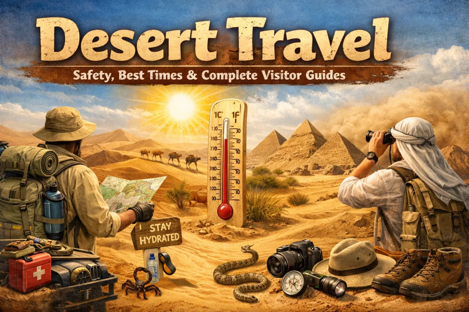
Desert travel sounds simple from a distance. Sand, sun, a wide horizon, maybe a camp, maybe a 4×4, maybe a night sky packed with stars. On the ground, it is more layered than that. A hot sand desert, a cold continental desert, and a high-altitude desert can all punish the same lazy plan in three very different ways.
That is why a useful desert visitor guide does not stop at pretty dunes or postcard timing. It has to explain temperature swing, solar load, altitude, road isolation, water math, season windows, and the simple truth many first-time visitors miss: deserts are not one climate. They are a family of dry landscapes with very different rules.
Across the globe, deserts cover about one-fifth of Earth’s land area, and drylands make up more than 40% of land. A desert usually means a place that gets 25 centimeters (10 inches) of precipitation a year or less. Yet only a small share of deserts is true dune country. Much of desert travel happens on gravel plains, rock plateaus, salt flats, or high, cold basins. Dry, yes. Simple, no.
Season Windows
What to Wear
Road Access
Altitude
Stargazing
| Desert Form | What It Usually Feels Like | What Changes for Visitors | Typical Examples |
|---|---|---|---|
| Hot Subtropical Desert | Very warm to very hot days, dry air, sharp cooling after sunset | Sun protection, water planning, early starts, long sleeves, night layers | Sahara, Arabian, parts of the Sonoran |
| Cold Continental Desert | Big yearly temperature range, windy spring, cold nights even in summer | Layering matters more than people expect, vehicle comfort matters, windproof kit is useful | Gobi |
| Coastal Desert | Dry air, fog in places, cooler average daytime conditions than many expect | Sun stays strong, nights cool quickly, road access may cross salt flats and high passes | Atacama, Namib coast |
| High-Altitude Desert | Thin air, strong UV, big day-night swing, cold dawns | Acclimatization, slower pacing, warmer layers, more attention to hydration | Atacama Altiplano, Tibet Plateau deserts |
What Desert Travel Really Means
Dryness is the shared trait. Everything else changes by latitude, elevation, distance from the sea, local wind, and terrain.
The image many people carry into desert travel is the Sahara stereotype: rolling dunes, camel tracks, a tent, and strong noon heat. That image fits part of the story, not all of it. The Sahara itself covers about 8.6 million square kilometers, the largest hot desert on Earth, but even there the landscape shifts between dunes, rocky hammada, gravel plains, mountains, wadis, and oasis corridors. The Gobi is even more misunderstood. Many visitors expect pure sand and get a cold desert of stone, steppe edges, wind, and huge skies.
The Atacama pushes the idea further. In its driest core, average rainfall is often cited at about 1 millimeter per year, and some stations have never recorded rain in the usual sense. Yet parts of the region sit at substantial elevation, and many popular outings from San Pedro de Atacama climb well above town level into the Altiplano. So a traveler can deal with dry heat, then dry cold, then thin air, all on the same trip. Not dramatic writing. Just how it goes.
This is why planning by the word desert alone is weak. Plan by desert type. Plan by route style. Plan by sleeping altitude. Plan by activity hour. A sunrise photography trip, a dune camp, a self-drive loop, a geology-focused road journey, and a night-sky trip do not ask the same thing from your body or your bag.
The Sahara in Numbers
Area: about 8.6 million km²
Average annual precipitation: around 76 mm across the desert as a broad average
Typical average winter day-night swing: roughly 20°C to 5°C
Typical average summer day-night swing: roughly 40°C to 25°C
The Gobi and Atacama in Numbers
Gobi precipitation: often under 200 mm a year, with some western areas under 50 mm
Gobi average range: January lows can reach -40°C, July highs can touch 45°C
Atacama sky conditions: about 300 clear nights a year in prime astronomy zones
ALMA altitude: about 5,000 m
There is another point worth saying plainly. Not all desert discomfort comes from heat. Wind fatigue, dry air, glare, long transfer distances, altitude headache, and cold mornings catch just as many visitors off guard. In the Gobi, the annual temperature range is huge. In the Atacama, altitude and UV exposure can matter more than raw heat. In the Moroccan Sahara, the most pleasant months often arrive outside peak summer, when days are easier and nights still feel alive rather than punishing.
How to Plan a Desert Trip Without Guesswork
Good desert trip planning is less about collecting random tips and more about answering a few very plain questions. What kind of desert is it? What is the sleeping altitude? How far are services apart? Will you walk, camp, or drive? And what happens after sunset? Those questions shape almost every smart decision that follows.
Start with sleeping conditions, not only daytime weather. Travelers often compare destinations by daytime averages and end up surprised when the real test comes at dawn. A desert day can be bright and easy, then turn cold, windy, and tiring once the sun slips. In the Sahara, shoulder-season travel works well because the heat drops into a more usable band while night cold stays manageable. In the Gobi, summer sounds safe on paper, yet cool evenings and strong winds can still make a poor clothing choice feel clumsy. In the Atacama, the real issue may be altitude stacking: a town around 2,400 meters, then excursions to 4,200 meters or more.
Next, study distance between fuel, water, and shade. This matters most for self-drive travel. In remote desert zones, the risk is rarely one dramatic event. It is accumulation: one wrong turn, one slow puncture, one missed refill, one extra hour in the sun. On exposed roads, a vehicle is not just transport. It is mobile shade, storage, and your easiest visible reference point.
Then choose your trip by activity timing. A stargazing trip wants clear skies, low moon, stable weather, and warm-enough night conditions. A hiking-centered trip wants shoulder months and early starts. A photography trip may favor cool dawns, dry air, and strong low-angle light. A road trip across desert plateaus wants route reliability and enough fuel range. Same destination, different season logic.
| Planning Question | Why It Matters | What to Check |
|---|---|---|
| What Type of Desert Is It? | Hot, cold, coastal, and high deserts stress the body in different ways | Average temperatures, rainfall pattern, wind season, terrain type |
| How High Will You Sleep? | Altitude changes hydration, pace, sleep quality, and headache risk | Town altitude, excursion altitude, overnight altitude |
| How Remote Is the Route? | Remote roads demand extra fuel, water, and route discipline | Fuel stops, mobile signal, unpaved segments, permit needs |
| What Is the Real Activity Window? | Noon may be the worst hour for walking and the worst light for photos | Sunrise and sunset timing, night temperature, local closure rules |
Last thing, and it matters. Build your trip around usable comfort, not a fantasy of endurance. The desert does not reward bravado. It rewards people who carry enough water, wear more fabric than they first wanted, slow down at altitude, and treat route planning like part of the trip itself. Under-planning looks adventurous online. In real desert travel, it usually just looks tired.
Best Time to Visit Deserts by Climate Pattern
There is no single “best season” for all deserts. There are only better seasons for a specific desert experience. Some travelers want easy daytime touring. Some want strong night skies. Some want long road days. Some want fewer people. The main climate patterns below help sort that out.
In hot subtropical deserts, the sweet spot is often spring and fall. Summer can push surface heat, glare, and fatigue too far for relaxed exploration, while winter may still feel pleasant by day but cold after dark. In the cold desert belt, the middle of summer may be the broad access season, yet shoulder months can feel better if wind and long transfers are your main concern. In coastal and high deserts, the answer depends on local rain pulses and altitude exposure as much as temperature.
Deserts also change by hour more than many landscapes do. Morning and late afternoon often decide whether a trip feels elegant or draining. A calm dawn in the Sahara can feel soft, almost forgiving. Noon may flatten color, spike glare, and make the same route feel twice as long. In the Atacama, stable autumn air can make roads, viewpoints, and night tours easier to combine. In the Gobi, a month with moderate daytime warmth can still demand a jacket at dinner.
| Desert Climate Pattern | Usually Best for Easy Travel | Months to Treat Carefully | Main Reason |
|---|---|---|---|
| Hot Subtropical | Spring and fall | Peak summer | Daytime heat and solar exposure rise fast |
| Cold Continental | Late spring to early autumn, with shoulder months often nicest | Deep winter and windy spring stretches | Big yearly temperature range and exposed wind |
| Coastal Desert | Often broad year-round access, with shoulder seasons especially comfortable | Local rain pulses or cooler night periods | Fog, elevation shifts, and sharp day-night change |
| High-Altitude Desert | Stable dry months with moderate days | Storm-prone periods and abrupt altitude gain | Thin air, intense UV, colder nights |
One practical rule: if your trip includes walking, photography, or sleeping outside, choose the season by night comfort and route stability, not by the warmest daytime average.
Best Time to Visit the Sahara Desert
For most travelers, especially those entering through Morocco, the strongest window for the Sahara Desert is spring and fall. That lines up with how tourism authorities and route operators describe the season: easier daytime conditions, more forgiving camp nights, and better overall comfort for dune walks, camel journeys, and road transfers. In broad Sahara climate terms, average winter day-night patterns can sit around 20°C and 5°C, while summer averages can move closer to 40°C and 25°C. Those numbers explain a lot.
The desert’s annual rainfall average is low, around 76 mm when treated across the whole Sahara, yet rain is not the main issue for most visitors. Heat is. Light is. Exposure is. In midsummer, even short outdoor periods can feel harder than travelers expect because dry air hides sweat loss. You may feel “fine” while still slipping behind on water. Then the lag shows up later as fatigue, headache, heavy legs, and a shorter temper. That is why spring and fall do so much work for Sahara travel safety: they reduce heat stress before it ever builds.
Winter is still very usable, especially for travelers who dislike hot days and want quieter routes. But winter Sahara planning should assume cold camp mornings and the possibility of near-freezing temperatures after sunset in some areas. That catches people who pack for “Africa” rather than for a desert with huge thermal swing. A pleasant day can still turn into a sharp temeprature drop once the sun is gone.
| Month Group | How It Usually Feels | What It Suits | What to Watch |
|---|---|---|---|
| December to February | Mild to pleasant days, cold nights | Scenic touring, photography, road access, quieter camp stays | Pack insulation for evening and dawn |
| March to May | Warm days, better-balanced nights | Walking, dune camps, camel routes, broad comfort | Sun exposure still builds quickly by midday |
| June to August | Very hot to extreme daytime heat | Short sunrise or sunset experiences only, if at all | Long outdoor hours feel draining fast |
| September to November | Warm days, easier evenings | One of the strongest all-round windows | Book good operators early in popular gateways |
How Sahara Routes Differ by Region
“Visiting the Sahara” often means one of several route styles, not one single journey. Moroccan Sahara routes tend to focus on access corridors from cities such as Marrakech or Fez toward dune systems like Erg Chebbi or farther southwest desert edges. These trips combine transfer roads, valleys, kasbah landscapes, oases, and finally dune country. That matters because the trip is not all sand. Clothing, pacing, and transport choices should fit mixed terrain.
Travelers who want the classic dune-camp feeling usually do best in the March to May or September to November bands. Those months keep the desert photogenic without turning the day into a contest of endurance. Winter remains a good option for travelers who prefer crisp air and are happy to dress for cold mornings. Summer, by contrast, is not ideal for a relaxed first visit.
Best Fit for Most First-Time Sahara Visitors: late March to early May and late September to early November. Those periods usually give the cleanest balance of warmth, clear skies, manageable nights, and enjoyable time outside the vehicle.
Best Time to Visit the Gobi Desert
The Gobi Desert is one of the clearest reminders that a desert does not need to behave like the Sahara. It is a cold desert with a fierce continental range. Average lows in January can reach -40°C, while average highs in July can climb to 45°C. Many areas receive less than 200 mm of precipitation a year, and some western sections get less than 50 mm. Wind also plays a larger role here than many travelers expect.
For broad visitor comfort, the most practical travel season runs from May to September, yet the sweet spots are often June and September. Local tour operators and travel pages in Mongolia repeatedly point to those months because they pull back from spring wind and the hottest stretch of summer while still keeping access, daylight, and overall route comfort on your side.
Spring in the Gobi can be beautiful, open, and sharp-edged, but it is also the season when strong winds become a real planning factor. Wind strips moisture from the skin and throat, raises dust, and makes long standing stops less fun than they looked on a map. In midsummer, roads are open and tourism is active, but the hottest days can still be tiring even though evenings cool. The Gobi usually gives you dry air, broad distance, and a feeling of enormous exposure. Lovely, yes. Gentle, not really.
| Season | What It Offers | What It Asks From You |
|---|---|---|
| Spring | Wide views, active landscapes, fewer crowds in some routes | Windproof outer layer, eye protection, patience with dust and exposed stops |
| Early Summer | Broad access and long daylight | Sun care, steady hydration, layers for evening cooling |
| Late Summer | Popular travel period and easy route logistics | Heat by day can still bite, especially on long drives |
| September | One of the best all-round months for comfort | Carry warm layers once the sun drops |
Why the Gobi Needs Different Packing Logic
Packing for the Gobi is less about “desert equals light clothes” and more about range management. You need breathable daytime clothing, yes, but you also need a wind-resistant shell, a useful fleece or insulated layer, and sturdy footwear that works on rock, dust, and uneven ground. Sandals may suit a warm hotel courtyard somewhere else. In the Gobi, they are rarely your smartest main shoe.
The other difference is surface variety. This is not a pure dune destination. Much of the Gobi is rocky, gravelly, or hard-packed. That changes comfort underfoot, driving rhythm, and even how much dust finds its way into zippers, lenses, and bags. Travel here feels open and sparse in a slightly different way from the Sahara: less sea of sand, more sea of earth and stone.
Best Time to Visit the Atacama Desert
The Atacama Desert is one of the world’s driest landscapes, but visitors should never reduce it to dryness alone. It is a coastal desert, a high-desert gateway, and one of the planet’s premier night-sky regions. In prime astronomy zones, skies are clear for about 300 nights a year. San Pedro de Atacama itself sits near 2,400 meters, and excursions often climb much higher. That means best time to visit the Atacama depends on both weather and altitude comfort.
The broad year-round access here is excellent, yet one of the strongest travel windows is April to June. Chile’s tourism material has leaned into that timing for good reason: summer rain pulses known as the Altiplanic winter have usually faded, roads to major attractions are more dependable, temperatures are more balanced, and visitor pressure often softens. Daytime conditions around 20°C to 26°C with cooler nights can feel nearly ideal for mixed trips built around lagoons, valleys, stargazing, and light hiking.
Summer, especially December to March, remains popular. It can work very well for travelers who like warm days and a lively base town. Yet that same period can bring route complications in higher zones because moisture arrives from the east and may trigger rain, storms, or temporary access changes. Winter, on the other hand, is dry and very clear, but nights turn much colder. For night tours and dawn departures, that matters a lot more than people think.
| Month Group | What It Usually Feels Like | Best For | Main Watchpoint |
|---|---|---|---|
| December to March | Warm days, lively town atmosphere | General sightseeing, popular holiday travel | Summer demand, rain pulses in higher areas, possible route issues |
| April to June | Balanced days, cool nights, strong route reliability | Best all-round comfort for many visitors | Nights still need real layers |
| July to August | Dry and clear, colder mornings and nights | Astrotourism, crisp visibility, fewer weather interruptions | Cold night tours and early starts |
| September to November | Very good shoulder season with stable outdoor conditions | Photography, walking, mixed-activity trips | Book early when demand rises |
Why the Atacama Feels Different From Other Deserts
The Atacama is dry in a way that often feels almost mineral. Fog can appear in coastal sectors because of the cold Humboldt Current, yet much of the interior remains fiercely arid. Some parts can go decades without meaningful rainfall, and in the driest sectors the average can be about 1 mm a year. There are even places where rainfall has never been recorded in the usual record span. Still, the travel experience is not only about emptiness. It is about contrast: salt flats, red valleys, geysers, high lagoons, volcanic silhouettes, and the pressure of altitude on a very clear sky.
That mix makes the Atacama one of the best desert visitor destinations for people who want more than dunes. It suits road travelers, astronomy lovers, landscape photographers, and geology-focused visitors especially well. You feel the dryness, yes, but you also feel scale, elevation, and a kind of precision in the light.
What to Wear in the Desert
The old mistake is easy to spot: someone imagines desert heat, packs shorts and thin tops, then spends the trip fighting sun, wind, glare, and evening cold. What to wear in the desert depends on temperature range, UV strength, and terrain, not on the lazy idea that less fabric always means more comfort.
In most warm deserts, the useful formula is lightweight coverage. Think long-sleeved breathable shirts, loose trousers, a wide-brim hat or a neck-covering cap, sunglasses with reliable UV protection, and closed shoes. More fabric sounds hotter until you remember what the desert actually does: direct sun, reflected light from sand or salt, wind, and almost no forgiving shade. Sand can reflect around 15% of UV radiation, and UV exposure rises by about 10% for every 1,000 meters of altitude. That is one reason the Atacama can feel so sharp on exposed skin.
If you are buying technical clothing, UPF ratings matter. A UPF 50 fabric blocks about 98% of UV radiation. That gives you a much cleaner benchmark than guessing from fabric feel alone. Light, breathable shirts are still great for heat comfort, but when sun intensity is high, rated protection beats fashion logic.
| Item | Hot Desert Use | Cold or High Desert Use | What to Avoid |
|---|---|---|---|
| Base Layer | Breathable long-sleeve top | Moisture-managing layer under fleece or jacket | Heavy cotton that stays damp too long during exertion |
| Legwear | Loose technical trousers | Softshell or warmer trekking pants when cold | Very short bottoms in full sun and scrubby terrain |
| Outer Layer | Very light overshirt or sun hoodie | Wind shell or insulated jacket | Bulky city jacket with poor movement |
| Footwear | Closed trail shoes or light boots | Sturdier closed shoes with warm socks | Flimsy open footwear as your only option |
| Headwear | Wide-brim hat or cap with neck cover | Hat plus beanie for night or dawn | No head coverage at all |
Hot Desert Clothing
In the Sahara or similar hot deserts, you want a clothing system that keeps sun off the skin while allowing air movement. Loose trousers and a light long-sleeve top do this better than most people expect. Closed shoes matter because dunes are not the whole story; you will also step on gravel, hot packed ground, vehicle tracks, and camp surfaces. Socks matter too. Fine sand finds small gaps faster than you think.
Cold Desert and High Desert Clothing
In the Gobi and Atacama highlands, think in layers. Start with a breathable base, add an insulating mid-layer, and carry a shell that blocks wind. This is the model that works from warm afternoon to cold pre-dawn without turning your bag into a closet. If your itinerary includes geysers, high lagoons, or stargazing, a packable insulated jacket earns its place very quickly.
Why Desert Nights Change the Packing List
Desert air cools fast because humidity and cloud cover offer little insulation. So even a trip sold on warm landscapes can require a fleece, warm socks, a hat, and sometimes gloves. The desert does this all the time: it looks sparse, then quietly demands more prep than a green landscape at the same daytime temperature.
Hydration, Food, and Body Management
Water planning is the backbone of desert travel safety. Public-land desert guidance often starts with a plain minimum: about one gallon of water per person per day for general travel, and up to two gallons per person per day for hikers or cyclists in hot conditions. That should not be treated like a magic number that fits everyone, but it is a very useful field baseline. Better to carry extra and return with it than to discover you built your day on hope.
The body can lose around 1 liter of sweat per hour in heat, and sweat carries sodium and chloride with it. Dry air makes this tricky because you may not feel soaked. Evaporation is so efficient that dehydration can advance quietly. Thirst also arrives late. By the time you feel obviously thirsty, you are already behind.
Good desert hydration is not just “drink more.” It is drink early, drink steadily, and replace some salt. Water plus a salty snack, a meal, or an electrolyte drink works better than endless plain water for long, exposed days. You do not need to turn a desert outing into a laboratory project. You do need to stop pretending coffee, a single bottle, or one café break is a plan.
What Works Well
- Carry more water than your map suggests, especially if you are driving remote roads.
- Drink before you feel dry, not after.
- Keep salty snacks or a proper meal in the system during longer active periods.
- Use an insulated bottle or reservoir so water stays drinkable in direct sun.
What Usually Fails
- Relying on natural water sources in very dry regions.
- Saving water by not drinking during the first half of the day.
- Skipping food and calling the tiredness “just heat.”
- Doing hard walking at noon because the morning felt easy.
Food should be simple and steady. In hot deserts, many people eat less than usual, which is fine until energy falls off a cliff. Aim for light, salty, easy-to-handle food: nuts, olives, bread, fruit that travels well, cheese, crackers, dates, sandwiches, rice-based meals, or local camp food with enough salt and carbohydrates to keep you moving. Save the heavy feast for evening when the air cools and your appetite comes back.
Desert Travel Safety on Foot, by Vehicle, and in Camp
A strong desert travel safety guide should make one idea impossible to miss: the desert is easiest when you prevent small problems from stacking. Most serious travel trouble starts that way. One person is slightly under-hydrated. Another has the wrong shoes. The vehicle fuel margin is thinner than it should be. A route takes longer than expected. The group starts later than planned. None of that looks dramatic at first. Then the daylight goes.
On Foot
Walking in the desert is most comfortable when the schedule respects the sun. Early morning and late afternoon are your friends. Midday exposure is the expensive hour. If you hike, carry a route map that still makes sense offline, wear a hat, take real water volume, and keep an eye on pace. A desert trail can look flat and “easy” while still draining you faster than a hillier route in cooler air.
Closed shoes matter because desert surfaces are rarely uniform. Even in famous dune zones, trail approaches, camp edges, rock shelves, and gravel fields are common. Keep ankles and feet out of the careless zone. Also, tell someone your route and expected return time. In remote desert terrain, patchy signal is normal, not unusual.
By Vehicle
Self-drive desert travel has its own rules. Your vehicle should be part transport, part shelter, part backup system. Public desert guidance often repeats the same basics for a reason: carry extra drinking water, check the spare tire, know your route, and tell someone where you are going. On remote unpaved roads, high-clearance vehicles or 4x4s may be more than a comfort upgrade. They may be the sensible minimum.
In places such as the Atacama’s high routes, authorities explicitly advise carrying sufficient fuel, water, and food and treating long distances between services seriously. On Chile’s Seismiles Route, for example, travel material points to about 600 kilometers of autonomy and extra fuel as a practical planning measure. That is not overthinking. That is what remote desert roads ask for.
For major sealed roads, the vehicle demand is lower, but do not let that lull you into laziness. Route 23 to San Pedro de Atacama is straightforward, yet many nearby attractions include rougher stretches. In the Australian Red Centre, sealed and 4WD route options can differ by section, permit need, and time. A road trip can be dreamy and still deserve real prep.
At Camp
Desert camps feel easy when three things are handled well: warmth, water access, and night visibility. People obsess over daytime outfits and forget that camp comfort depends on the hour after dark. Bring a headlamp, keep a warmer layer outside the main bag, and avoid assuming the campsite will feel as mild as the sunset looked.
Camps also need sun discipline during setup and breakdown. This sounds minor, but many people collect their strongest exposure when they are standing around, unpacking, or waiting. That time still counts. Shade, hat, water in reach. Simple stuff. It works.
A reliable desert rule: the further you are from fuel, signal, or settlement, the more your margin matters. Margin means extra water, extra time, extra clothing, extra battery, and more fuel than the optimistic plan suggests.
What to Do If You Are Stranded in a Desert Area
This part deserves plain language. If you are stranded in a remote desert area by vehicle, stay with the vehicle unless there is an immediate local reason not to. A vehicle gives you shade, visibility, storage, and a fixed location that is easier for others to find. Walking off into open desert usually turns a vehicle problem into a body problem.
- Stop early, not late. If you sense a mechanical issue, treat it before you are forced into a worse place.
- Create shade and reduce exertion. Stay calm, move slowly, and keep time in direct sun low.
- Ration activity, not water. Do not “save” water by letting dehydration build.
- Use communication while power is still healthy. Send location, route, and expected needs clearly.
- Make the vehicle visible. Hazard lights when useful, visible clothing, open hood if appropriate, anything that helps the vehicle read as a stopped party needing attention.
- Wait where search logic can work. If you shared the route, that route is now your ally.
If you are stranded on foot, the priorities shift slightly: reduce effort, find shade, protect skin and head, and avoid wandering without a very good reason. In extreme heat, distance that looks short can become expensive very fast. That is why route-sharing before the trip matters so much. Rescue begins with someone knowing where to start looking.
Also watch for terrain-specific hazards that feel small until they are not. Dry channels can flash with water after upstream rain. Muddy desert roads can trap vehicles even where the wider landscape still looks dry. Dirt roads in clay-heavy terrain can become a mess after moisture. In the desert, “It looked okay” is not much of a safety system.
Altitude, UV, and Cold: The Side of Desert Travel People Underestimate
Not every desert sits low and hot. Some of the most memorable ones sit high enough to change how your body behaves. The Atacama is the cleanest example. San Pedro de Atacama is already near 2,400 meters, which is right around the point where some travelers start to notice altitude effects. Many excursions go far above that. The Tatio Geysers, for instance, rise to about 4,200 meters.
Unacclimatized travelers can start to feel altitude strain at roughly 2,450 meters and above. Once sleeping altitude rises above 2,750 meters, gradual ascent becomes the smarter call. Above 3,000 meters, conservative travel medicine advice often says not to raise sleeping altitude by more than about 500 meters per day without extra acclimatization time. That may sound technical, but the practical takeaway is simple: do not rush your first high-desert day.
Add UV to the mix and the desert becomes even sharper. UV exposure rises by about 10% for every 1,000 meters of altitude. So a high desert can feel cool in the air while still delivering heavy sun load. That combination fools people all the time. They feel comfortable, so they forget hat, sunscreen, lip care, or eye protection. Later they pay for it.
Cold comes along quietly too. The Atacama is famous for dryness, yet the daily temperature difference at very high sites can be huge. ALMA’s Chajnantor plateau, around 5,000 meters, is one of the driest places on Earth and can see a day-night difference of around 40°C. Most visitors will not sleep there, of course, but the number tells you something valuable: in a high desert, cold is part of the landscape even when the postcard is all sunlight.
Smart First Day in a High Desert: hydrate well, eat lightly but enough, avoid rushing into your highest excursion, keep alcohol low or out, and plan only mild exertion at first. Boring advice. Very effective advice.
Famous Desert Roads and Why They Matter to Visitors
Desert roads are more than transfer lines. They shape the travel style itself. Some deserts are best understood through a slow road rhythm: long horizons, changing surfaces, scattered settlements, salt basins, mountain edges, and the gradual shift from one dry landscape to another.
The Red Centre Way
In Australia’s desert heartland, the Red Centre Way stands out as one of the strongest road journeys in arid country. Tourism material describes the route as roughly 1,135 kilometers, usually given at least six days, linking Alice Springs, Uluṟu, Kata Tjuṯa, Kings Canyon, and the West MacDonnell ranges. Part of its appeal is that it shows desert travel as a sequence of rock, gorge, open road, and cultural landscape rather than one single sand scene.
The Atacama Road Network
The Atacama offers two road personalities. One is accessible and broad: main roads into San Pedro de Atacama and the classic day-trip network around valleys, lagoons, and salt flats. The other is bigger, higher, and more remote. Chile’s Seismiles Route, for example, runs about 530 kilometers through high desert and volcanic country, with more than 15 peaks above 6,000 meters. This is not casual sightseeing by compact rental car. It is desert road travel as an altitude exercise.
Then there is the broader north-south logic of the Pan-American Highway, which runs through the Atacama. Even when visitors do not drive its desert length, that line helps explain how this desert is experienced: as a giant dry corridor with side roads that branch into salt, volcano, observatory country, and coastal fog zones.
Sahara Gateway Roads
In the Moroccan Sahara, the road into the desert is part of the story. Visitors often approach through valleys and oases before the dunes take over visually. The move from mountain-backed settlements into dune country teaches an important desert lesson: the edge zones matter. Oases, date groves, wadis, and desert towns are not side notes. They are how people have crossed and lived with arid land for centuries.
For travelers, this means a desert road trip is often best when it is treated as a chain of ecological and cultural transitions rather than a race to the dunes. Seen that way, the journey gets richer, and planning gets smarter too.
Best Deserts for Stargazing
If night sky is high on your list, desert travel can be extraordinary. Dry air, low humidity, sparse settlement, and wide horizons create some of the clearest observing conditions on Earth. But even here, not all deserts are equal. The strongest stargazing deserts combine clear skies, limited light pollution, and reliable night access.
Atacama Desert
The Atacama sits at the top of many astronomy lists for a reason. Around 300 clear nights a year, high and dry conditions, and world-famous observatory regions give it rare consistency. Paranal stands at about 2,635 meters, while ALMA’s plateau reaches around 5,000 meters. For ordinary visitors, that does not mean you need extreme elevation to enjoy the sky. It means the region is naturally suited to seeing deep into the night.
Namib Desert
Namibia’s NamibRand Nature Reserve is often described as one of the naturally darkest accessible places on Earth. This is desert stargazing with genuine darkness, not just “less city light than usual.” If your idea of a desert night includes long Milky Way views, little haze, and a real sense of isolation, the Namib belongs near the top.
Sahara and Other Dry Desert Regions
The Sahara can be superb for stargazing too, especially in low-light camp areas and in seasons when nights are cool but not biting. The desert’s breadth helps, but timing still matters. Shoulder seasons usually give the nicest balance for people who want to sit outside for a long stretch rather than admire the stars for ten cold minutes and crawl into a blanket.
Saudi Arabia’s AlNufud now also appears in dark-sky conversations because of its protected night environment, and parts of the wider Arabian desert belt offer excellent astro-tourism potential. The point is not just which desert is “best.” It is which desert gives you the night temperature, access, and darkness that fit the kind of stargazing trip you want.
| Desert | Why the Night Sky Works | Best Visitor Type |
|---|---|---|
| Atacama | Very high number of clear nights, dry air, observatory-quality sky | Astro-tourists, photographers, science-minded travelers |
| Namib | Very dark accessible skies and low light pollution | Travelers who want darkness as the main event |
| Sahara | Wide open camps, dry air, low-light zones in good seasons | Travelers who want stars as part of a classic desert camp trip |
Choosing the Right Desert for Your Travel Style
Some deserts suit first-time visitors better than others, not because they are “better” in a grand sense, but because they match a certain travel rhythm more naturally. The Sahara often works well for people who want the classic desert feeling with reachable dune camps and strong visual payoff. The Atacama suits travelers who want landscape variety, astronomy, and geology with a comfortable base. The Gobi suits people who like distance, emptiness, road travel, and a less polished sense of remoteness.
| If You Want… | Often the Best Match | Why |
|---|---|---|
| Classic Dunes and Camp Nights | Sahara | Strong visual identity, warm-color landscapes, good shoulder-season comfort |
| Night Sky and Mixed Landscapes | Atacama | Salt flats, volcanoes, valleys, observatory-grade sky, broad year-round appeal |
| Huge Space and Road Adventure | Gobi | Cold-desert scale, long horizons, sparse settlement, varied surfaces |
| Pure Darkness and Desert Silence | Namib | Dark-sky quality and a powerful sense of open wilderness |
Common Desert Travel Mistakes
First-time visitors usually do not fail because they forgot one heroic survival trick. They fail because they ignored simple patterns the desert repeats every day. The list below shows the mistakes that come up again and again in desert visitor planning.
- Choosing the trip by photos, not climate logic. Dunes at sunset do not show you the noon heat or the 5 a.m. cold.
- Packing for daytime only. A desert can ask for sunscreen at lunch and a fleece at breakfast.
- Underestimating altitude. This is a classic Atacama error.
- Starting with too little water. “I’ll refill later” works until it does not.
- Walking hardest at midday. The body pays later, even if it feels fine during the first hour.
- Treating remote roads as ordinary roads. Distance between services changes everything.
- Ignoring wind. Wind in deserts is not just a comfort issue. It dries, cools, carries dust, and tires people out.
- Trusting signal coverage too much. Desert travel still rewards offline navigation and route-sharing.
One more mistake deserves its own line: thinking a desert is empty. It may look open, but it is full of systems that deserve respect—fragile crusts, sparse vegetation, animal movement, sacred landscapes, and local route knowledge that took generations to build. The smartest desert visitor pays attention to that and steps a little lighter.
Low-Impact Desert Travel and Visitor Conduct
Desert landscapes often look durable because they appear bare. That can be misleading. Biological soil crusts, sparse plants, and lightly used tracks can take a long time to recover from damage. Stay on marked or accepted routes where required, use registered local operators in managed destinations, and avoid the urge to create your own shortcut simply because the ground looks open.
Water use matters too. In dry regions, even small tourist hubs may rely on narrow resource margins. Use water with respect. So does noise. A desert camp or roadside stop is usually better when it keeps the desert’s own soundscape intact—wind, birds, footsteps, quiet conversation, not constant speakers and engine revving.
Local knowledge is part of the value of desert travel. In Sahara edge towns, Atacama villages, or Gobi camps, people have learned how to read weather, movement, and timing in dry country with remarkable precision. Travelers who listen usually have a better trip. Those who do not often just spend more money correcting avoidable errors.
Desert Packing Matrix by Climate and Activity
A final packing view helps pull everything together. Not a giant checklist, just a clean matrix you can actually use when matching season, route, and activity.
| Trip Type | Core Clothing | Always Carry | Add This If Relevant |
|---|---|---|---|
| Sahara Shoulder-Season Camp Trip | Breathable long sleeves, loose trousers, closed shoes, light fleece | Hat, sunglasses, sunscreen, lip balm, headlamp, refillable water system | Scarf or buff for wind and sand |
| Gobi Road Journey | Layered system, wind shell, sturdy shoes, warmer evening layer | Hydration setup, dust-safe bag organization, eye protection | Beanie and gloves for cold dawns |
| Atacama Base-and-Day-Trip Travel | Light day layer, warm night layer, technical trousers, closed shoes | Sun kit, water, snacks, headlamp for early or late excursions | Extra insulation for geysers and stargazing |
| Remote Desert Self-Drive | Comfortable layered travel clothing | Extra water, food, first aid, spare tire plan, offline maps, charging backup | Fuel reserve, tire inflator, recovery basics where appropriate |
The pattern underneath all of this is simple. Desert travel goes well when your planning matches the kind of dryland you are entering. Hot desert, cold desert, high desert, coastal desert—different label, different logic. Get the season right, get the clothing right, build a real water margin, respect distance, and the trip opens up in the right way: more landscape, less friction, more sky, less fatigue.