
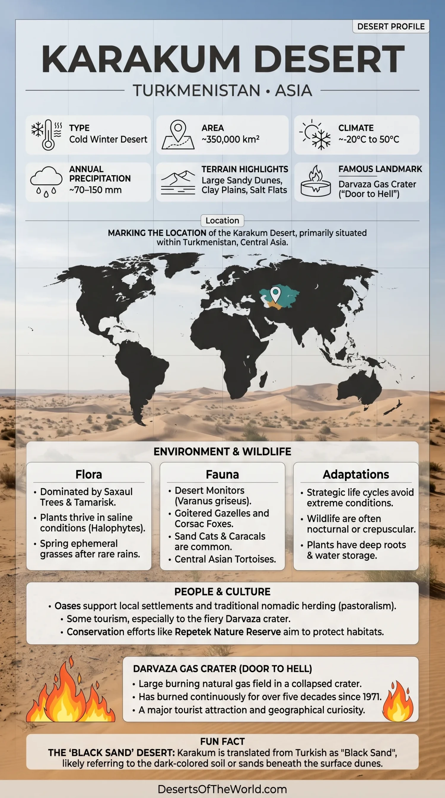
Location & Continent
Continent: Asia
Country: Turkmenistan
Coordinates: ~39°N, 59°E
Karakum Desert – Map & Street View
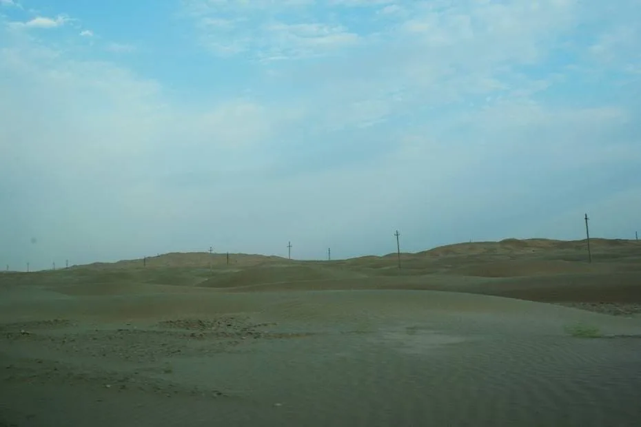
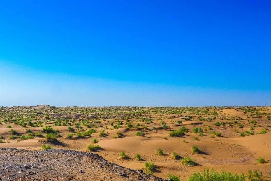
Photos of the Karakum Desert
Physical Features
Area: ~350,000 km²
Share of Turkmenistan: Roughly 70% of the country’s territory
Elevation: Much of the desert lies around 100–220 m above sea level, with local depressions and higher margins
Main Landforms: Sand ridges, barchans, fixed and semi-fixed dunes, takyr clay flats, saline depressions, gravel surfaces, and ancient river channels
Climate & Precipitation
Climate: Strongly continental arid desert climate
Temperature: Summer temperatures commonly exceed 40°C and can approach 50°C in the hottest areas; winter temperatures can fall well below 0°C
Precipitation: Generally about 70–150 mm annually, with most rainfall during the cooler part of the year and spring
Evaporation: Far exceeds annual precipitation across the desert
Ecological Features
Biogeographic Realm: Palearctic
Environment: Temperate desert and xeric shrubland within the Turanian desert system
Main Habitats: Sandy desert, saxaul woodland, takyr flats, saline depressions, ephemeral spring vegetation, and river-edge habitats along the Amu Darya margin
Flora & Fauna
Flora: White and black saxaul (Haloxylon spp.), Calligonum, wormwood, salt-tolerant shrubs, sedges, and short-lived spring plants
Fauna: Goitered gazelle, corsac fox, sand cat, caracal, jerboas, Central Asian tortoise, desert monitor, houbara bustard, and other desert birds and reptiles
Geology & Notable Features
Geology: Large areas are covered by wind-reworked sand derived partly from ancient river deposits, with clay flats, saline basins, and buried sedimentary formations beneath the desert
Notable Features: Repetek, Bereketli Garagum, Darvaza Gas Crater, Karakum Canal, Western Uzboy, Murghab and Tejen oasis zones, and the Karashor Depression
Karakum Desert
The Karakum Desert, also written Kara Kum or Garagum, occupies about 350,000 square kilometers of Turkmenistan. It stretches between the Amu Darya valley in the east, the Kopet Dag and southern uplands, the Khorezm region to the north, and the Western Uzboy toward the west.
The name is commonly translated as Black Sand. Despite that name, the landscape includes pale and reddish sand, clay flats, salt-affected depressions, gravel surfaces, ancient drainage channels, and areas stabilized by desert shrubs. Most of Turkmenistan’s interior lies within this desert system.
Geography
The Karakum occupies a broad lowland within the Turan region. Much of the surface lies only a few hundred meters above sea level, although the desert changes in elevation and structure from north to south.
Turkmen geographic descriptions commonly divide it into Zaunguz Karakum, Central Karakum, and Southeastern Karakum. Zaunguz in the north is older and generally higher than the central desert. The southeastern sector contains extensive sandy terrain closer to the Amu Darya and Repetek.
The desert is not covered entirely by loose dunes. Large areas consist of stabilized or semi-stabilized sand, clayey takyrs, saline hollows, low ridges, and gravel surfaces.
Sand Ridges and Takyrs
Wind shapes much of the exposed sand into ridges and barchans. In many areas, however, saxaul and other vegetation hold the surface in place.
UNESCO documentation for Repetek describes fixed sand ridges commonly around 15–20 m high and several kilometers long. Broad depressions occur between them.
Another common landform is the takyr. These flat clay surfaces form in low areas where temporary water spreads across fine sediment and later evaporates. When dry, the surface hardens and often develops a polygonal network of cracks.
Climate
The Karakum has a continental desert climate with large seasonal temperature differences. Summers are long, sunny, and very hot. Winters are much colder and can bring frost and occasional snow.
Annual precipitation is generally only 70–150 mm. Rainfall is irregular and concentrated mainly outside the hottest summer period. A small number of weather systems may supply much of the year’s moisture.
Repetek in the southeastern Karakum is among the hottest parts of Central Asia. The combination of intense summer heat, low humidity, and limited rainfall produces very high evaporation.
Vegetation
Plant cover is sparse compared with grassland or woodland regions, but large sections of the Karakum support established desert vegetation.
Saxaul is one of the characteristic plants. White saxaul is associated mainly with sandy terrain, while black saxaul can occupy lower depressions and areas with different groundwater and soil conditions.
Other plants include:
- Calligonum shrubs: Common on sandy surfaces and dunes.
- Wormwood: Occurs in dry shrub communities.
- Salt-tolerant plants: Grow around saline depressions and mineral-rich soils.
- Spring ephemerals: Germinate and complete much of their life cycle after cool-season rainfall.
Vegetation density varies greatly according to sand movement, soil chemistry, groundwater depth, grazing, and local rainfall.
Wildlife
The Karakum supports animals adapted to large temperature changes and limited surface water. Many avoid daytime heat through nocturnal activity, burrowing, or use of shaded vegetation.
The desert fauna includes goitered gazelle, corsac fox, sand cat, caracal, jerboas, desert monitor, Central Asian tortoise, and houbara bustard. Reptiles and small mammals are especially well represented in sandy habitats.
Wildlife is not distributed evenly across the desert. Protected areas with relatively intact vegetation support different communities from heavily grazed land, canal corridors, settlements, or industrial zones.
Repetek and the Cold Winter Deserts of Turan
The Repetek protected area lies in the southeastern Karakum near Turkmenabat. UNESCO records the Repetek component at 34,600 hectares.
Its landscape contains fixed sand ridges, dune fields, depressions, and extensive saxaul vegetation. Repetek has been part of UNESCO’s Man and the Biosphere network since 1979.
In 2023, Repetek became one of the Turkmenistan components of the transnational Cold Winter Deserts of Turan World Heritage property. Other Turkmen components include Bereketli Garagum, Gaplangyr, and Yeradzhi.
The inscription recognizes a series of Central Asian desert areas in Kazakhstan, Turkmenistan, and Uzbekistan that preserve different desert ecosystems and ecological processes.
Karakum Canal
The Karakum Canal carries water from the Amu Darya westward across Turkmenistan. Its total length is approximately 1,375 km, making it one of the longest irrigation and water-supply canals in the world.
The canal supports irrigated agriculture, settlements, industry, and water supply, including areas around Ashgabat. It changed land use across parts of the desert by making large-scale irrigation possible far from natural perennial rivers.
Water loss through seepage and evaporation has also affected surrounding soils and groundwater. Irrigation development in the Amu Darya basin contributed to the reduction of river water reaching the Aral Sea.
The canal therefore represents one of the largest human alterations of the Karakum landscape.
Western Uzboy
The Western Uzboy is an abandoned river channel crossing western Turkmenistan. It records an earlier drainage route connected with water from the Amu Darya system.
Today the channel is dry across most of its length, but its valleys, depressions, and sediments remain visible in the desert landscape. The Uzboy helps explain why parts of the western Karakum contain landforms created by water even though no large permanent river now follows the route.
The modern Amu Darya instead flows north toward the Aral Sea basin.
Darvaza Gas Crater
The Darvaza Gas Crater lies in the central Karakum and is widely known by the nickname “Door to Hell.” It is a gas-burning depression within a natural gas field.
The exact sequence of events that created and ignited the crater is not as firmly documented as many popular accounts suggest. The commonly repeated story places the event in the Soviet period, but published versions differ on the date and circumstances.
Its present condition has also changed. In 2025, Turkmenistan’s government reported that additional gas extraction wells around the field had reduced the amount of gas feeding the crater. Officials stated that its glow, once visible from several kilometers away, had become visible mainly from the immediate vicinity.
Natural Gas and Desert Infrastructure
Much of Turkmenistan’s petroleum industry operates in or beneath desert terrain. The Amu Darya petroleum basin underlying eastern Turkmenistan and adjoining countries contains major natural gas resources.
Gas fields, pipelines, access roads, wells, railway lines, and settlements create localized industrial corridors within an otherwise sparsely populated landscape.
The desert is therefore both a natural dryland system and an area of intensive resource extraction. The ecological effects are concentrated around infrastructure, water use, grazing zones, and disturbed surfaces rather than distributed evenly across the entire Karakum.
Conclusion
The Karakum Desert covers about 350,000 km² of Turkmenistan and consists of much more than mobile sand. Fixed dune ridges, takyrs, saline depressions, saxaul woodland, ancient drainage channels, and low desert plains form much of its surface.
The Western Uzboy records an older river system, while the 1,375 km Karakum Canal carries Amu Darya water across the modern desert. Repetek preserves intact sand-desert habitat and has formed part of the UNESCO-listed Cold Winter Deserts of Turan since 2023. Darvaza and the region’s natural gas fields add another layer to the landscape, linking the Karakum directly with Turkmenistan’s energy infrastructure.
References
Government / Official Sources
- Government of Turkmenistan – Karakum Geography and Desert Regions
- Government of Turkmenistan – Karakum Landscape and Regional Divisions
- Government of Turkmenistan – Darvaza Gas Supply Reduction
UNESCO Sources
- UNESCO World Heritage Centre – Cold Winter Deserts of Turan
- UNESCO – Repetek and Turkmenistan Component Areas
- UNESCO – Repetek Biosphere State Reserve