
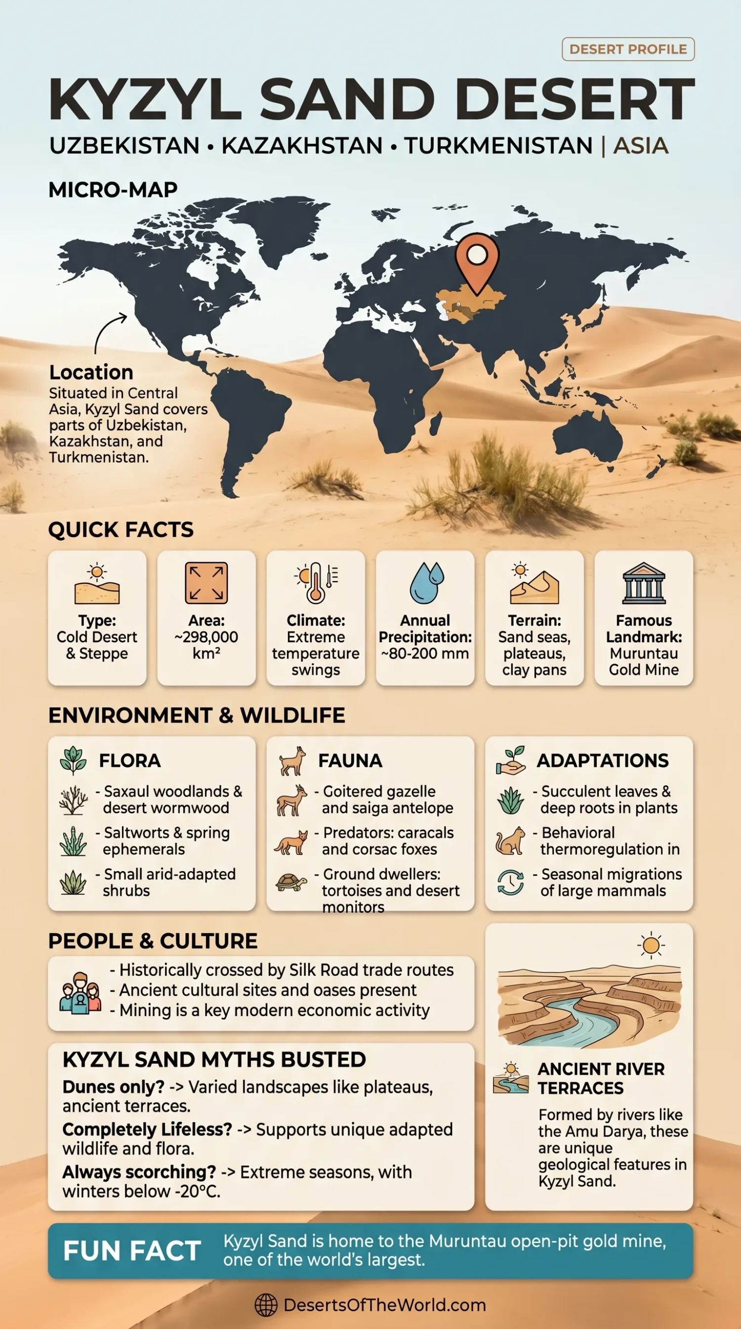
Location & Continent
Continent: Asia
Countries: Primarily Uzbekistan and Kazakhstan, with the wider desert landscape reaching toward northern Turkmenistan
Coordinates: ~41°N, 64°E
Kyzyl Kum – Map & Street View
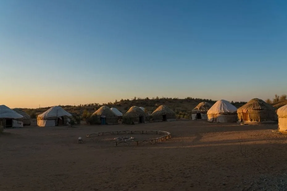
Photos of the Kyzyl Kum Desert

Physical Features
Area: ~298,000–300,000 km²
Location: Between the Amu Darya and Syr Darya rivers, southeast of the Aral Sea
Elevation: Much of the desert lies below 300 m, with isolated rocky uplands rising considerably higher
Landforms: Sand ridges, barchans, gravel plains, takyr clay surfaces, enclosed depressions, and isolated low mountain massifs
Climate & Precipitation
Climate: Strongly continental arid climate with hot summers and cold winters
Temperature: Summer temperatures can exceed 45°C; severe winter cold can fall below −20°C in parts of the desert
Precipitation: Generally about 100–200 mm annually, falling mainly during winter and spring
Ecological Features
Biogeographic Realm: Palearctic
Environment: Temperate desert, sandy shrubland, clay desert, and river-edge tugai habitat
Main Vegetation: Saxaul, wormwood, salt-tolerant shrubs, Calligonum, grasses, and short-lived spring plants
Flora & Fauna
Flora: Black and white saxaul (Haloxylon spp.), wormwood (Artemisia), saltworts, Calligonum shrubs, tamarisk near watercourses, and spring ephemerals
Fauna: Goitered gazelle, corsac fox, sand cat, jerboas, Central Asian tortoise, desert monitor, agamid lizards, Asian houbara, larks, and other arid-zone birds
River-Edge Fauna: Bukhara deer survives in protected tugai woodland along the Amu Darya, including the Kyzylkum State Nature Reserve
Geology & Notable Features
Geology: Windblown sand and younger desert sediments cover much of the surface, while isolated uplands expose older rocks linked to the southern Tien Shan geological belt
Notable Features: Muruntau gold deposit, Auminzatau and Kuldjuktau mountains, Kyzylkum State Nature Reserve, Amu Darya tugai habitats, and Sarmishsay Gorge on the southeastern desert margin
Kyzyl Kum Desert
The Kyzyl Kum, also written Kyzylkum or Qizilqum, is a large Central Asian desert whose name means Red Sand. It occupies roughly 300,000 square kilometers between the Amu Darya and Syr Darya, southeast of the Aral Sea.
Most of the desert lies in Uzbekistan and Kazakhstan. Its surface is not one continuous sand sea: sand ridges alternate with gravel plains, clay depressions, dry basins, grazing land, and isolated rocky uplands. Major mining districts and river-edge ecosystems also occur within or along the desert.
Geography
The Kyzyl Kum occupies the broad lowland between two of Central Asia’s major rivers. The Syr Darya defines much of its northeastern side, while the Amu Darya lies along the southwest. The desert slopes generally toward the northwest and the Aral Sea region.
Much of the landscape is a sandy or sandy-clay plain below 300 m above sea level. Isolated uplands interrupt this low relief, particularly in central Uzbekistan. These include the Bukantau, Tamdytau, Auminzatau, and Kuldjuktau areas.
The Ural River does not border the Kyzyl Kum and is far to the northwest in Kazakhstan and Russia.
Sand Ridges, Takyrs and Rocky Uplands
Wind has produced extensive ridges and barchan dunes across the Kyzyl Kum, but many sand surfaces are partly stabilized by vegetation. Saxaul, grasses, and shrubs reduce sand movement in areas where plant cover persists.
| Landform | Description | Distribution |
|---|---|---|
| Sand Ridges and Barchans | Wind-shaped sand bodies ranging from mobile dunes to vegetation-stabilized ridges | Widespread across sandy sectors |
| Takyrs | Flat clay surfaces that become hard and cracked after temporary water evaporates | Especially common in depressions and northwestern areas |
| Rocky Uplands | Older bedrock exposed above the surrounding desert plain | Central and southeastern Kyzyl Kum |
| River Corridors | Floodplain and tugai habitats supported by the Amu Darya and Syr Darya | Desert margins |
Climate
The Kyzyl Kum has a strongly continental desert climate. Summers are hot and dry, while winters are cold enough for frost and occasional snow.
Annual precipitation is generally around 100–200 mm. Most falls in winter and spring rather than during summer. Rainfall varies between years, and much of the moisture is lost rapidly through evaporation.
Summer heat can exceed 45°C. The Kyzylkum State Nature Reserve has recorded temperatures as high as approximately 47°C and winter lows near −25°C, illustrating the broad annual temperature range found in the region.
Seasonal Plant Growth
The timing of precipitation strongly affects vegetation. Winter and early-spring moisture allows annual herbs and grasses to complete much of their growth before summer heat intensifies.
By late spring and summer, many short-lived plants have dried out. Longer-lived shrubs such as saxaul, wormwood, saltworts, and Calligonum remain active through adaptations to water shortage, saline soil, or shifting sand.
Flora and Fauna
Vegetation varies according to sand depth, soil salinity, groundwater, grazing pressure, and distance from major rivers.
Saxaul is one of the characteristic desert plants. Its extensive root system allows it to survive on dry sandy ground and helps stabilize loose sediment. Wormwood, salt-tolerant shrubs, Calligonum, and seasonal grasses occupy other desert surfaces.
Animals associated with the wider Kyzyl Kum include:
- Goitered Gazelle: An arid-land ungulate using open desert and semi-desert habitat.
- Asian Houbara: A desert and steppe bird studied in the Kyzyl Kum for its habitat use and breeding ecology.
- Central Asian Tortoise: A terrestrial tortoise occupying sandy and clay desert habitats.
- Desert Monitor: A large lizard occurring in suitable sandy and scrub environments.
- Jerboas and Other Rodents: Small mammals that use burrows to avoid daytime heat and winter cold.
- Corsac Fox and Sand Cat: Predators associated with open dry habitats in Central Asia.
Riparian areas support a different animal community from the open desert. Tugai forest along the Amu Darya provides habitat for wild boar, jackals, birds, reptiles, and the endangered Bukhara deer.
Amu Darya and Tugai Habitats
The Kyzyl Kum is usually identified with sand and shrub desert, but the Amu Darya margin supports narrow belts of tugai, the floodplain woodland characteristic of Central Asian rivers.
These habitats contain poplar, willow, tamarisk, reeds, and other plants dependent on river water and groundwater. Their wildlife differs sharply from that of the surrounding sandy desert.
The Kyzylkum State Nature Reserve protects both desert and river-edge environments. Uzbekistan’s environmental authorities give its total area as 10,311 hectares, including 7,134 hectares of desert and 3,177 hectares of Amu Darya riparian habitat.
Mining and Mineral Resources
Mining is one of the main industrial land uses in the Uzbek part of the Kyzyl Kum. The desert contains deposits of gold, uranium, natural gas, and other mineral resources.
The best-known mining area is Muruntau in central Uzbekistan. USGS geological work identifies the Muruntau deposit as one of the world’s largest individual gold deposits. Gold mineralization occurs within deformed sedimentary rocks cut by major shear structures and intrusive bodies.
The Kyzyl Kum also contains the Auminzatau and Kuldjuktau mountain areas. USGS and Uzbekistan’s mining authorities have conducted geological and geochemical work there to assess resources including gold, tungsten, rare-earth elements, graphite, and uranium.
Mining sites occupy limited portions of the desert but can require large amounts of infrastructure, water, roads, and waste-management capacity.
Pastoralism and Settlements
Large parts of the Kyzyl Kum are used as seasonal rangeland. Karakul sheep, camels, horses, and other livestock graze where shrubs and grasses provide enough forage.
Permanent settlement is concentrated around river valleys, wells, transport corridors, mining centers, and irrigated areas. Bukhara and Navoi lie near the southeastern desert margin rather than in the most sparsely populated interior.
Water availability determines where agriculture is possible. Irrigated farming is concentrated mainly near the Amu Darya, Syr Darya, and developed oasis zones rather than across the open desert.
Kyzylkum State Nature Reserve
The Kyzylkum State Nature Reserve was established in 1971 along the Amu Darya in Uzbekistan. It protects a combination of southwestern Kyzyl Kum desert and floodplain tugai habitat.
Uzbekistan’s environmental authorities report 359 animal species from the reserve: 37 mammals, 266 birds, 29 reptiles, 2 amphibians, and 25 fish species. Fifty are listed in Uzbekistan’s Red Book.
One of the reserve’s best-known mammals is the Bukhara deer. This deer depends on tugai woodland rather than open sand desert and survives in several protected river corridors in Uzbekistan.
The reserve therefore protects two closely connected but different environments: arid Kyzyl Kum terrain and the Amu Darya floodplain.
Sarmishsay on the Desert Margin
Sarmishsay Gorge lies in the Karatau range of Uzbekistan’s Navoi Region near the southeastern Kyzyl Kum landscape. The site contains one of Uzbekistan’s largest concentrations of petroglyphs.
Uzbekistan submitted Sarmishsay to UNESCO’s World Heritage Tentative List in 2024. UNESCO documentation records approximately 10,000 rock carvings spanning several archaeological periods, together with settlement remains, burial sites, and other archaeological material.
The protected museum-reserve covers about 5,000 hectares. Its position at the transition between desert and low mountains also supports plant and animal communities different from those of the central sand plains.
Conclusion
The Kyzyl Kum occupies roughly 300,000 km² between the Amu Darya and Syr Darya. Sand ridges and barchans cover large areas, but the desert also contains takyrs, gravel plains, isolated mountain massifs, mining districts, grazing land, and river-edge woodland.
Its climate is controlled by strong continental seasonality, with only about 100–200 mm of precipitation in most years and most rainfall arriving during winter and spring. Saxaul and other dryland plants stabilize parts of the sandy surface, while protected Amu Darya tugai supports Bukhara deer and other river-dependent wildlife. Muruntau, the Kyzylkum State Nature Reserve, and the desert’s isolated geological uplands show how mineral resources, desert ecology, and river systems occupy different parts of the same Central Asian landscape.
References
Government / Official Sources
- Government of Uzbekistan — Kyzylkum State Nature Reserve
- Government of Uzbekistan — Fauna of the Kyzylkum Nature Reserve
- Government of Uzbekistan — Bukhara Red Deer and Protected Areas
Research Sources
- U.S. Geological Survey — Geology of the Muruntau Gold Deposit
- U.S. Geological Survey — Auminzatau and Kuldjuktau Mountains Geological Data
- Geophysical Research Letters — Sediment Sources and Fluvial-Aeolian Processes in the Kyzyl Kum
- Monash University — Kyzyl Kum Agamid Lizard Ecology
- University of East Anglia — Asian Houbara Habitat and Abundance in Kyzyl Kum