
Location & Continent
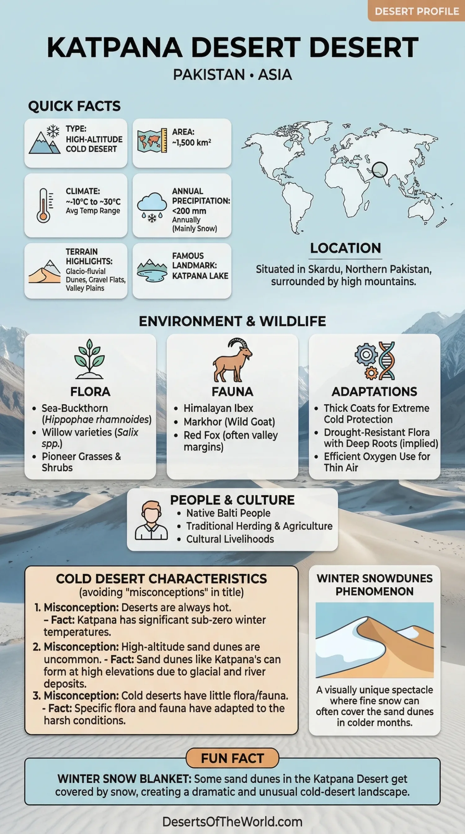
Continent: Asia
Country / Region: Pakistan — Gilgit-Baltistan (Skardu District)
Coordinates: 35.3105°N, 75.5907°E
Katpana Desert – Map & Street View
Click to load the interactive map
Click to load the interactive map
Photos of the Katpana Desert
Physical Features
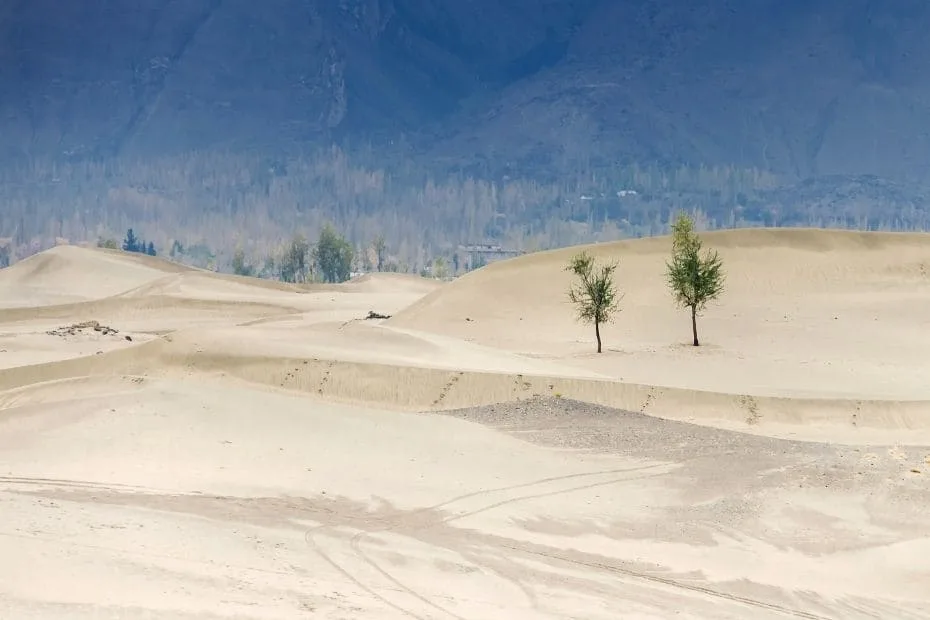
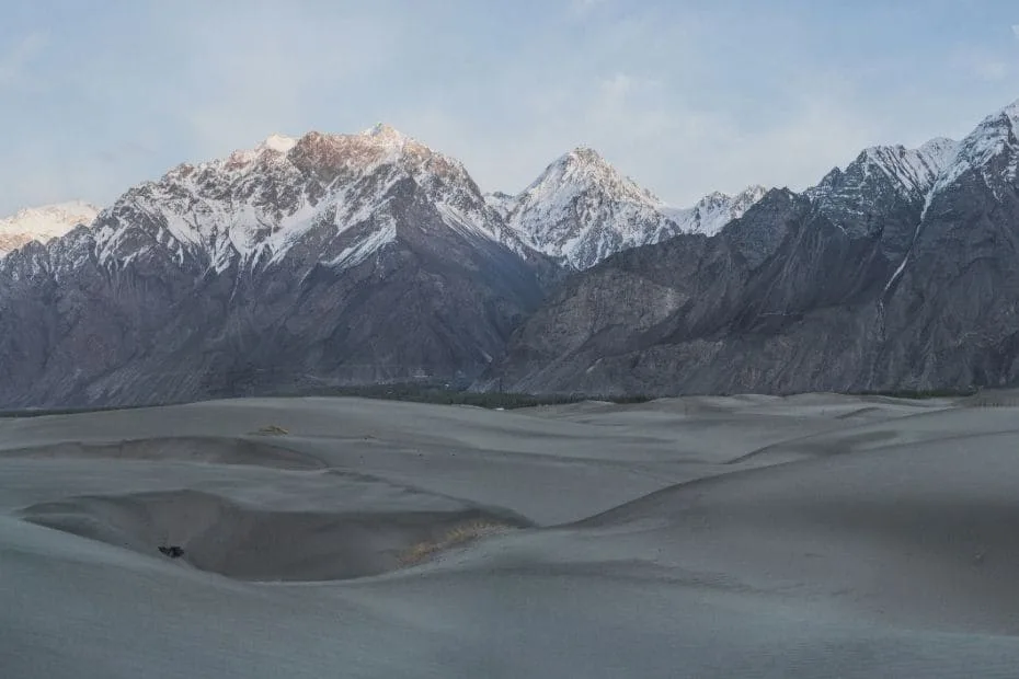
The Katpana Desert—often called the Cold Desert of Skardu—sits on the floor of the Skardu Valley, a broad intermontane basin carved by the Indus and Shigar rivers and walled in by the Karakoram. Here, wind has sculpted pale, flowing dunes over glacio-fluvial sediments, creating a dune field that sometimes wears a winter veil of snow. The best-known, visitor-friendly dunes lie beside Katpana Lake, a short drive from Skardu Airport, while sister dunes unfurl across the river at Sarfaranga in Shigar.
Elevation: ~2,226 m (7,303 ft) at the main dune field Setting: High-altitude valley plain within the Karakoram Landforms: Crescenting sand dunes, gravelly flats, loessic valley fills, and seasonal wetlands around lakes and channels Extent: Discrete dune belts occur from the Indus floodplain north toward New Ranga; the Katpana and Sarfaranga sectors are the most accessible for visitors
Climate & Precipitation
Shielded from the South Asian monsoon by surrounding ranges, Skardu has a cold, high-altitude desert climate: summers are sunny and mild by mountain standards; winters are sharp, with frequent freezes. Snowfall can dust the dunes in mid-winter, especially after passing westerly disturbances.
Temperature: April–October days commonly reach up to ~27 °C; mid-winter nights often fall below −10 °C; the Skardu record low is −24.1 °C (7 Jan 1995) Precipitation: Low overall; moisture arrives mainly as winter snow and occasional spring storms
Ecological Features
Ecozone: Cold desert / alpine steppe of the upper Indus basin
Biome: Montane grasslands & shrublands
Ecoregion: Karakoram–West Tibetan Plateau alpine steppe (arid, high-elevation grass-shrub mosaic)
Flora & Fauna
Vegetation on the active dunes is sparse—pioneer grasses and drought-hardy shrubs find purchase where moisture lingers. Around streams and lake margins, ribbons of willow and sea-buckthorn green the valley. In the wider steppe and slopes above, hardy wildlife endures thin air and long winters.
Flora (regional & riparian): Hippophae rhamnoides (sea-buckthorn), Salix spp. (willows), junipers and alpine forbs in protected pockets Fauna (regional): Himalayan ibex, urial and markhor on the slopes; red fox and small mammals on the valley margins; raptors and chukar among common birds; snow leopard persists in higher, rugged habitat
Geology & Notable Features
The Skardu basin is a sediment trap: for millions of years, glaciers and rivers have poured rock flour, gravel, and sands into this valley. Today’s dunes are the wind-worked skin of those deposits. The basin itself sits where terranes of the Himalaya and Karakoram meet—an austere classroom for tectonics, glaciation, and aeolian (wind-driven) processes.
Geology: Glacio-fluvial valley fills reworked by persistent valley winds into dunes; basin framed by Karakoram crystalline rocks and major thrusts Notable Nearby: Katpana Lake, Skardu Airport (gateway); Sarfaranga Cold Desert (across the Indus in Shigar); access onward to Deosai and Central Karakoram National Park
Human Impact and Culture
The surrounding regions of the Katpana Desert are inhabited by various indigenous communities, predominantly Balti people. Their culture has been shaped greatly by the desert landscape, evident in their traditional practices and livelihoods. The locals primarily engage in agriculture and animal husbandry, utilizing the limited resources available effectively.
Tourism and Attractions
The Katpana Desert has seen growth in tourism, largely due to its sand dunes, clear night skies, and activities such as camel rides and trekking. Visitors also engage with local communities and cultural traditions, combining outdoor activities with regional heritage.
Tourist Attractions Overview
| Attraction | Description | Activities |
|---|---|---|
| Sand Dunes | Majestic sand formations providing stunning views | Trekking, Photography |
| Shigar Fort | A historical fort with architectural beauty | Cultural Tours, Sightseeing |
| Indus River | Scenic river offering picturesque views | Boating, Fishing |
Conclusion
The Katpana Desert reflects adaptation to high-altitude desert conditions by both local communities and natural systems. Its landscapes, ecosystems, and cultural history define its role within the region. The area continues to attract visitors and researchers interested in cold desert environments.
FAQ
Why is it called a “cold” desert?
Because altitude changes everything. At over two kilometers above sea level, dry air, clear skies, and long winter nights drive temperatures far below freezing—yet moisture remains scarce—so you get dunes that can wear snow.
When is the best time to visit?
Late spring through early autumn (roughly May–October) offers clear skies and comfortable days. Winter visits are possible but bring serious cold-weather gear and check road conditions.
Is Katpana really among the world’s highest deserts?
Yes—its dune field sits around ~2,200–2,300 m. While “highest” claims vary globally, Katpana is widely cited as one of the highest cold-desert dune systems accessible by road.
What should I pack?
Layers, windproof outerwear, sun protection, and sturdy footwear. Nights cool rapidly even in summer; in winter, expect sustained sub-zero temperatures.
Are there sensitive habitats?
Yes. Stick to existing tracks, avoid fragile vegetation on dune slip faces, and keep a respectful distance from wildlife—especially in winter when energy budgets are tight.
References
Katpana Desert — Wikipedia
Skardu (climate & record lows; PMD-sourced) — Wikipedia
Government of Gilgit-Baltistan — District Skardu
Pakistan Geographical Review (2021): Katpana Desert coordinates & setting — University of the Punjab
Landforms & landscape evolution in the Skardu–Shigar–Braldu valleys — University of Cincinnati
Karakoram–West Tibetan Plateau alpine steppe — Wikipedia