
Location & Continent
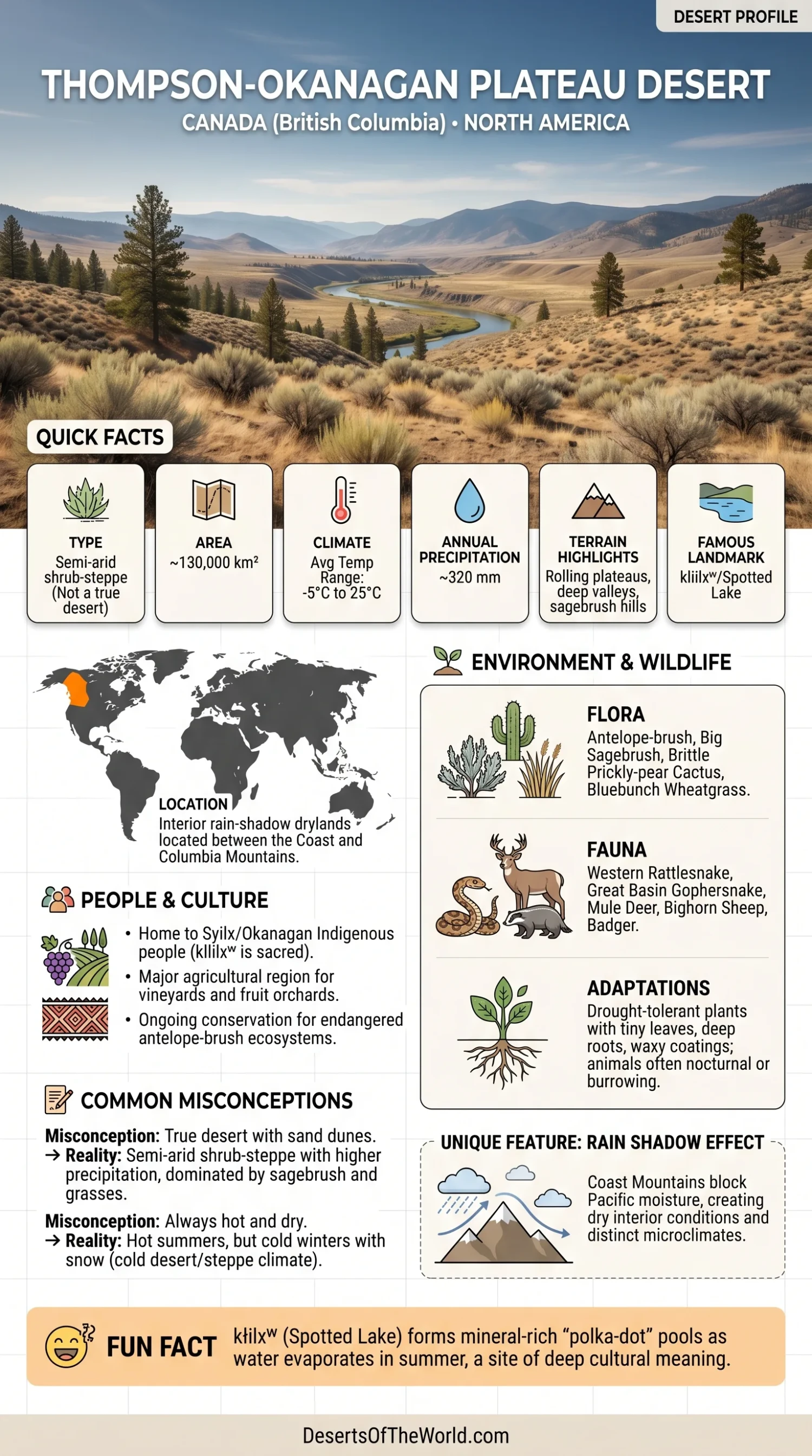
Despite the common name “Okanagan Desert,” the South Okanagan is not generally classified as a true desert. Environment and Climate Change Canada climate normals for Osoyoos show about 323 mm of annual precipitation, while the natural vegetation is better described as semi-arid shrub-steppe and grassland. Its hot, dry summers, sagebrush-covered slopes, and rain-shadow setting still give parts of the valley a distinctly desert-like appearance.
Continent: North America
Country: Canada (British Columbia)
Region: Southern Interior of British Columbia, especially the South Okanagan and lower Similkameen valleys
Coordinates: Approximately 49°N, 119.5°W near Osoyoos
Okanagan Desert (Thompson–Okanagan Plateau) – Map & Street View
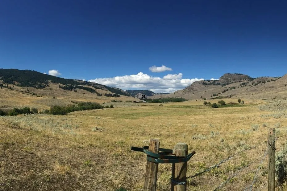
Photos of the Okanagan Desert & Shrub-Steppe
Physical Features
Desert-Like Area: A patchwork of shrub-steppe, bunchgrass, antelope-brush habitat, and other dry ecosystems concentrated mainly in the South Okanagan and lower Similkameen valleys.
Thompson–Okanagan Plateau Ecoregion Area: Approximately 31,596 km². This much larger mapped ecoregion includes dry valleys, plateaus, grasslands, forests, lakes, and river systems and should not be treated as the area of the “Okanagan Desert” itself.
Elevation: Valley bottoms around 250–400 m, with Osoyoos at approximately 283 m; surrounding plateaus and mountains rise above 1,000 m.
Setting: Interior rain-shadow drylands of southern British Columbia. Open grassland and shrub-steppe dominate some of the driest valley floors, while Ponderosa pine and Douglas-fir become more common with increasing elevation and moisture.
Climate & Precipitation
Climate Type: Semi-arid interior climate in the driest valley bottoms, with hot, dry summers and cold winters.
Osoyoos Annual Mean Temperature: Approximately 10.7°C for the 1991–2020 climate-normal period.
Osoyoos July Daily Mean: Approximately 23.2°C.
Osoyoos January Daily Mean: Approximately −1.0°C.
Annual Precipitation: Approximately 323 mm at Osoyoos under the 1991–2020 climate normals.
These figures replace broad monthly rainfall estimates that can obscure local conditions. Precipitation varies across the Thompson–Okanagan because elevation, valley position, and rain-shadow effects change substantially over short distances. Higher terrain is generally cooler and wetter than the Osoyoos valley floor.
Ecological Features
Ecozone: Montane Cordillera
Ecoregion: Thompson–Okanagan Plateau
Dryland Habitats: Shrub-steppe, bunchgrass, antelope-brush grassland, open Ponderosa pine woodland, and riparian habitats.
The South Okanagan contains some of Canada’s warmest and driest valley-bottom ecosystems. Antelope-brush communities occur mainly on low-elevation sandy and gravelly soils in the southern Okanagan Valley and support many plants and animals with limited Canadian distributions.
Dry grassland is only part of the regional ecology. Rivers, wetlands, oxbows, lakes, open conifer woodland, and cooler upland forests occur nearby, creating strong habitat changes with elevation and available moisture.
Flora & Fauna
Flora: Antelope-brush (Purshia tridentata), big sagebrush (Artemisia tridentata), rabbitbrush (Ericameria spp.), brittle prickly-pear cactus (Opuntia fragilis), bluebunch wheatgrass (Pseudoroegneria spicata), needle-and-thread grass, and other drought-tolerant bunchgrasses.
Fauna: Western rattlesnake (Crotalus oreganus), Great Basin gophersnake, American badger, mule deer, bighorn sheep, Great Basin spadefoot, Lewis’s woodpecker, lark sparrow, and other grassland and shrub-steppe species.
Several animals found in the South Okanagan occur in Canada mainly or entirely within the dry southern interior of British Columbia. The close combination of shrub-steppe, grassland, wetlands, and open woodland helps support this high local diversity.
Geology & Notable Features
Geology: The interior plateau contains volcanic rocks, including Chilcotin Group basalts, over older geological terranes. Pleistocene glaciation reshaped valleys and left extensive glacial and glaciofluvial sediments.
Landscape: Broad plateaus are cut by deep valleys containing lakes and river systems. Sandy and gravelly glacial deposits provide the substrate for some of the driest shrub-steppe habitats near Osoyoos.
Notable Features: Nk’Mip Desert Cultural Centre, Osoyoos Desert Centre, South Okanagan grasslands, and kłlilxʷ (Spotted Lake) west of Osoyoos.
At kłlilxʷ, summer evaporation concentrates dissolved minerals in the shallow lake and produces visually distinct mineral pools. The lake is also a sacred place for the Syilx/Okanagan people.
Valleys, Rivers, And Agriculture
The dry landscape is crossed by major waterways including the Okanagan River and, farther north within the broader ecoregion, the Thompson River. Riparian areas beside rivers and streams support vegetation that differs sharply from nearby shrub-steppe and dry grassland.
Warm summers and irrigation allow extensive agriculture in suitable valley locations. Vineyards and fruit orchards are common in the Okanagan, including grapes, cherries, apples, pears, and other crops. Agriculture occupies some of the same low-elevation environments that naturally support rare antelope-brush and bunchgrass communities, which is one reason remaining dryland habitats are closely monitored and protected.
Why The Okanagan Is Called A Desert
The term “Okanagan Desert” is an informal description of the unusually dry shrub-steppe near Osoyoos rather than the name of a formally defined climatic desert. The combination of low precipitation, summer heat, sparse shrubs, bunchgrasses, cactus, exposed soils, and rain-shadow conditions creates a desert-like landscape within Canada.
The distinction is useful because the dry valley-bottom ecosystem should not be confused with the entire 31,596 km² Thompson–Okanagan Plateau ecoregion. Much of the broader ecoregion includes forested uplands, lakes, river valleys, and ecological zones that receive considerably more moisture.
References
Government / Official Sources
- Environment and Climate Change Canada — Thompson–Okanagan Plateau ecoregion area
- Statistics Canada — Thompson–Okanagan Plateau ecoregion
- Province of British Columbia — Thompson–Okanagan region overview
- Environment and Climate Change Canada — Osoyoos 1991–2020 climate normals
- British Columbia Government — Antelope-Brush Ecosystems
- British Columbia Government — South Okanagan Wildlife Management Area
Universities / NGOs
- University of British Columbia — Assessment and Monitoring in Antelope-Brush Ecosystems
- Nature Trust of BC — Antelope-Brush Conservation Lands
- E-Flora BC — Opuntia fragilis in British Columbia