
Location & Continent
Continent: North America
Country: United States (Nevada, Utah, Idaho, California, Oregon)
Coordinates: ~39.5°N, 116°W (regional center)
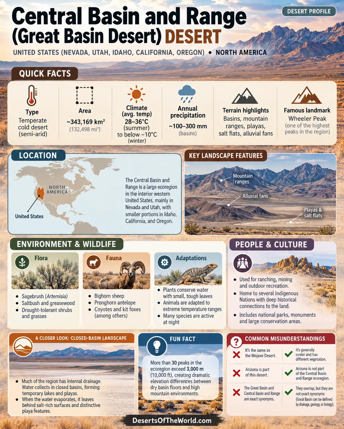
The Central Basin and Range is a large ecoregion of the interior western United States. According to the U.S. Geological Survey, about 65.4% lies in Nevada and 25.1% in Utah, with smaller portions in Idaho (5.6%), California (3.7%), and Oregon (0.2%). Arizona is not part of the defined Central Basin and Range ecoregion.
The Central Basin and Range overlaps extensively with what is commonly called the Great Basin Desert, but the terms are not exact synonyms. Central Basin and Range is an ecological region used by federal mapping systems, while the Great Basin can be defined by drainage, geology, or biological characteristics.
Map & Street View
Photos of the Central Basin and Range
Physical Features
Area: Approximately 343,169 km² (132,498 mi²)
Elevation: Most basin floors are above 1,200 m (4,000 ft); many mountain ranges exceed 3,000 m (10,000 ft)
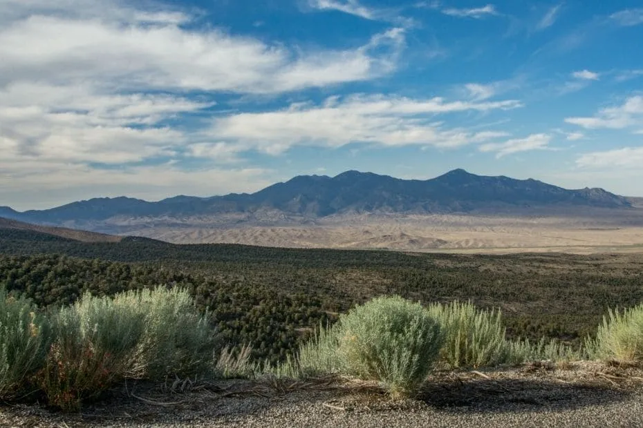
Landforms: Broad desert basins, north-south mountain ranges, playas, salt flats, alluvial fans, dune fields, caves, and high-elevation glacial landforms
Hydrology: Much of the region has internal drainage, with water ending in closed basins where it evaporates, infiltrates into the ground, or collects temporarily in lakes and playas
The landscape follows the classic Basin and Range pattern: long mountain ranges separated by broad, relatively flat valleys. More than 30 peaks within the ecoregion exceed 3,000 m, creating large elevation differences between dry basin floors and cooler mountain environments.
Alluvial fans spread outward from mountain fronts where streams deposit gravel, sand, and finer sediment. In the lowest parts of closed basins, temporary lakes can evaporate and leave behind playas and salt-rich surfaces.
Climate & Precipitation
Type: Temperate cold desert and semi-arid interior climate with four distinct seasons
Temperature: Basin summers commonly reach about 28–36°C (82–97°F); winter lows frequently fall below −10°C (14°F), with colder conditions at higher elevations and in some valleys
Precipitation: Commonly about 100–300 mm annually across dry basins, while mountain ranges receive more precipitation and winter snow
Evaporation: High evaporation in closed basins contributes to playas, saline soils, and salt flats
Elevation creates strong local climate differences. Dry valleys can experience hot summer days and cold winter nights, while mountain ranges intercept additional moisture and retain seasonal snow. Snowmelt supplies springs, streams, wetlands, and terminal lakes in parts of the region.
The Central Basin and Range is generally cooler than the Mojave Basin and Range to the south. This difference is reflected in its vegetation: sagebrush, saltbush, and greasewood communities are more characteristic of the Central Basin and Range than Joshua trees or widespread creosote-dominated desert scrub.
Ecological Features
Ecozone: Nearctic
Biomes: Temperate desert, sagebrush steppe, salt-desert shrubland, and pinyon–juniper woodland, with montane, subalpine, and alpine communities on higher ranges
Mountain Refugia: Isolated high ranges provide cooler and wetter habitats separated by broad arid valleys
The large elevation range produces several ecological zones within relatively short horizontal distances. Basin floors support drought- and salt-tolerant shrubs, slopes commonly carry sagebrush and woodland, and the highest mountains can support conifer forest, subalpine vegetation, and alpine communities.
These isolated mountain habitats allow species associated with cooler environments to persist above the surrounding desert basins. Springs and seeps provide additional small habitats where groundwater reaches the surface.
Flora & Fauna
Flora: Big sagebrush (Artemisia tridentata), shadscale (Atriplex confertifolia), greasewood (Sarcobatus vermiculatus), rabbitbrush, winterfat, Mormon tea, Indian ricegrass, and other bunchgrasses; pinyon pine and Utah juniper on suitable slopes; limber pine and bristlecone pine in some high mountain areas
Fauna: Pronghorn, mule deer, bighorn sheep, jackrabbits, kangaroo rats, greater sage-grouse, burrowing owls, golden eagles, lizards, snakes, and specialized invertebrates associated with springs and saline waters
Sagebrush and salt-desert shrub communities dominate many lower and middle elevations. Shadscale and greasewood tolerate dry or alkaline basin soils, while pinyon pine and Utah juniper become more common on rocky slopes where moisture conditions improve.
High mountains support a different set of species. Conifers, mountain shrubs, and alpine plants occur above the desert floor, while mammals and birds can move between elevation zones according to season and available food.
Springs, seeps, marshes, and terminal lakes occupy only a small part of the landscape but support aquatic and moisture-dependent organisms that cannot survive on the surrounding dry basin floors.
Geology & Notable Features
Geology: Crustal extension and normal faulting created repeated north-south fault-block mountain ranges and intervening basins; sedimentary, volcanic, and metamorphic rocks occur across the region
Notable Features: Bonneville Salt Flats, Great Basin National Park, Wheeler Peak, Lehman Caves, numerous playas and alluvial fans, and ancient shorelines associated with Lake Bonneville
The characteristic topography developed as the Earth’s crust stretched and fractured. Blocks of crust were uplifted or tilted along normal faults to form mountain ranges, while adjoining blocks subsided and became basins.
Erosion gradually carries rock and sediment from the ranges toward the valley floors. Material spreads across alluvial fans at mountain fronts and accumulates in closed basins. Where temporary lakes repeatedly fill and evaporate, fine sediment and dissolved minerals can form broad playas and salt flats.
Closed Basins and Terminal Lakes
Internal drainage is one of the defining features of the wider Great Basin landscape. Water does not generally reach an ocean. It may evaporate, seep underground, feed springs and wetlands, or collect in terminal lakes and playas.
During cooler and wetter periods of the past, some basins held much larger lakes. Lake Bonneville covered a broad area of western Utah during the late Pleistocene. The Great Salt Lake and numerous ancient shoreline features are remnants of that changing hydrologic history.
Mountain Ranges Above the Desert Basins
The mountains are an essential part of the Central Basin and Range rather than boundaries separating one desert from another. They intercept precipitation, accumulate winter snow, and create cooler habitats above the arid valleys.
Ranges in central and eastern Nevada contain peaks above 3,000 m. Great Basin National Park in eastern Nevada provides a clear example of this elevation pattern, rising from sagebrush-dominated lower terrain through pinyon–juniper woodland to high conifer forests and alpine environments near Wheeler Peak.
Field Conditions Across the Region
- Road surfaces: Many remote roads cross dry lake beds or clay-rich soils that can become difficult to travel when wet.
- Temperature range: Conditions can change sharply between exposed basin floors and high mountain terrain.
- Water: Permanent surface water is limited across many basins, although springs, seeps, streams, and terminal lakes occur locally.
- Night skies: Large sparsely populated areas have low levels of artificial light.
Frequently Asked Questions
Is the Central Basin and Range the Same as the Great Basin Desert?
No. The two areas overlap extensively, but they describe different geographic concepts. The Central Basin and Range is an EPA and USGS ecoregion covering about 343,169 km². The Great Basin can be defined hydrographically, geologically, or biologically, and its boundary changes according to the definition being used.
Which States Contain the Central Basin and Range?
The ecoregion occurs mainly in Nevada and Utah, with smaller areas in Idaho, California, and Oregon. USGS figures place 65.4% of the ecoregion in Nevada and 25.1% in Utah.
Why Are Salt Flats and Playas Common?
Many basins have no outlet to the ocean. Water carrying dissolved minerals collects in low areas and then evaporates or infiltrates into the ground. Repeated wetting and drying leaves fine sediment and salts on the basin floor.
How Does Snow Affect the Desert?
Mountain ranges receive more snow than the surrounding basins. Seasonal snowmelt feeds streams, springs, seeps, wetlands, and some terminal lakes, supplying water to habitats far below the high peaks.
What Vegetation Is Typical of the Central Basin and Range?
Typical basin vegetation includes sagebrush, shadscale, greasewood, rabbitbrush, winterfat, and bunchgrasses. Pinyon pine and Utah juniper commonly occur on suitable mountain slopes, while higher elevations can support additional conifer and alpine communities.
References
- U.S. Geological Survey – Central Basin and Range Ecoregion
- U.S. Geological Survey – Central Basin and Range Ecoregion, Professional Paper 1794-A
- National Park Service – The Great Basin and Its Geographic Definitions
- National Park Service – Mountains and Basin and Range Topography
- National Park Service – Great Basin National Park Geodiversity Atlas
- National Park Service – Great Basin Trees and Shrubs
- Utah Division of Wildlife Resources – Utah Wildlife Action Plan