
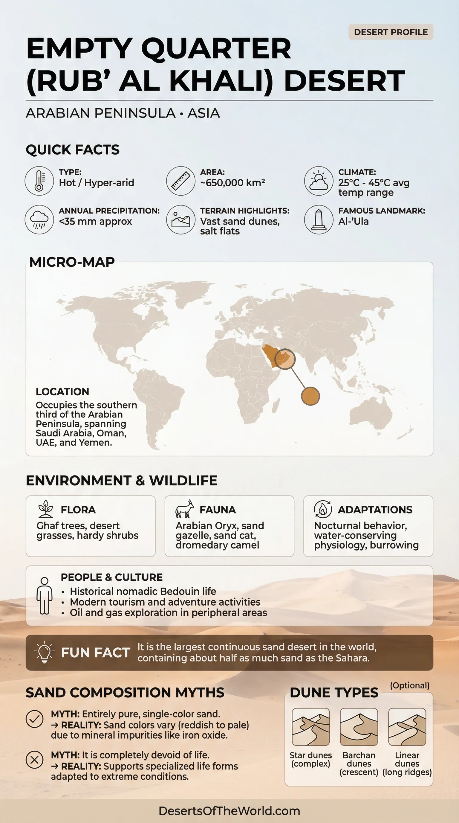
Location And Continent
Continent: Asia
Region: Arabian Peninsula in West Asia, forming a vast core of the Arabian Desert.
Countries: Saudi Arabia, Oman, United Arab Emirates, Yemen
Meaning Of The Name: Rub’ al Khali translates to “Empty Quarter”, reflecting the region’s immense open dune fields.
Approximate Extent: 16.5°–23.0°N, 44.5°–56.5°E
Center Point (Approx.): 20°N, 50°E
Empty Quarter (Rub’ al Khali) Desert
The Empty Quarter, also written as Rub’ al Khali, is one of Earth’s largest sand seas. It spreads across the southern Arabian Peninsula in broad dune fields separated in places by salt flats, shallow basins, and gravel surfaces.
The Rub’ al Khali is widely described as the largest continuous erg, or dune-dominated sand sea, on Earth. Its boundaries are not defined identically by every map or geographic source, which accounts for some variation in published area estimates.
Map And Street View
These embeds show the position of the Rub’ al Khali within the Arabian Peninsula and the relationship between its dune fields, plateaus, and basins.
Map View
Nearby Dune Edge View
Photos Of The Empty Quarter
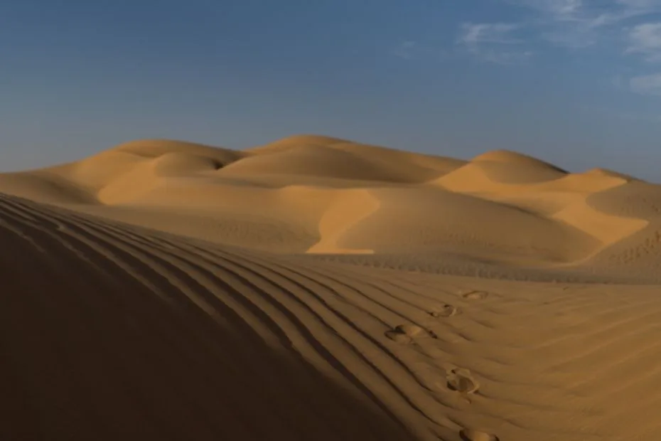
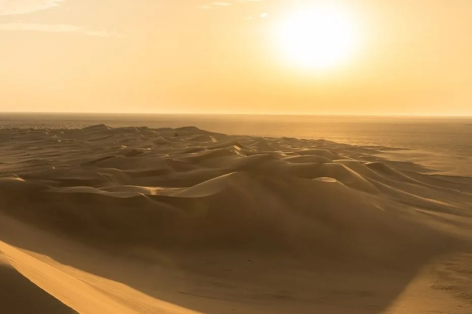
Photos of the Empty Quarter commonly show peach and orange sands, sharp dune shadows, and long ridges extending across the open desert.
Measurements And Scale
The Rub’ al Khali is frequently described with rounded measurements because different geographic definitions place its outer boundaries in slightly different locations.
| Feature | Typical Value | Notes |
|---|---|---|
| Area | ~580,000–650,000 km² | Different maps define the edges of the dune sea slightly differently. |
| Length | ~1,000 km | A long span across the southern Arabian Peninsula dominated by sand. |
| Width | Up to ~500 km | Broad dune belts occur alongside flats and gravel corridors. |
| Highest Dunes | Up to ~250 m | Dune height varies widely according to location and dune type. |
Elevation varies across the region, with higher sandy uplands in the west and southwest and lower plains toward the northeast. This regional gradient influences drainage, dune distribution, and the location of low basins.
Climate And Precipitation
The Empty Quarter climate is generally hyper-arid. Rainfall is uncommon and often highly localized. Many parts of the Rub’ al Khali receive well under 50 mm of rain annually, while individual years may produce little measurable precipitation.
Summer daytime temperatures can become extremely high. Nights are usually cooler because of clear skies, low atmospheric moisture, and strong radiative heat loss from the desert surface.
Wind controls much of the movement and redistribution of exposed sand. Prevailing and seasonally changing wind directions produce long linear ridges, complex dune intersections, and smaller surface ripples.
Ecology Of The Empty Quarter
The Rub’ al Khali ecosystem supports organisms adapted to severe water scarcity, high surface temperatures, and widely separated habitats. Biological activity becomes more concentrated near depressions, dune margins, groundwater-influenced areas, and locations that receive temporary moisture.
- Ecozone: Hyper-arid desert with localized vegetation around favorable low areas and dune margins.
- Plant Growth: Strongly dependent on rare rainfall events and available groundwater.
- Main Environmental Limit: Reliable water availability determines much of the distribution of vegetation and animal activity.
Flora And Fauna
Vegetation in the Empty Quarter is mostly low and widely spaced. Many plants are drought specialists with deep roots, small leaves, or waxy surfaces that reduce water loss. Near dune bases, groundwater-influenced areas, and shallow depressions, shrubs and hardy grasses may become more noticeable.
Many animals avoid the hottest daytime conditions and become more active at dusk, during the night, or early in the morning. Tracks often provide evidence of small mammals, reptiles, and invertebrates even when the animals themselves are difficult to observe.
Examples Of Desert-Adapted Life
- Plants: Salt-tolerant and drought-tolerant shrubs, scattered grasses, and occasional trees on margins where groundwater is accessible.
- Mammals: Small rodents and desert-adapted carnivores in suitable habitats, with larger grazers occurring in some protected landscapes.
- Reptiles And Invertebrates: Lizards, snakes, scorpions, beetles, and other species adapted to sand, heat, and limited moisture.
- Birds: Resident and seasonal species occur around desert margins, wadis, plateaus, and locations where water or vegetation is available.
Geology And Landforms
The Rub’ al Khali landscape includes more than dunes. Gravel plains, gypsum-rich surfaces, sabkhas, hard mineral crusts, interdune corridors, and ancient lake deposits occur in different parts of the desert.
Major Landform Types
- Erg (Sand Sea): Vast dune fields containing several dune forms and overlapping generations of wind-blown sand.
- Linear Dunes: Long, parallel ridges aligned with dominant or recurring wind directions.
- Star Dunes: Tall, multi-armed dunes that develop where sand-moving winds arrive from several directions.
- Sabkha (Salt Flat): Flat mineral-rich surfaces where dissolved salts accumulate as moisture evaporates, appearing intermittently along desert margins and low basins.
- Gravel And Gypsum Plains: Firmer surfaces that separate sections of the dune sea and provide different soil and habitat conditions.
Sand color ranges from pale gold to orange and reddish tones. Quartz dominates much of the sand, while additional minerals and differences in grain coatings influence local coloration.
Water, Salt Flats, And Ancient Lakes
Water is scarce on the surface today, but the Empty Quarter contains abundant evidence of wetter periods. Hardened clay, carbonate, gypsum, lake sediments, river deposits, and abandoned drainage features record episodes when water occupied areas that are now hyper-arid.
Most modern surface water produced directly by rainfall is short-lived and localized. Temporary water can collect in depressions after unusual rainfall and then disappear through evaporation or infiltration. Salt flats develop where dissolved minerals remain after water is lost.
There are also groundwater-fed exceptions. Research published in 2025 showed that parts of the Umm Al Heesh lake system in the Saudi Rub’ al Khali contain permanent spring lakes maintained by groundwater discharge from a Paleocene aquifer.
Large Holocene Lake And 150 Km Outlet Valley
A 2025 study in Communications Earth & Environment reconstructed an extensive water-shaped landscape in the Saudi part of the Rub’ al Khali. During the peak of the Holocene Humid Period or an earlier humid phase, stronger seasonal rainfall reactivated floodplains and filled a topographic depression covering approximately 1,100 km².
The basin eventually filled enough for water to breach its margin. The resulting outflow cut an approximately 150 km-long valley through the desert landscape. Geological evidence indicates that this was not simply a small isolated lake system but part of a much larger drainage network.
Sediment provenance indicates transport over distances of up to approximately 1,000 km from the Asir Mountains. The researchers linked this large source-to-sink system to periods when the African Monsoon extended farther into Arabia and produced stronger seasonal rainfall punctuated by heavy precipitation events.
The reconstructed lake, floodplains, river deposits, and outlet valley show that parts of the modern Empty Quarter once experienced enough runoff to support large connected drainage systems. The number and precise timing of individual flooding events still require further field evidence and dating.
Permanent Spring Lakes At Umm Al Heesh
A 2025 Scientific Reports study examined the origin of water at Umm Al Heesh in the Saudi Rub’ al Khali using hydrogeochemistry, isotope measurements, geological information, field observations, and satellite imagery.
The results show that groundwater from a Paleocene aquifer rises naturally through fractures, faults, sinkholes, and other subsurface pathways. This groundwater reaches the surface and maintains a group of permanent spring-fed small lakes despite the surrounding hyper-arid climate and very high evaporation.
The Umm Al Heesh system also contains a larger, more temporary lake. Water from the permanent spring lakes can flow across interdune topography into a sabkha depression, producing a temporary secondary lake whose area and salinity vary more strongly with evaporation and changing inflow.
This distinction changes the interpretation of modern water in the Empty Quarter. Rainfall-fed pools and many surface-water features remain temporary, but the Umm Al Heesh small lakes demonstrate that persistent surface water can exist where confined groundwater is continuously discharged from an underlying aquifer.
Wind, Dunes, And Sand Patterns
Wind moves loose grains by rolling, bouncing, and short-distance suspension. Sand accumulates into dune crests, while slipfaces form on the sheltered side where grains move downslope.
Different parts of the Rub’ al Khali contain linear dunes, star dunes, and mixed dune systems. Their shape reflects prevailing wind direction, seasonal changes in airflow, sand supply, underlying topography, and interaction between older and younger dune generations.
Edges, Oases, And Place Names
The margins of the Empty Quarter contain transitions between dune fields, oases, escarpments, gravel plains, and salt-rich basins. The Liwa area on the northern margin is one example where very large dunes occur near inhabited and vegetated landscapes.
Groundwater conditions and local topography allow some desert margins to support denser vegetation than the central dune fields. Place names across the region commonly refer to physical features such as dunes, basins, wells, salt flats, and routes.
Protected Landscapes And Scientific Interest
Parts of the Rub’ al Khali connect with protected landscapes, including areas on the western margin where dunes meet limestone plateaus. ‘Uruq Bani Ma’arid includes large dune systems and habitats supporting desert-adapted wildlife.
The Empty Quarter also preserves geological and environmental records of past climate change. Dune deposits, mineral crusts, ancient lake beds, river sediments, groundwater-fed lakes, and buried drainage systems provide evidence for shifts between hyper-arid conditions and earlier humid phases.
Recent studies of the large Holocene lake system and the Umm Al Heesh spring lakes show that both past monsoon-driven surface drainage and present groundwater discharge have shaped water environments within the Rub’ al Khali.
References
NASA Earth Observatory: Empty Quarter (Rub’ al Khali)
U.S. Geological Survey: Empty Quarter Image And Description
Scientific Reports (2025): Origin Of Umm Al Heesh Lake In The Rub’ Al Khali Desert, Saudi Arabia
KAUST: Research On Past Wet Phases In Rub’ Al Khali
UNESCO World Heritage Centre: ‘Uruq Bani Ma’arid
National Center For Wildlife (Saudi Arabia): Protected Areas
National Center For Wildlife: ‘Uruq Bani Ma’arid World Heritage Status