
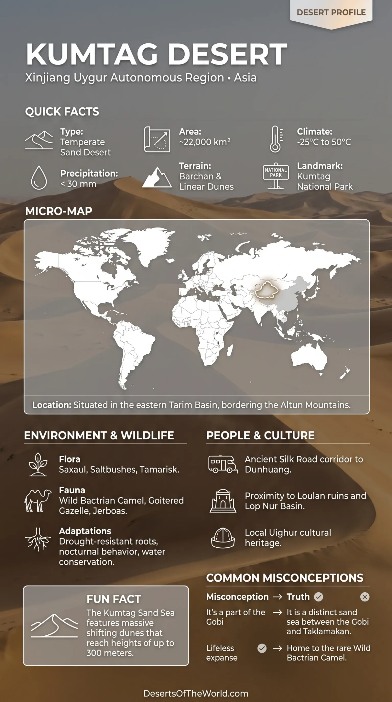
Location & Continent
Continent: Asia
Country: China
Administrative Setting: Xinjiang and western Gansu, near the Qinghai boundary
Coordinates: Approximately 39°08′–41°00′N, 89°58′–94°54′E
Kumtag Desert – Map
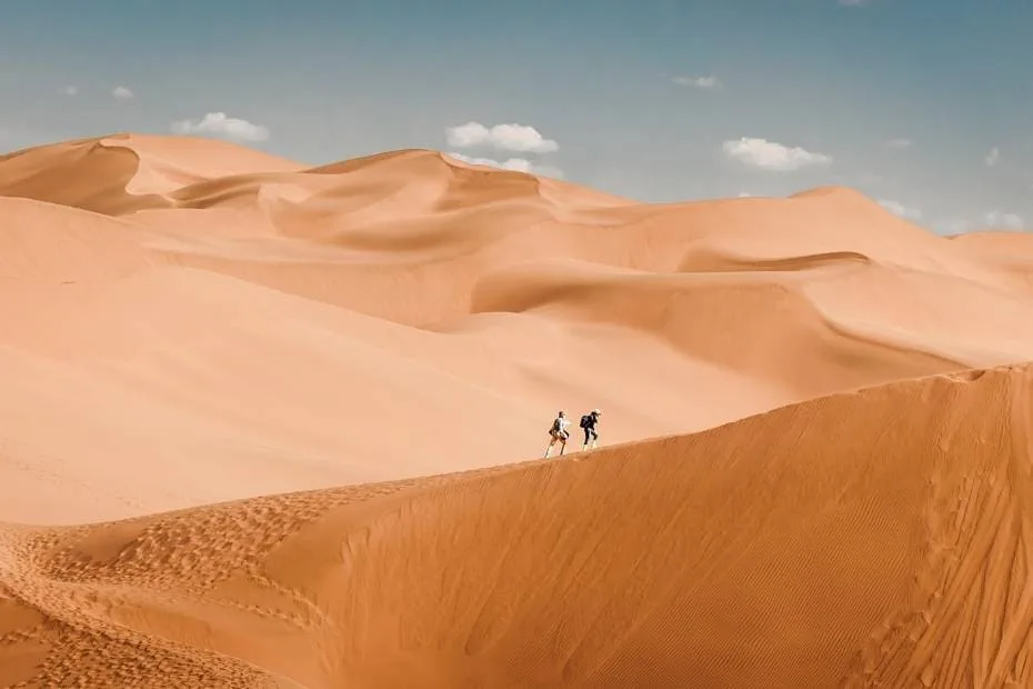
Photos of the Kumtag Desert
Physical Features
Area: Approximately 22,800 km²
Length: About 280 km east–west
Width: About 120 km north–south
Setting: Between the Lop Nur Depression to the west and Dunhuang Basin to the east, with the Altyn Tagh Mountains to the south
Landforms: Mobile dune fields, longitudinal dunes, barchans, gravel surfaces, alluvial plains, yardangs, and wind-eroded corridors
Climate & Precipitation
Climate: Extremely arid continental desert climate
Temperature: Hot summers and cold winters; summer daytime temperatures can exceed 40°C while winter temperatures fall well below freezing
Precipitation: Generally below 50 mm annually, with many parts receiving less than 30 mm
Wind: Strong northerly and northeasterly winds are major controls on sand transport and dune development
Ecological Features
Biogeographic Realm: Palearctic
Environment: Hyper-arid sand desert with sparse shrubland and gravel surfaces
Vegetation Pattern: Very sparse in the desert interior, becoming more developed near mountain runoff channels, groundwater, and desert margins
Flora & Fauna
Flora: Saxaul (Haloxylon spp.), Calligonum, tamarisk, salt-tolerant shrubs, and short-lived plants appearing after rainfall
Fauna: Wild Bactrian camel, goitered gazelle, jerboas, foxes, reptiles, and desert birds in suitable habitats
Wild Camel Habitat: The wider Kumtag–Lop Nur–Altun region contains important remaining habitat for the wild Bactrian camel
Geology & Notable Features
Sand Sources: Weathered material from the Altyn Tagh Mountains, alluvial deposits, and former river and lake sediments
Dune Systems: Longitudinal dunes, barchans, complex dune ridges, and the distinctive pseudo-feathery patterns visible in satellite imagery
Notable Areas: Sanlongsha dune field, Lop Nur margin, Aqik Valley, Altyn Tagh foothills, and the western end of the Hexi Corridor near Dunhuang
Kumtag Desert
The Kumtag Desert, often written Kumtagh Desert, is a highly arid sand sea in northwestern China. Scientific surveys place its area at approximately 22,800 km², extending about 280 km from east to west and 120 km from north to south.
It lies east of the Lop Nur Depression and north of the Altyn Tagh Mountains. The eastern side approaches the Dunhuang Basin and the western end of the Hexi Corridor. Much of its surface consists of active dunes and wind-eroded desert terrain rather than the oasis-centered landscape sometimes associated with the same English place name in tourism material.
Geography
The Kumtag occupies an extremely dry interior basin between mountain and depression systems. Its southern margin follows the northern foothills of the Altyn Tagh Mountains, while the Lop Nur Depression forms the western boundary. To the north are the Aqik Valley and mountain belts associated with the eastern Tian Shan and Beishan region.
The Taklamakan Desert lies farther west beyond Lop Nur rather than directly forming the northern boundary of Kumtag. The Gobi is also not a single adjoining eastern wall; the transition toward Gansu consists of basins, gravel desert, dune fields, mountain ridges, and the Dunhuang region.
Much of the desert developed on alluvial and fluvial plains built by sediment transported out of surrounding mountains. Wind later reworked this material into extensive dune systems.
Dune Systems
Kumtag contains several dune forms rather than one uniform field of crescent dunes. Longitudinal ridges, barchans, compound dunes, sand sheets, and coarse-grained wind surfaces occur in different sectors.
One of the best-known patterns is the so-called pseudo-feathery dune system. From the air, pale dune ridges and darker interdune surfaces form shapes resembling feathers. Field studies showed that these patterns are mainly combinations of longitudinal dunes, sand drifts, and coarse lag deposits rather than a separate dune type.
Research published in 2026 on complex longitudinal dunes found that several wind directions contribute to their present form. Northerly and easterly winds help extend and reshape the ridges, while deflected westerly winds affect their steeper sides. Differences in grain size also influence how individual parts of the dunes move.
Where the Sand Comes From
The Kumtag’s sand was not produced by a single source. Mineral and geochemical studies have linked much of it to rocks exposed in the Altyn Tagh Mountains south of the desert.
Weathered rock fragments are carried downslope by floods and temporary streams and deposited on alluvial fans. Once dry, finer material can be picked up and redistributed by wind.
A second source lies to the north. Sediment from the Aqik Valley and lower reaches of the Shule River includes older river and lake deposits that can be eroded by strong winds and carried into the desert.
This combination of mountain erosion, intermittent water transport, former lake sediments, and wind redistribution explains why Kumtag contains both active dunes and exposed gravel or clay surfaces.
Climate
The Kumtag is one of the driest desert regions in China. Annual precipitation is generally below 50 mm, and several studies report averages below 30 mm across much of the sand sea.
Rainfall is irregular and insufficient to maintain widespread continuous vegetation. Water arriving from the Altyn Tagh foothills after rain or snowmelt can temporarily enter channels along the desert margin, but most channels do not support permanent flow across the interior.
The continental setting produces a large seasonal temperature range. Summers are hot, while winters are cold enough for extended periods below freezing. Strong winds and low soil moisture allow exposed sediment to move readily across sparsely vegetated surfaces.
Vegetation and Wildlife
Vegetation is extremely sparse across the most mobile dune fields. Plants become more common around mountain runoff routes, gravel plains, groundwater-supported depressions, and less mobile sand.
Saxaul, Calligonum, tamarisk, and other drought-tolerant shrubs occur where soil and moisture conditions permit. These plants can reduce near-surface wind speed and trap moving sediment around their roots.
The wider region supports animals adapted to large distances between water sources and limited vegetation. The most notable is the wild Bactrian camel (Camelus ferus). Its remaining range includes desert terrain around Kumtag, Lop Nur, and the Altun Mountains.
Goitered gazelles, small rodents, foxes, reptiles, and desert birds also occur in suitable habitats. The barren central dune fields generally support fewer animals than areas with shrubs, springs, or mountain runoff.
Wild Bactrian Camel Habitat
The Kumtag forms part of a larger dryland system used by the wild Bactrian camel, a species with a fragmented distribution in northwestern China and southwestern Mongolia.
A habitat study covering the Kumtag, Lop Nur, Altun Mountains, and surrounding terrain found that existing protected areas included more than half of the habitat identified as currently suitable in the study model. The analysis also projected that climate change could reduce suitable habitat in parts of the region by the 2050s.
Wild camel conservation in this landscape therefore depends on maintaining movement between desert basins, mountain-edge water sources, and protected habitat rather than treating individual dune fields as isolated units.
Sanlongsha Dune Field
Sanlongsha lies in the northern Kumtag and has been used extensively for research into dune and ripple movement. The dune field stretches for roughly 55 km and covers about 2,728 km².
Its terrain includes dunes, interdune corridors, and coarse-grained ripple surfaces. Some parts developed on an alluvial plain that slopes from higher terrain in the northeast toward lower areas in the southwest.
Repeated field measurements and remote-sensing studies have made Sanlongsha one of the better documented areas for observing how wind direction, grain size, and local topography interact in the Kumtag.
Relationship with Lop Nur
The Lop Nur Depression lies immediately west of Kumtag. Although the two landscapes are connected geographically, they are not the same desert feature.
Lop Nur is dominated by former lake beds, salt crusts, clay surfaces, and yardangs. Kumtag is much more strongly associated with active sand transport and dune fields. Sediment can move between adjoining sectors, and former river and lake deposits around Lop Nur and Aqik Valley have contributed material to the Kumtag sand system.
This connection helps explain why the western desert margin contains a mixture of dunes, gravel, lake sediment, and wind-eroded terrain.
Dunhuang and the Eastern Margin
The eastern side of the Kumtag approaches Dunhuang and the western Hexi Corridor in Gansu. Historic routes through this region linked the Hexi Corridor with the Tarim Basin and Central Asia.
The Silk Roads did not follow one road directly across every dune field. Routes used passes, oases, river corridors, and desert margins where water and supplies were more dependable. UNESCO’s Chang’an–Tianshan Corridor documentation places Dunhuang and the Yumen Pass area within the larger route network leading west toward Hami and the Tarim Basin.
The nearby Dunhuang yardang region should also be distinguished from Kumtag’s dune fields. Yardangs are wind-eroded ridges cut into consolidated sediment, whereas dunes are accumulations of loose windblown sand.
Kumtag and the Shanshan Name
The name Kumtag or Kumutage also appears in connection with the well-known dune area beside Shanshan County in the Turpan region. Tourism pages often use the English name “Kumtag Desert” for this site.
This can create confusion with the approximately 22,800 km² Kumtagh Sand Sea described in scientific literature farther south and east around Lop Nur, the Altyn Tagh foothills, and western Gansu. Coordinates and regional context should therefore be checked when photographs, tourism information, or scientific measurements are attributed simply to “Kumtag Desert.”
The Shanshan dune area is an accessible visitor site beside an oasis town. The remote core of the larger Kumtag sand sea is a different geographic setting and should not be represented as a general recreational or unrestricted trekking area.
Kumtag Desert Measurements
| Feature | Measurement or Description |
|---|---|
| Desert Area | Approximately 22,800 km² |
| East–West Length | About 280 km |
| North–South Width | About 120 km |
| Geographic Range | Approximately 39°08′–41°00′N, 89°58′–94°54′E |
| Annual Precipitation | Generally below 50 mm; below 30 mm in many study areas |
| Western Boundary | Lop Nur Depression |
| Southern Boundary | Altyn Tagh Mountains |
| Sanlongsha Dune Field | Approximately 2,728 km² |
Conclusion
The Kumtag Desert covers about 22,800 km² between the Lop Nur Depression, Altyn Tagh Mountains, and Dunhuang Basin. Its surface contains mobile dunes, longitudinal ridges, barchans, gravel corridors, alluvial plains, and wind-eroded terrain.
Sand is supplied both from the Altyn Tagh mountain system and from older river and lake deposits near Aqik Valley and the lower Shule River. Strong winds then sort and redistribute this sediment into the dune patterns visible today. The desert also forms part of the wider habitat used by wild Bactrian camels, linking its dune systems with the protected drylands around Lop Nur and the Altun Mountains.
References
Geomorphology and Sand Sources
- Geomorphology – “Raked” Linear Dunes in the Kumtagh Desert, China
- Geomorphology – Yardangs in the Kumtagh Desert
- Geomorphology – Pseudo-Feathery Dunes in the Kumtagh Desert
- Acta Geographica Sinica – Composition, Origin and Weathering of Kumtagh Desert Sediment
- Journal of Geographical Sciences – Surface Sediment Sources in the Kumtagh Desert
- Geomorphology – Wind Controls on Complex Longitudinal Dunes in the Kumtagh Desert
Ecology and Wildlife
- Global Ecology and Conservation – Wild Bactrian Camel Habitat in the Kumtag Desert Region
- Chinese Academy of Sciences – Desert Ecology and Sand Control in Xinjiang