
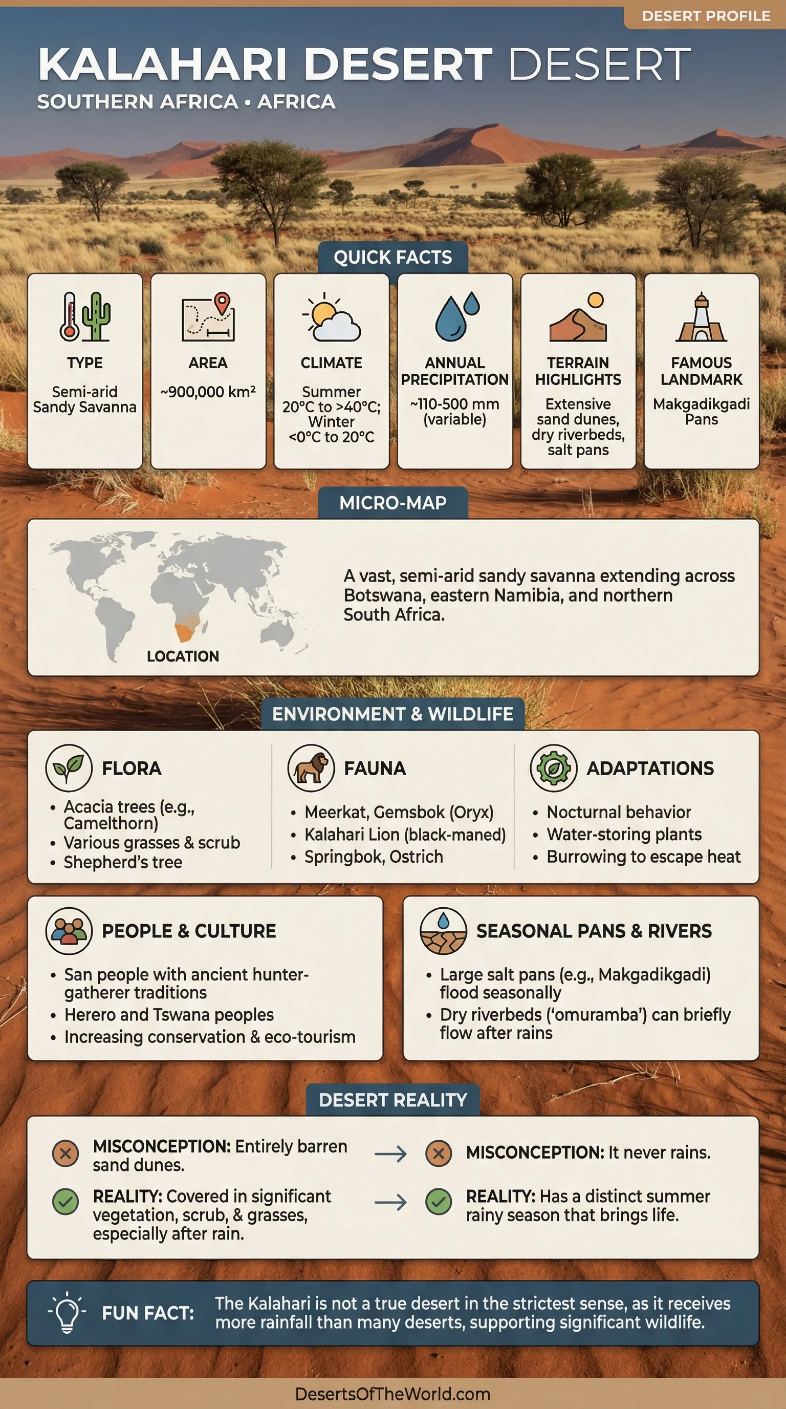
Location & Continent
Continent: Africa
Core Desert: Botswana, Namibia, South Africa
Broader Kalahari Basin: Extends northward into Angola, Zambia, and Zimbabwe
Coordinates: ~23°S, 22°E
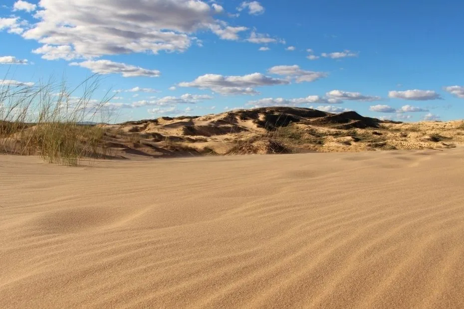
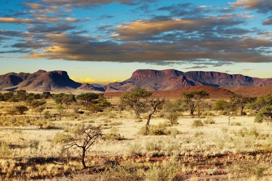
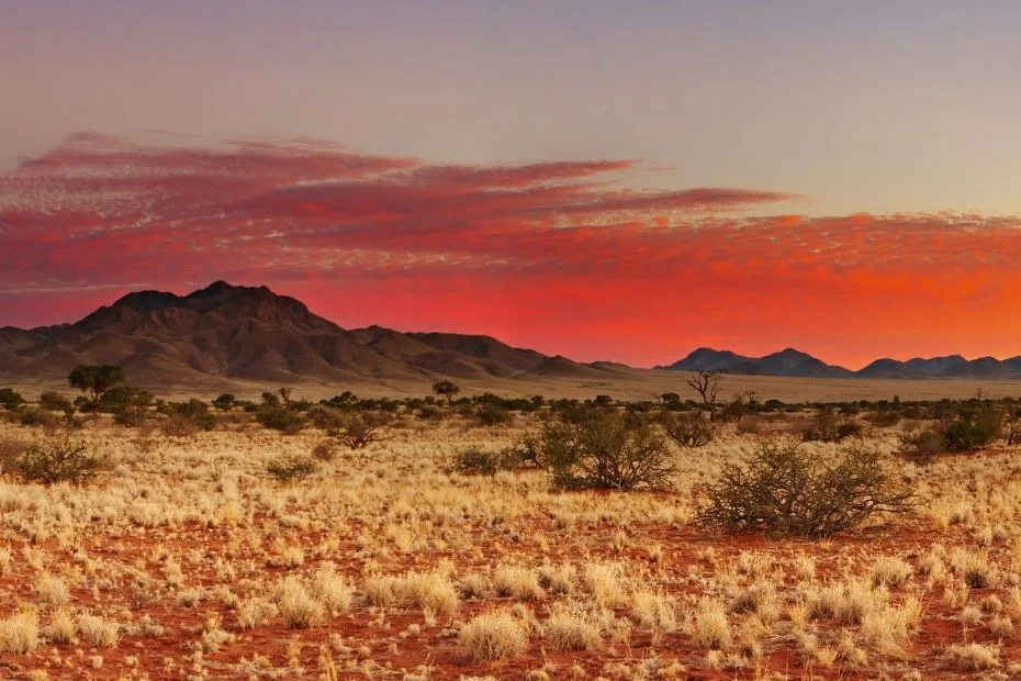
Photos of the Kalahari Desert
Physical Features
Area: ~900,000 km² for the Kalahari Desert in common geographic use
Landscape: Red sand sheets and dunes, dry river valleys, grasslands, shrub savanna, pans, and woodland toward wetter margins
Elevation: Generally around 800–1,200 m above sea level across much of the interior plateau
Climate & Precipitation
Temperature: Summer temperatures can exceed 40°C; winter nights can fall below 0°C in the southern Kalahari
Precipitation: Strong north–south and east–west variation, from roughly 100–150 mm in the driest southwest to more than 500 mm toward wetter northern and eastern margins; most rain falls in summer
Ecological Features
Biogeographic Realm: Afrotropical
Environment: Semi-arid sandy savanna grading into drier desert conditions in the southwest and woodland toward wetter northern areas
Ecoregions: Kalahari Acacia-Baikiaea Woodlands and adjoining Kalahari sandveld and savanna systems
Flora & Fauna
Flora: Camel thorn (Vachellia erioloba), shepherd’s tree, Kalahari sour grass, dune grasses, shrubs, and woodland species in wetter sectors
Fauna: Lion, cheetah, leopard, brown and spotted hyena, gemsbok, springbok, blue wildebeest, eland, meerkat, bat-eared fox, pangolin, ostrich, kori bustard, and numerous raptors
Geology & Notable Features
Geology: A broad interior basin mantled by deep Kalahari sands, with long dune systems, calcrete, pans, and fossil drainage features
Notable Features: Okavango Delta on the northern Kalahari Basin, Makgadikgadi Pans, dry Nossob and Auob riverbeds, and extensive red dune fields
Geography
The Kalahari covers about 900,000 square kilometers under a commonly used geographic definition. Botswana contains much of its central area, while the southern and western sectors extend into South Africa and Namibia.
Its surface is dominated by deep windblown sand. In many areas, long parallel dunes are stabilized by grasses and shrubs rather than moving continuously. The southern Kalahari is especially known for red dunes separated by broad interdune valleys.
- Sand Dunes: Long dune ridges occur across large areas, particularly in the southern Kalahari.
- Salt Pans: The Makgadikgadi Pans in Botswana occupy part of the floor of a former large lake system.
- Dry Riverbeds: The Nossob and Auob cross the southern Kalahari as normally dry channels and flow only after exceptional rainfall.
- Okavango Delta: The Okavango River spreads into an inland delta in northern Botswana, where its water enters the Kalahari Basin rather than reaching the sea.
The Kalahari is therefore much larger than the nearby Namib Desert and should not be described as the second-largest desert in southern Africa after the Namib.
Climate
Rainfall varies greatly across the Kalahari. The southwest is the driest sector, while northern and eastern areas receive more summer rain and support denser vegetation.
- Hot Summers: Temperatures above 40°C (104°F) occur during the hottest periods.
- Cold Winter Nights: Frost can occur in the southern Kalahari, and temperatures have fallen well below 0°C in protected areas such as Kgalagadi.
- Summer Rainfall: Most rain falls during warm-season thunderstorms, generally between about November and April depending on location.
In Kgalagadi Transfrontier Park, mean annual rainfall ranges from about 120 mm in the southwest to 350 mm toward the northeast, and individual years can vary widely. This variability is typical of the southern Kalahari.
Flora and Fauna
Vegetation differs from the drier southwest to the wetter northern Kalahari. Grasses and low shrubs cover many stabilized dunes, while trees become more common along dry riverbeds and in areas receiving greater rainfall.
| Type | Species | Dryland Trait |
|---|---|---|
| Flora | Camel thorn (Vachellia erioloba) | Tolerates dry sandy soils and provides shade, browse, and nesting sites along dunes and riverbeds |
| Flora | Kalahari sour grass (Schmidtia kalahariensis) | Annual grass adapted to sandy semi-arid environments and seasonal rainfall |
| Fauna | Gemsbok | Can tolerate high temperatures and long periods with limited free-standing water |
| Fauna | Meerkat | Lives in social groups and shelters in burrow systems during temperature extremes |
The wildlife of the wider Kalahari cannot be represented by a single species count because the region covers several habitats and countries. In Kgalagadi Transfrontier Park alone, SANParks lists 59 mammal species and roughly 280 bird species. Large herbivores include gemsbok, springbok, blue wildebeest, eland, and red hartebeest, while predators include lion, cheetah, leopard, brown hyena, and spotted hyena.
People, Protected Areas and Regional Ecology
The Kalahari includes protected landscapes, grazing areas, settlements, and Indigenous cultural landscapes spread across several countries.
- San Communities: San peoples have long histories in the Kalahari. The UNESCO-listed ǂKhomani Cultural Landscape in South Africa documents land use, cultural practices, and ethnobotanical knowledge associated with the southern Kalahari.
- Juǀ’hoansi: Juǀ’hoansi communities live mainly in northeastern Namibia and parts of Botswana and Angola and retain detailed knowledge of Kalahari plants, wildlife, seasons, and night skies.
- Kgalagadi Transfrontier Park: Botswana and South Africa jointly manage more than 3.6 million hectares of southern Kalahari habitat as one cross-border conservation area.
- Okavango Delta: The Okavango creates a large inland wetland inside the northern Kalahari Basin, producing a sharp ecological contrast with surrounding drylands.
Land use and conservation conditions vary across the region, so the Kalahari should not be treated as one continuous protected ecosystem.
Conclusion
The Kalahari Desert is a vast sand-covered dryland centered on Botswana, Namibia, and South Africa. Its red dunes, stabilized sandveld, pans, dry riverbeds, and seasonal grasslands reflect strong variation in rainfall across the basin.
The southern Kalahari contains some of the driest terrain, including the Nossob and Auob river systems and the dune fields of Kgalagadi, while the northern basin includes the Okavango Delta and wetter woodland environments. This rainfall gradient explains why much of the Kalahari supports extensive vegetation and large wildlife populations despite its desert name.
References
Encyclopaedia Britannica – Kalahari Desert
SANParks – Kgalagadi Transfrontier Park Climate
SANParks – Kgalagadi Major Features, Vegetation and Wildlife
U.S. Geological Survey – Okavango Delta in the Kalahari Basin
UNESCO World Heritage Centre – ǂKhomani Cultural Landscape
UNESCO – Juǀ’hoansi Knowledge and the Kalahari