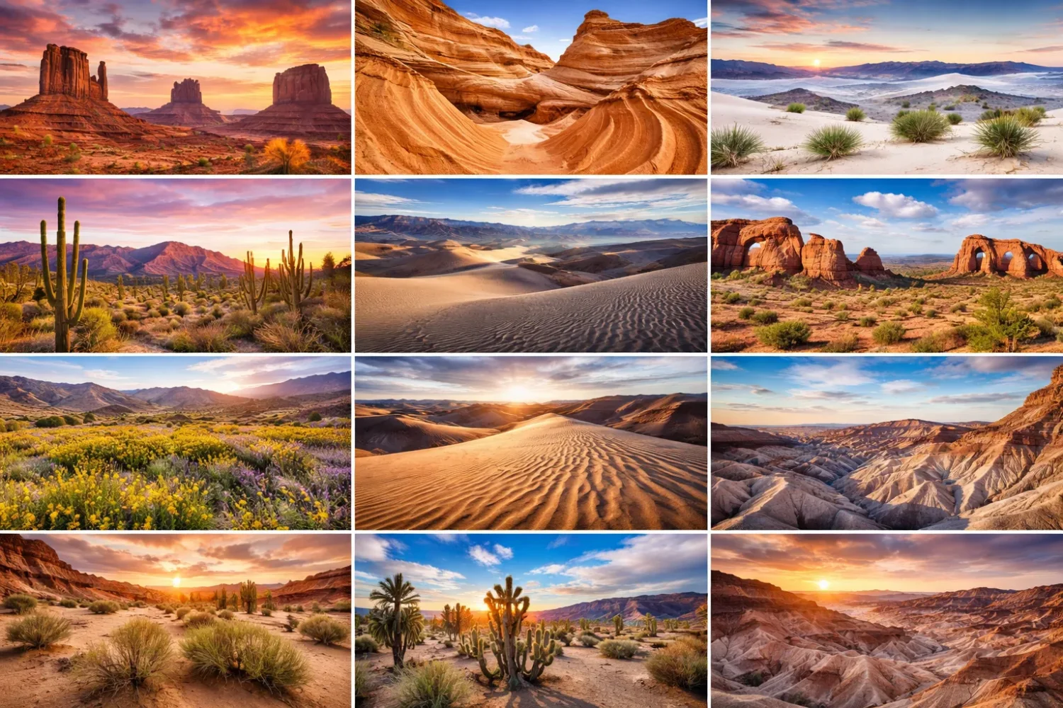
North America is often reduced to four headline deserts. That shortcut helps in a classroom, but it leaves out a lot of the map. The continent also holds cold-desert basins, lava plateaus, dune seas, shrub-steppe country, and semi-arid transitions that behave like desert land even when they do not look like the postcard version of a sand sea. Put those pieces together and the picture gets much sharper.
Gran Desierto de Altar
Location & Continent Continent: North America Country: Mexico State: Sonora Desert System: Sonoran Desert Nearest Well-Known Places: Puerto...
Read More →Colorado Desert
Location and Continent Continent: North America Countries and Regions: United States (Southern California), Mexico (Northern Baja California) Often-Referenced...
Read More →Death Valley
Location & Continent Continent: North America Country: United States Region: Eastern California and southern Nevada, within the Mojave...
Read More →Black Rock Desert
Location & Continent Continent: North America Country: United States State: Nevada Counties: Washoe, Pershing, Humboldt Region: Great Basin...
Read More →Chihuahuan Desert
Location & Continent Continent: North America Country: Mexico (Chihuahua, Coahuila, Durango, Zacatecas, Nuevo León, San Luis Potosí) ;...
Read More →Baja Californian Desert
Baja California Desert — Location & Continent Continent: North America Country: Mexico (Baja California; Baja California Sur) Coordinates:...
Read More →Sonoran Desert
Location & Continent Continent: North America Country: United States (Arizona, California); Mexico (Sonora, Baja California, Baja California Sur)...
Read More →Mojave Basin and Range
Location & Continent Continent: North America Country: United States (California, Nevada, Arizona, Utah) Coordinates: 35°N, 115°W Mojave Desert...
Read More →Snake River Plain
Location & Continent Continent: North America Country: United States (primarily Idaho, reaching toward eastern Oregon and western Wyoming)...
Read More →Arizona/New Mexico Plateau
Location & Continent Continent: North America Country: United States (Arizona & New Mexico) Coordinates: ~35°N, 109°W Arizona/New Mexico...
Read More →Colorado Plateaus
Location & Continent Continent: North America Country: United States (Arizona, Utah, Colorado, New Mexico) Coordinates: ~36°N, 111°W Colorado...
Read More →Central Basin and Range (Great Basin Desert)
Location & Continent Continent: North America Country: United States (Nevada, Utah, California, Oregon, Idaho) Coordinates: ~39.5°N, 116°W (regional...
Read More →Wyoming Basin
Location & Continent Continent: North America Country: United States (primarily Wyoming; edges into CO/UT/ID/MT within the broader ecoregion)...
Read More →Northern Basin and Range
Location & Continent Continent: North America Country: United States (Oregon, Idaho, Nevada, Utah, California) Coordinates: 43°N, 117°W Northern...
Read More →Columbia Basin
Location & Continent Continent: North America Country: United States (Washington, Oregon, and a small portion of Idaho) Coordinates:...
Read More →Thompson-Okanagan Plateau Desert
Location & Continent Despite its name, the “Okanagan Desert” is not a true desert by scientific definition. Annual...
Read More →16 inventions in North America
This page follows 16 desert or desert-edge regions across the United States, Mexico, and southern Canada. Some are classic named deserts, such as the Sonoran or Chihuahuan. Others are ecoregions that geographers use because the land, climate, plants, and drainage fit a dry-country pattern more closely than a simple state line ever could. That distinction matters. It tells you why one dry valley grows saguaros, another grows sagebrush, and another opens into bare clay flats.
There is another reason to treat these landscapes together: North American aridity is built by structure. Mountain walls strip moisture from Pacific air, inland basins trap runoff, and elevation changes flip heat into cold in a matter of hours. So a desert here is not just “a place with little rain.” It is a land system. Wind, slope, rock, groundwater, and seasonality all get a vote.
One Point To Keep In Mind: not all 16 entries are “true deserts” in the narrow textbook sense. A few are better read as xeric plateaus, cold-desert basins, or semi-arid shrub-steppe regions. They still belong in the same conversation because travelers, ecologists, and map readers run into them as part of the same dry belt.
What Makes A North American Desert Different
On this continent, deserts do not line up as one simple strip. Instead, they break into hot lowlands, cold high basins, and plateaus with dry surface soils but strong winter cold. That is why the same word, desert, covers places as different as Death Valley, the Gran Desierto de Altar, the Great Basin, and the southern Okanagan.
Rainfall alone never tells the full story. Timing matters just as much. The Sonoran Desert gets both winter storms and summer monsoon rain in many sectors, which helps support more plant variety than many people expect. The Mojave leans harder on winter moisture. The Chihuahuan receives more summer rain. In cold-desert country, snow can matter as much as rain because spring melt feeds basins, seeps, and short-lived grass growth.
Landform matters too. Endorheic basins keep water from reaching the sea, so salts collect and playas form. Fault-block mountains create the familiar basin-and-range pattern seen across Nevada and neighboring states. Basalt plateaus in the Columbia and Snake River country create dry surfaces with very different soils from the dune fields of Sonora or the gravel fans of southern California. Look closely and North America dosen’t repeat one desert shape. It repeats a dry logic through many shapes.
Terms You Will See Again And Again
- Erg: a broad dune sea built from mobile sand.
- Playa: a flat basin floor that may hold shallow water only after storms or snowmelt.
- Alluvial Fan: a cone of gravel, sand, and silt spread by runoff where steep slopes meet basin floors.
- Endorheic Basin: an internally drained basin where water stays inland rather than reaching the ocean.
- Sky Island: a cooler, wetter mountain block rising from dry lowlands.
- Shrub-Steppe: a dry plant community where shrubs and bunchgrasses share the ground.
How The 16 Areas Compare
| Desert Or Dry Region | Best Way To Read It | Moisture Pattern | Surface You Notice First |
|---|---|---|---|
| Gran Desierto de Altar | Hot dune desert inside the Sonoran system | Very dry, with strong wind action | Massive active dunes and volcanic neighbors |
| Colorado Desert | Low desert subdivision of the Sonoran | Very low rainfall, extreme summer heat | Below-sea-level basins, fans, badlands |
| Death Valley | Extreme low hot basin within Mojave country | Very low rainfall, intense evaporation | Salt flats, fans, bare ranges |
| Black Rock Desert | Cold-desert playa in Great Basin country | Low and variable, winter moisture matters | Broad lakebed plain |
| Chihuahuan Desert | Large hot desert with high-basin structure | Summer rain is a big part of the pattern | Basins, grass-shrub mosaics, isolated ranges |
| Baja Californian Desert | Pacific-influenced desert on the peninsula | Low rainfall, coastal moderation in places | Rocky plains, dry scrub, maritime edge |
| Sonoran Desert | Hot subtropical desert | Winter rain plus summer monsoon in many sectors | Columnar cacti, broad bajadas, thorny scrub |
| Mojave Basin And Range | Hot desert basin-and-range country | Mainly winter moisture, very dry valleys | Playas, creosote flats, Joshua tree zones |
| Snake River Plain | Semi-arid basalt plain with desert traits | Dry lowlands framed by wetter uplands | Basalt, sagebrush, broad low plain |
| Arizona/New Mexico Plateau | Transitional high-desert plateau | Mixed winter moisture and monsoon influence | Grasslands, tablelands, pinyon-juniper margins |
| Colorado Plateaus | Dry high plateau system | Low rainfall, elevation changes matter a lot | Canyons, mesas, buttes, slickrock |
| Central Basin And Range | Core cold-desert Great Basin terrain | Low moisture, much of it snow | Internally drained basins and salt flats |
| Wyoming Basin | High cold-desert basin | Low precipitation, harsh winters | Arid basins, badlands, shrublands |
| Northern Basin And Range | Cooler sagebrush basin-and-range country | Dry, cooler than southern desert basins | Lava plains, low mountains, wide basins |
| Columbia Basin | Basalt shrub-steppe dryland | Low precipitation, strong rain shadow | Basalt tablelands, loess, scablands |
| Thompson-Okanagan Plateau Desert | Semi-arid shrub-steppe at the north edge of Great Basin country | Low rainfall for Canada, hot dry summers | Valley-bottom grassland and antelope-brush |
Patterns That Tie The Whole Region Together
Before moving into each desert, it helps to see the repeating mechanics. Rain shadow is one of them. Pacific air masses lose moisture on the west-facing slopes of the Cascades, Sierra Nevada, Peninsular Ranges, and other mountain chains. The air then descends warmer and drier on the inland side. That is one reason California’s inland basins, Nevada’s dry valleys, and the Columbia country can sit so close to wetter high ground.
Internal drainage is another. In much of the Great Basin and adjoining dry country, rivers do not reach the sea. Water pools, evaporates, and leaves minerals behind. That process builds salt pans, alkaline flats, and dusty playas. It also explains why these landscapes often feel hard-edged and open rather than sandy in the popular sense.
Then there is elevation. North American deserts can be very hot, but many are also cold in winter. The Great Basin, the Wyoming Basin, and the dry plateaus of the interior West show that clearly. By contrast, lower Sonoran country holds more frost-sensitive plants, including famous columnar cacti. Same continent. Very different plant rules.
Last comes seasonality. A desert that receives a little rain in both winter and summer behaves differently from one that depends almost entirely on winter storms or from one that waits for late-summer monsoon bursts. Once you watch the calendar along with the map, the 16 regions below start to make sense fast.
The 16 Deserts
Hot Desert Core Of The Southwest And Northern Mexico
Gran Desierto De Altar
Gran Desierto de Altar is one of the most striking dune landscapes in North America, and it feels different from almost every other dryland on the continent. This is not just a sandy patch inside the Sonoran system. It is a true dune sea, the largest active dune field in North America, with dunes that can rise to about 200 meters. When people think of American deserts as rock, scrub, and gravel, this place corrects the record immediately.
The setting helps explain that scale. The desert lies in northwestern Sonora, close to the Colorado River delta and the Gulf of California. For long periods, sediment from the delta fed the sand supply, while wind sorted and pushed it into vast ridges, crescents, and star-like dune forms. To one side sits the volcanic Pinacate field, so the visual contrast is sharp: black lava, pale dunes, wide sky. Few desert pairings on the continent show geomorphology this clearly.
Ecologically, the area belongs to the Sonoran Desert, yet it behaves like a tougher, more mobile sector of that wider system. Plants need deep root strategies or the ability to survive shifting sand. Water is brief, patchy, and valuable. Animal movement follows shade, wind shelter, and timing more than distance. In that sense, the Gran Desierto is a reminder that sand mobility is itself a climate force. When the ground moves, every form of life has to negotiate with it.
Colorado Desert
The Colorado Desert is the low desert of southeastern California and the far north of Baja California, and it works as the western edge of the broader Sonoran world. It stretches from around the San Gorgonio Pass toward the Colorado River delta, and its lowest basins sit in some of the harshest heat on the continent. In the lowest tracts, annual rain can average only about 3 to 4 inches, while summer temperatures can push toward 130°F. Heat here is not a side note; it organizes daily life, soil moisture, and plant spacing.
This desert is easy to misread if you only know it from road corridors or irrigated valleys. The real structure is older and drier: alluvial fans, faulted basin margins, badlands, dry washes, and depressions tied to the Salton Sink and Imperial Valley. Water imported for agriculture created green edges in places, yet the native landform still shows through. Step away from canals and fields and the Colorado Desert reasserts itself very quickly.
Plant cover is usually open and efficient rather than lush. Creosote bush, ocotillo, smoke tree, cholla, and scattered desert fan palms in oases tell you where moisture lingers and where it does not. That mosaic matters. So does elevation. The Colorado Desert is lower and hotter than neighboring interior uplands, which is why it feels more severe than the word “California” often leads people to expect. It is Sonoran in lineage, but local in mood.
Death Valley
Death Valley is the continent’s shorthand for desert extremes, and the shorthand is deserved. Furnace Creek holds the famous 134°F (57°C) air-temperature record from 1913. Badwater Basin sits around 282 feet below sea level, the lowest point in North America. Average annual rainfall on the valley floor is under 2 inches. Those numbers are well known, yet the real lesson is how many extreme variables stack on top of one another in one basin.
The valley is long, enclosed, and brutally efficient at evaporation. Moisture that does arrive often comes as brief storms, and the runoff rushes from steep ranges onto fan aprons before vanishing or pooling in flats. That is why Death Valley displays salt pans, alluvial fans, gravel benches, badlands, dunes, and fault-bounded mountains in one connected space. It is almost a desert textbook laid open at full scale.
Still, Death Valley is not only a “hottest place” headline. It also shows how vertical relief shapes desert climate. Mountains around the basin gather more moisture than the floor, which means the surrounding slopes and uplands can look surprisingly different in season and plant cover. So when people describe Death Valley as empty, they are usually looking too narrowly. It is spare, yes. Empty, no. It is a basin where geology never stops showing.
Baja Californian Desert
Baja Californian Desert occupies the long peninsula that extends south from the United States into northwestern Mexico, and it has a desert character shaped not only by dryness but by coastal influence. That maritime edge makes it different from the more interior Sonoran and Mojave sectors. Rainfall is low across the region, often below the classic desert threshold, and in some of the driest tracts it drops to very small totals indeed. Yet ocean proximity, fog, and peninsular topography soften the pattern in places.
This desert is less about giant inland dune fields and more about rocky plains, dry scrub, volcanic hills, washes, and long ecological gradients. Northern sectors connect more visibly to California’s Mediterranean-fringe drylands, while farther south the vegetation mix shifts again. That makes Baja valuable for readers who want more than a simple “cactus desert” label. Here, latitude and marine air matter almost as much as rainfall totals.
Biologically, the peninsula is known for local endemism because it behaves partly like a long ecological island. Isolation, rugged topography, and varied moisture exposure all help. So while Baja Californian desert country may look understated beside Death Valley or the Gran Desierto, it is one of the best places to see how desert form changes when the Pacific gets close. It stays dry, but the dryness is filtered through coast, slope, and peninsula shape.
Sonoran Desert
Sonoran Desert covers roughly 100,000 square miles across Arizona, southeastern California, Sonora, and much of Baja California. It is the desert many people picture first because of its saguaro silhouettes, open bajadas, and warm winter light. Yet its real identity lies in climate timing. Many sectors receive both winter rain and summer monsoon storms, with total annual precipitation often falling in a broad 3 to 20 inch range depending on location and elevation.
That double-season moisture pattern changes everything. It supports more plant forms than colder or more winter-only deserts. Legume trees, thornscrub, columnar cacti, palo verde, ironwood, organ pipe cactus in the warmer reaches, and broad mixes of annual wildflowers can all fit into the same greater desert system. The Sonoran is also unusual for its close tie to the Gulf of California. In ecological terms, it behaves as a maritime desert in ways the interior Mojave and Great Basin do not.
For desert readers, the Sonoran is one of the best places to learn that arid does not mean simple. A wash, a rocky slope, a fan surface, and a frost pocket can support very different plant communities within a short drive. The Sonoran also teaches scale well: broad enough to be continental, detailed enough to change block by block. It is hot desert country with fine-grained variety.
Mojave Basin And Range
Mojave Basin and Range sits in the drier, higher interior to the north and west of the lower Sonoran country, and it expresses the classic basin-and-range geometry better than most desert travelers realize. The larger Mojave Desert spans more than 25,000 square miles, while valley floors often receive only about 2 to 10 inches of precipitation in a year. Most of that moisture comes in winter, with a smaller summer contribution in eastern and higher sectors.
This desert is famous for Joshua trees, though not every part of the Mojave grows them. They appear where elevation, cold tolerance, and rainfall line up correctly. Lower, hotter, flatter terrain shifts toward creosote bush, blackbrush, saltbush, and open gravel plains. The physical layout is unmistakable: isolated ranges, long fans, dry lakes, rock pediments, and wide valleys where surface water vanishes almost as soon as it appears. Relief is the organizing force here.
The Mojave often gets described only through its extremity, especially when Death Valley enters the conversation. That misses the texture. It is not just a hot basin. It is a structural desert, built from faulting and internal drainage, where altitude can change the plant palette within a few hundred meters. Read the Mojave as a map of elevations, not just as one hot block, and it becomes much easier to understand why it bridges the Sonoran lowlands and the colder Great Basin to the north.
Chihuahuan Desert
Chihuahuan Desert is the largest desert in North America, covering close to 647,500 square kilometers or roughly 250,000 square miles, with more than 90 percent of its area in Mexico. It stretches far beyond what many U.S.-based maps imply. That scale alone makes it a pillar in any North American desert discussion, but area is not the only reason it stands out. The Chihuahuan is also known for unusually high biological variety among deserts.
Its climate rhythm differs from the Mojave and much of the Sonoran. Summer rain plays a larger role, especially through monsoonal patterns, which helps support grass-shrub mosaics rather than the more uniformly sparse look many people expect from a desert. Basin floors, gypsum dunes, limestone ridges, volcanic fields, and isolated mountain blocks all fit within the same greater system. The desert is home to more than 170 amphibian and reptile species, and a notable share are endemic or have very limited ranges.
What makes the Chihuahuan especially useful in a 16-desert page is the way it blends openness with elevation. It is a hot desert, yes, yet much of it sits in high basins, not tropical lowlands. That gives it a cooler winter side, more grass, more sky-island effect, and a different plant language from the Sonoran. Lechuguilla, sotol, yucca, creosote, and desert grasslands all tell the story. So do its basin edges. It is vast, elevated, and more varied than the label “hot desert” suggests.
Cold Deserts, Basins, And Plateau Drylands
Black Rock Desert
Black Rock Desert in Nevada is one of the clearest examples of a playa desert. The protected wilderness alone covers more than 314,000 acres, and the wider basin preserves the floor of ancient Lake Lahontan. That lake history explains the famous flatness. When the surface dries, it becomes a hard, pale plain with extraordinary visual reach. When storms arrive, water can briefly return and the entire place changes character.
Unlike the dune-driven Gran Desierto or the furnace-basin image of Death Valley, Black Rock shows what a desert looks like when evaporation, sediment settling, and inland drainage dominate the surface story. The eye goes first to openness, then to the low ring of mountains, then to the subtle traces left by water that is now gone. It feels ancient, yet active. Dust, seasonal mud, saline crusts, and ephemeral pooling all keep reshaping the floor.
Ecologically, Black Rock belongs with Great Basin country. That means cold-desert logic: winter cold, spring pulses, sparse shrubs on the margins, and a playa center that can look almost vegetation-free. This is a good place to correct another common myth, namely that deserts must be sandy. Many of North America’s drylands are not sand deserts at all. Black Rock proves the point in one glance.
Central Basin And Range (Great Basin Desert)
Central Basin and Range, often read as the heart of the Great Basin Desert, is the continent’s best-known cold-desert system. This is internally drained country: water runs into basins, not to the ocean. Basin floors can receive desert-level moisture, while surrounding ranges rise high enough to catch more snow and feed short-lived streams or springs. Many Nevada landscapes sit inside this pattern, which is why the Great Basin feels less like one desert block and more like a chain of repeating basins and ranges.
The surface signature is unmistakable: salt flats, playas, sagebrush basins, greasewood margins, alluvial fans, and mountain fronts. Valley-bottom precipitation can be low enough to fit a strict desert definition, while higher ground carries more moisture and a colder seasonal cycle. In many areas of central Nevada, annual precipitation falls in roughly the 5 to 16 inch band depending on elevation. Much of that moisture comes as snow rather than summer rain.
That cold-season bias changes vegetation. Instead of saguaros or organ pipe cactus, you find sagebrush, saltbush, rabbitbrush, and cold-tolerant shrubs. Trees, where they appear, usually cling to higher elevations. The Great Basin also breaks the public image of a desert as a flat expanse. It is one basin after another, each with its own floor, fans, local springs, and mountain weather. Read it as a repeating structure, not a single plain, and the map snaps into focus.
Northern Basin And Range
Northern Basin and Range occupies arid country across parts of Oregon, Idaho, Nevada, Utah, and neighboring sections of the interior West. It is cooler and, in many tracts, a bit less severe in heat than the central and southern basin-and-range deserts. Yet it remains very much a dryland. The EPA description captures it well: arid tablelands, intermontane basins, dissected lava plains, and widely scattered low mountains. That combination tells you almost everything you need to know before you even step outside.
Vegetation is mostly sagebrush steppe, which means shrub cover mixed with bunchgrasses where soils and grazing history allow. Compared with the Columbia Basin, this region is generally drier and less suited to cultivation. Compared with the Snake River Plain, it is higher and cooler. Those contrasts matter because they explain why two neighboring dry regions can look related yet still carry different soils, grasses, and fire behavior.
For many readers, this region is where “desert” starts to blur into “semi-arid rangeland.” That is fair, though the blur itself is part of the point. North American deserts have edges, and Northern Basin and Range is one of the clearest. It shows how dryland ecology can dominate a landscape even when the scenery is built more from lava plains and broad sage country than from dramatic dunes or bare salt basins.
Wyoming Basin
Wyoming Basin is a high, cold-desert basin that many casual lists leave out, which is a mistake. It sits in an intermontane setting, nearly ringed by forested mountains, and the climate is dry enough to produce broad shrublands, sparse grass cover, badlands, playas, and long open basins. In some sectors, annual precipitation falls below 7 inches, while slightly higher elevations can climb beyond that. The result is a landscape that feels severe without borrowing the iconic imagery of the Southwest.
The plant story leans heavily on sagebrush, greasewood, saltbush, and cold-tolerant grassland fragments. Winter is a major ecological filter here. So are wind and evaporation. This is one reason the Wyoming Basin deserves a place beside better-known deserts: it proves that cold, high, and open can produce desert function even when there is no giant cactus or famous dune field to signal it.
Geomorphically, the basin mixes broad valley floors with eroded uplands and isolated hills, creating a surface that feels rougher and more interrupted than a classic sand desert. That roughness is useful. It shows how North American dryness also lives in badland country, in dust-prone basins, and in places where snow is part of the desert water budget. Desert does not end where winter begins. In Wyoming, winter is part of the formula.
Columbia Basin
Columbia Basin is one of the most instructive dry landscapes on the continent because it is built on basalt, not on a sand sea or a classic fault-basin floor. Much of the region lies in rain shadow, and arid sectors receive less than about 30 centimeters of annual precipitation. The broader plateau is underlain by lava rock up to two miles thick, and in many places that surface is mantled by loess. It is hard to imagine a better case study in how geology and aridity can fuse into one landscape.
This is shrub-steppe country. Sagebrush, bunchgrasses, dry grassland, and scabland surfaces dominate the native pattern, though irrigation and agriculture have transformed large sections. The contrast between native dryland and irrigated cropland is one of the strongest on the continent. It can make the basin look less desert-like from above than it is ecologically. Strip away the water engineering and the dry foundation becomes obvious again.
Another reason the Columbia Basin matters is its Ice Age imprint. Parts of the plateau were carved by catastrophic glacial floods, leaving coulees, scablands, and stripped rock surfaces that still shape water flow and soil depth. So when this region enters a desert conversation, it broadens the discussion in the best way. A dryland does not have to be a dune field to be desert-minded.
Snake River Plain
Snake River Plain runs across southern Idaho as a long volcanic lowland, about 320 miles in length and roughly 55 to 62 miles wide in its eastern reach. The broader basin includes mountain sources with much more moisture, but the plain itself is commonly semi-arid and supports sagebrush-steppe vegetation. In dry sectors, precipitation is often low enough to make water storage, groundwater, and runoff timing the real story of the land.
The geology stands out first. Repeated basalt flows built the platform, and the region is closely tied to aquifer systems, springs, and lava-derived soils. That gives the Snake River Plain a very different feel from sandy Sonoran country or salt-flat Great Basin basins. Dryness is real, yet it is paired with volcanic form and with river incision that cuts across the plain and exposes the structure beneath.
Vegetation tends toward sagebrush, rabbitbrush, and bunchgrasses, though land use has altered much of the original cover. This is one of those regions where a reader needs to hold two truths at once: it is not the poster-child desert of travel brochures, and it is still part of North America’s dry interior logic. High evaporation, limited lowland moisture, broad basalt plains, and sparse native cover place it firmly in that conversation.
Arizona/New Mexico Plateau
Arizona/New Mexico Plateau is best understood as a transitional high-desert region. It lies between the semiarid tablelands to the east, the higher relief Colorado Plateaus to the north, and the hotter Mojave and Chihuahuan desert country to the west and south. That “between” quality is not a weakness. It is the whole identity. This is where grassland, shrubland, and pinyon-juniper margins often meet on broad tablelands and shallow basins.
The plateau does not rely on one single plant symbol the way the Sonoran relies on the saguaro or the Mojave on the Joshua tree. Instead, it reads through patterns: semi-arid grasslands, low-relief plateaus, scattered badlands, broad skies, and a climate influenced by both winter moisture and the summer monsoon. In practical field terms, that means patchiness. A low basin may look sparse and open, while a nearby rise carries a thicker pinyon-juniper presence.
This region matters because it corrects the habit of drawing hard desert borders where the land itself prefers gradients. The Arizona/New Mexico Plateau is dry enough to share much with surrounding deserts, yet elevated and grassy enough to form its own style of aridity. If you want to understand why the interior Southwest looks layered rather than uniform, start here. This is desert transition made visible.
Colorado Plateaus
Colorado Plateaus is a vast highland dryland system of canyons, mesas, cliffs, benches, buttes, and exposed rock history. The plateau covers about 390,000 square kilometers, and many lower sectors average around 8 inches of annual precipitation. Temperatures swing widely with elevation. Lower areas can be hot in summer, while higher rims and uplands cool off sharply and may see very cold winter conditions. This is not a uniform desert plain. It is a dry highland world cut into layers.
The scenery gets most of the attention, and fairly so. Yet the surface structure tells the ecological story too. Low-lying zones support saltbush and greasewood, while higher terrain carries more pinyon-juniper and shrub cover. Sheer relief matters. A canyon wall can throw shade, alter runoff, trap soil, and create habitat contrast within a very short distance. That is why the plateau feels intricate even when rainfall is sparse.
For a North American desert page, the Colorado Plateaus are essential because they show that desert country can be vertical. Slickrock, canyon incision, and broad tablelands expose geologic time in a way few other regions can. The dryness is real, but it is braided with rock structure, elevation, and winter cold. This is aridity on a staircase of stone.
Thompson-Okanagan Plateau Desert
Thompson-Okanagan Plateau Desert needs a careful reading because the name can mislead people. In a strict scientific sense, not every part of this region qualifies as a true desert. Still, the southern Okanagan and nearby valleys preserve rare semi-arid shrub-steppe pockets that are the only real expression of this kind of dryland in Canada. In fact, these areas form the northern tip of North America’s Great Basin desert system.
Mean annual precipitation in the southern Okanagan can sit around 300 millimeters, which is dry by Canadian standards and dry enough to create hot, open valley-bottom habitats with bunchgrass, sagebrush, and especially antelope-brush in favored places. Summers are warm and dry, winters cold enough to remind you that this is not the Sonoran. That mix gives the region a cold semi-arid character rather than a subtropical desert one.
The reason to include Thompson-Okanagan in a 16-desert page is simple. It shows how far north the continent’s dry interior logic can reach when rain shadow, valley topography, and heat line up. It also protects a very small, very distinct ecological edge. The scenery may not shout “desert” to every visitor on first sight. Stay a little longer and the message becomes clear. This is a desert margin worth reading closely.