
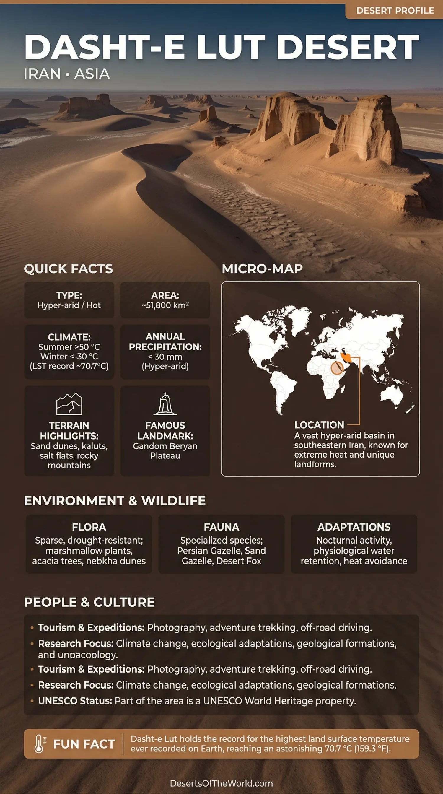
Location & Continent
Continent: Asia
Country: Iran (Kerman, Sistan and Baluchestan, and South Khorasan provinces)
Coordinates: ~30.216°N, 58.839°E (UNESCO World Heritage property reference)
Photos of the Dasht-e Lut
Physical Features
Area (UNESCO World Heritage property): 2,278,015 ha (~22,780 km²); buffer zone 1,794,134 ha
Wider Desert Area: Commonly estimated at approximately 51,800 km²
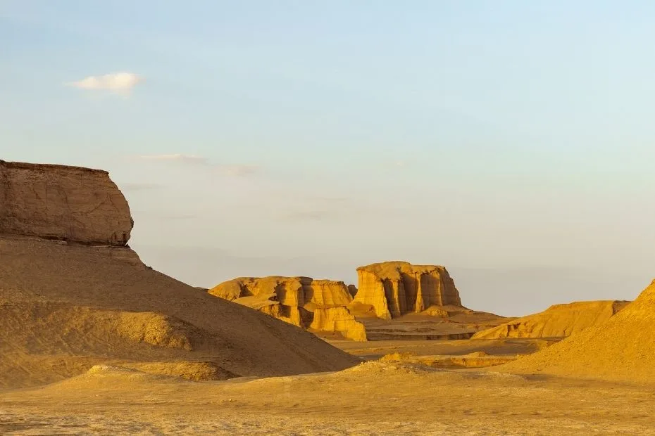
Relief Highlights: Yardangs, or kaluts, up to ~155 m high; sand seas cover about 40% of the UNESCO property, with dunes reaching up to ~475 m
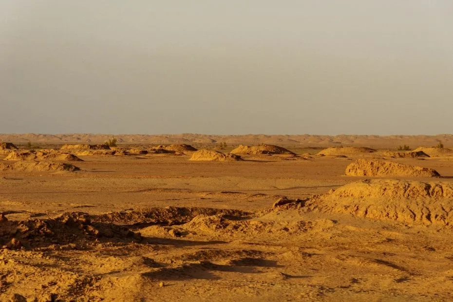
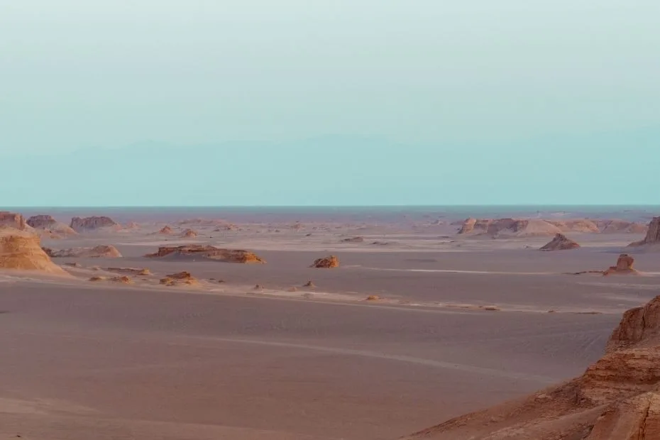
Landscape: Interior desert basin with yardang fields, dune systems, stony desert pavements, salt pans, alluvial fans, and the dark Gandom Beryan plateau
Climate & Precipitation
Temperature: Among the hottest land surfaces measured by satellite; land-surface temperature reached 70.7°C in 2005, while later multi-year satellite research reported values up to ~80.8°C
Precipitation: Hyper-arid; annual precipitation in the driest parts is typically less than 30 mm
Ecological Features
Ecozone: Palearctic, Iranian Plateau desert region
Biome: Deserts and xeric shrublands
Major Desert Environments: Yardang fields in the west, extensive dune fields in the south and east, stony desert pavements, playas, evaporite surfaces, and sparsely vegetated desert margins
Flora & Fauna
Flora: Vegetation is extremely sparse across the central desert but increases toward margins and higher ground; shrubs and grasses occur in suitable sites, and vegetation-anchored nebkha dunes can reach approximately 12 m
Fauna: Desert-adapted arthropods and vertebrates occur in parts of the Lut; biological surveys remain less extensive than geological and geomorphological research
Geology & Notable Features
Geology: Strong winds drive large-scale aeolian erosion and deposition, producing extensive yardangs, dunes, ventifacts, and stony surfaces; evaporite processes form salt polygons, fractured crusts, gypsum domes, and other salt landforms
Notable Features: Kalut ridges traceable for more than 40 km, dunes reaching ~475 m, Gandom Beryan, extensive hamada surfaces, and large sand seas
Dasht-e Lut: An Overview
Dasht-e Lut, also known as the Lut Desert, is a hyper-arid desert basin in southeastern Iran. The wider desert covers roughly 51,800 square kilometers, while the UNESCO World Heritage property designated in 2016 covers 2,278,015 hectares, or about 22,780 km².
The Lut contains several sharply different desert surfaces. Large yardang fields occupy the west, active dune systems dominate parts of the east and south, and broad areas of stony pavement and evaporite terrain occur elsewhere. Satellite observations have also identified parts of the desert as having some of the highest land-surface temperatures measured on Earth.
Geography and Landforms
Dasht-e Lut occupies an interior basin surrounded by mountains in southeastern Iran. Its hyper-aridity is partly related to this enclosed setting and the resulting rain-shadow conditions.
Wind is one of the main forces shaping the present landscape. Strong north-northwesterly to south-southeasterly winds occur for extended periods between roughly June and October. Wind-driven erosion has carved long parallel ridges known as yardangs or kaluts from consolidated sediments.
Yardangs cover about one-third of the UNESCO property. Some reach approximately 155 m in height, while individual ridges can continue for more than 40 km. Farther south and east, transported sediment has accumulated into large sand seas containing linear, star, crescentic, and compound dunes. Some dunes reach approximately 475 m.
Stony desert pavements also occupy large sections of the basin. The Gandom Beryan area in the northwest is especially dark because of its exposed volcanic and basaltic surface.
Climate Characteristics
The climate of Dasht-e Lut is hyper-arid. In the driest sections, annual precipitation is generally less than 30 millimeters, and evaporation greatly exceeds rainfall.
The temperature figures associated with the Lut require a distinction between land-surface temperature and air temperature. The widely reported 70.7°C measurement from 2005 was obtained by satellite and refers to the temperature of the ground surface, not the standard shaded air temperature used in weather records. Later satellite analyses found land-surface temperatures reaching approximately 80.8°C during the period examined.
Bare, dry surfaces absorb intense solar radiation, while limited soil moisture provides little evaporative cooling. Dark surfaces such as those around Gandom Beryan can become especially hot.
Flora and Fauna
Vegetation is absent or extremely sparse across some parts of the central Lut, but the entire desert is not biologically empty. Plant cover becomes more evident toward the margins, higher elevations, drainage routes, and locations where soil conditions retain more moisture.
A 2026 field study covering five areas of the Lut World Heritage site recorded 76 plant species from 64 genera and 31 families. Most recorded plants were perennial shrubs and grasses. Species richness was higher at elevated sites where temperatures are lower and moisture conditions are less severe.
The desert also supports arthropods and other animals adapted to arid conditions. Biological information from the most extreme interior remains incomplete, so individual species should not be assumed to occur throughout the desert simply because they are present in the wider southeastern Iranian drylands.
Ecosystem Adaptations
Organisms occupying the Lut use habitats that provide some protection from extreme surface conditions. Activity during cooler hours, shelter beneath rocks or within sediment, and the use of localized vegetation are common survival strategies in desert environments.
Vegetation can also alter the physical landscape. Where sand accumulates around plants near the less arid margins of the basin, it forms nebkhas, or vegetation-anchored dunes. UNESCO documentation records some Lut nebkhas reaching approximately 12 m or more.
Access, Tourism and Research
Dasht-e Lut is visited for geological fieldwork, desert research, photography, and organized desert travel. Its large roadless areas, extreme heat, limited water, and difficult terrain require careful route planning.
- Geological Research: Yardangs, dunes, salt landforms, wind erosion, and sediment transport provide field sites for geomorphology and desert-process studies.
- Climate Research: Satellite observations of land-surface temperature have made the Lut an important location for studying thermal extremes.
- Desert Travel: Kalut areas near the western margin are more accessible than much of the interior, while remote sections require local knowledge and suitable transport.
- Off-Road Access: Vehicle use can damage fragile desert surfaces, and UNESCO management documentation identifies uncontrolled motorized access as an issue requiring management.
Notable Landforms in Dasht-e Lut
- Kaluts: Long corridors and ridges carved from consolidated sediments by wind erosion and occasional runoff.
- Gandom Beryan: A dark stony surface in the northwestern part of the UNESCO property associated with very high land-surface temperatures.
- Eastern and Southern Sand Seas: Extensive active dune fields containing several dune forms, with individual dunes reaching approximately 475 m.
- Evaporite Landforms: Salt polygons, salt pans, gypsum domes, fractured crusts, and crystalline deposits created as mineral-rich water evaporates.
Comparison with Other Deserts
| Desert | Reference Area | Climate | Characteristic Landforms |
|---|---|---|---|
| Dasht-e Lut | ~22,780 km² UNESCO property; wider desert ~51,800 km² | Hyper-arid | Yardangs, very high dunes, stony pavements, salt landforms |
| Sahara Desert | ~9,200,000 km² | Predominantly hot and arid | Sand seas, gravel plains, rocky plateaus, mountains |
| Atacama Desert | ~105,000 km² | Hyper-arid to arid | Salt flats, gravel surfaces, dunes, volcanic terrain |
| Sonoran Desert | ~310,000 km² | Hot subtropical desert | Basins, mountain ranges, alluvial fans, sandy plains |
Temperature records are not compared in this table because the best-known Lut figures are satellite-derived land-surface temperatures, while many historical desert temperature records refer to air temperature. The two measurements are not directly equivalent.
Conclusion
The Dasht-e Lut is defined by active wind erosion, large dune systems, extensive stony surfaces, evaporite landforms, and an exceptionally dry interior basin. Its western yardangs rise to about 155 m and extend for tens of kilometers, while dunes in the eastern and southern sand seas reach approximately 475 m.
Satellite measurements have documented extreme land-surface temperatures in the Lut, but these values are distinct from standard air-temperature records. Biological surveys also show that the desert is not uniformly lifeless: vegetation and animal activity occur where elevation, substrate, and moisture provide suitable conditions. These physical and ecological patterns explain the Lut Desert’s value as a UNESCO World Heritage property and as a field site for research on desert geomorphology, climate, and dryland ecology.
References
UNESCO World Heritage Centre – Lut Desert (property area, yardangs, dunes, landforms and climate)
NASA Earth Observatory – Iran’s Lut Desert
Bulletin of the American Meteorological Society – Global Land-Surface Temperature Extremes
UNESCO – Lut Desert State of Conservation Documentation
UNEP-WCMC – Lut Desert World Heritage Datasheet
European Space Agency – Dasht-e Lut Satellite Imagery
Wildlife Institute of India – Lut Desert Climate and Landscape