
Photos of the Atacama Desert
Location & Continent
Continent: South America
Countries: Mainly northern Chile; some broader definitions extend the desert belt into southern Peru, western Bolivia and north-western Argentina along the Andes foothills.
Coordinates (central plateau): Approx. 24°S, 69°W
Atacama Desert – Map & Street View
Physical Features
Type: Cold coastal desert plateau west of the Andes
Area: About 105,000 km² in its core hyper-arid zone (up to roughly 128,000 km² including barren Andean slopes).
Length: Around 1,000–1,600 km along Chile’s Pacific coast, depending on where boundaries are drawn.
Width: Typically 100–160 km from the coast to the Andean piedmont
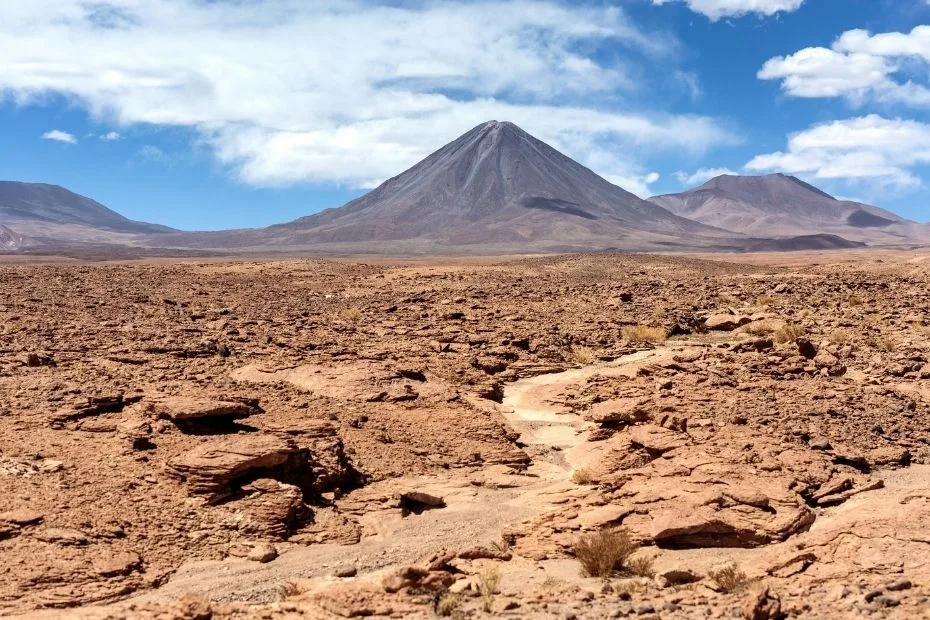
Elevation: Coastal plains near sea level rise to high plateaus and volcanoes above 4,000–6,000 m in the Andes (for example, the Licancabur region near San Pedro de Atacama).
Climate & Precipitation
Climate type: Cold desert (Köppen BWk) with mild temperatures but almost no rain
Average annual rainfall (core): Often below 15 mm; some weather stations have never recorded measurable rain.
Typical daytime temperatures: 18–25°C at mid-elevations, cooler than many hot deserts
Night-time temperatures: Can fall close to 0°C or below at higher altitudes
Main drying factors: Subtropical high-pressure belt, strong rain shadow from the Andes and Chilean Coast Range, plus the cold Humboldt (Peru–Chile) Current offshore.
| Climate Feature | Coastal Atacama | Hyper-arid Core | High Andes Edge |
|---|---|---|---|
| Typical daytime temp. | 15–20°C | 18–25°C | 5–15°C |
| Annual rainfall | 5–20 mm | 0–15 mm (some years zero) | Up to 100 mm, often as snow |
| Moisture source | Coastal fog (camanchaca) | Almost none | Summer storms from the Altiplano |
Ecological Features
Ecozone: Neotropical, coastal hyper-arid desert
Biome: Deserts and xeric shrublands
Ecoregion: Atacama Desert ecoregion – a narrow, extremely dry strip between the Pacific Ocean and the Andes, with coastal hills, interior plains and salt flats.
Flora & Fauna (Overview)
Flora diversity: More than 500 plant species recorded, mostly highly specialized herbs, shrubs and cacti able to survive extreme drought and salinity.
Fauna highlights: Andean flamingos on salt lakes, vicuñas and guanacos on high plateaus, Darwin’s leaf-eared mouse, lizards, desert invertebrates and rare amphibians around permanent water.
Geology & Notable Features
Geological setting: A long plateau on the active South American margin, squeezed between the subducting Nazca Plate offshore and the uplifting Andes to the east.
Typical landforms: Salt flats (salares), lava-capped plateaus, alluvial fans, dune fields, deeply eroded quebradas (canyons) and volcanic peaks
Key features: Salar de Atacama, Valle de la Luna, El Tatio geyser field, coastal cliffs near Iquique and numerous Andean volcanoes.
Introduction to the Atacama Desert
The Atacama Desert is often described as the driest non-polar desert on Earth. In parts of its central plateau, no rain has ever been recorded during the entire period of modern weather observations.
Spread across northern Chile along the Pacific coast, the Atacama is not a sea of endless dunes but a complex mosaic of salt flats, gravel plains, volcanic peaks and fog-shrouded coastal hills. Its landscapes look so alien that space agencies use them as a testing ground for Mars missions.
At first glance the desert seems empty. Look closer and you find mining towns, ancient villages, world-class observatories and pockets of life clinging to any drop of moisture they can find.
Northern Chile: A Country of Extremes
Chile is a long, narrow country stretched between the Pacific Ocean and the Andes Mountains. Nowhere is that geography more dramatic than in the Atacama region.
- To the west lies the cool Pacific, chilled by the Humboldt Current.
- In the middle lies the almost rainless Atacama plateau.
- To the east rise the high Andes, with volcanoes, salars and seasonal snow.
This layout creates sharp contrasts over short distances. A traveler can leave a cloudy, foggy coastal city like Antofagasta, cross bone-dry plains with abandoned nitrate works, and arrive at high-altitude lagoons full of flamingos in just a few hours.
Northern Chile is also a global hub for astronomy, copper and lithium mining, and adventure tourism. About 40% of the world’s professional astronomy infrastructure is located in the country, much of it in the Atacama’s clear, dark skies.
Geography and Landscape of the Atacama
From north to south the Atacama can be imagined as several parallel belts:
- Coastal strip: Narrow plains and cliffs, often wrapped in dense fog known as camanchaca.
- Coastal ranges: Low mountains that trap fog, creating “fog oases” (lomas) where plants and animals can survive.
- Interior plateau: Hyper-arid plains and gently sloping basins cut by dry valleys and interrupted by salars such as the vast Salar de Atacama.
- Andean front: Higher ground leading into the volcanic Andes, including volcanoes like Licancabur and geothermal fields such as El Tatio.
Many of the most iconic views – the eroded sandstone and gypsum formations of Valle de la Luna or the white crust of salt flats dotted with turquoise ponds – look almost unreal, like a cracked mirror reflecting another planet.
Why the Atacama Is So Dry
The Atacama’s extreme dryness is not the result of a single factor; it is the outcome of several processes working together:
- Subtropical high-pressure belt: Descending air in the subtropics suppresses cloud formation and rainfall.
- Two-sided rain shadow: Moist air from both the Pacific and the Amazon Basin is blocked by the Chilean Coast Range to the west and the Andes to the east, creating a double mountain barrier.
- Humboldt Current: The cold Peru–Chile current chills the air above the Pacific. Cool air holds little moisture, so clouds form over the ocean but rarely deliver rain inland.
- Geological history: The Atacama did not become dry everywhere at the same time. Evidence from the northern hyper-arid core indicates that very dry conditions began far earlier than some wetter environments documented farther south.
In the central plateau, a single storm can be big news. Weather stations have recorded stretches of several years with no measurable rainfall at all, and even modest El Niño events only wet certain fringe areas.
Was the Atacama Always This Dry?
The Atacama’s climate history varies by location. A fossil reported in Scientific Reports in 2026 provides evidence that part of the southern Atacama supported a much wetter environment about 8.8 million years ago, during the late Miocene. The specimen, a tooth assigned to the capybara relative Cardiatherium, is the oldest known capybara record from Chile.
Capybaras and their close relatives are tied to persistent freshwater environments. At the fossil site, stable-isotope evidence from ancient soil carbonates points to vegetation dominated by C3 plants, while fossil phytoliths record palms and other dicot plants. Taken together, the evidence indicates permanent freshwater and riparian habitat in this part of the southern Atacama at the time.
This does not mean the entire Atacama was wet during the late Miocene. A separate 2026 study of the hyper-arid core in northern Chile found evidence that aridification there began much earlier. Cosmogenic neon measurements from quartz clasts in the Coastal Cordillera show extremely slow landscape change, with some clasts recording surface-exposure histories reaching back into the Eocene. The study places the beginning of intense aridification earlier than the development of the modern Humboldt Current and major Andean uplift.
The two records describe different parts of a large desert system. The northern hyper-arid core could remain extremely dry over very long periods while river-fed and riparian environments persisted farther south. The Atacama’s present climate is therefore the result of a long and geographically uneven history rather than one single moment of desert formation.
July 2026 Rain and Flooding in Huasco Province
On 18–19 July 2026, a winter frontal system brought intense rainfall to parts of north-central Chile, including the southern portion of the Atacama Region. SENAPRED declared a Red Alert for Huasco Province on 18 July as rainfall affected normally dry drainage channels and raised concern around rivers and quebradas.
By 19 July, emergency work in Huasco Province was focused on restoring road access toward Alto del Carmen and San Félix. Activated quebradas, flooding and damaged or blocked transport links left some communities isolated, while authorities used ground crews and later air support to move assistance into affected areas. Freirina and Vallenar were among the Atacama Region communities that received humanitarian air support during the response.
The event was geographically limited. It is best described as flooding in parts of the Atacama Region, especially Huasco Province, rather than flooding across the Atacama Desert as a whole. The episode also shows how an extremely dry landscape can produce rapid runoff when heavy rain reaches steep valleys, alluvial channels and usually dry quebradas.
Rare, Widespread Snow in August 2026
Back-to-back winter storms in August 2026 brought snow across an unusually broad part of northern Chile. NASA satellite imagery showed snow extending from the Andes across the hyper-arid core of the Atacama and, after the later storm, close to the Pacific coast south of Antofagasta. Snow and high winds also forced ALMA on the Chajnantor Plateau to suspend operations temporarily.
The later storm developed from a cutoff low associated with an unusually large atmospheric trough. Combined with coastal moisture, it produced precipitation across the coast, desert interior and Andes. Some lower areas received rain rather than snow: Taltal recorded nearly 40 mm of rain in three days, about ten times its annual mean.
The event followed another rare Atacama snowfall in 2025, but NASA described one of the August 2026 storms as unusually widespread because the snow reached far beyond the high Andes into the desert interior and toward the coast.
Flora: Life at the Edge of Drought
How can plants survive in a place where some soils may go decades without rain? The Atacama’s vegetation offers a whole catalogue of survival strategies.
Key plant communities include:
- Fog-dependent lomas: On coastal hills, shrubs, herbs and lichens collect moisture from nightly fog. Here, seasonal flowers and small shrubs can form green patches above otherwise bare plains.
- Hyper-arid specialists: Plants such as llareta (Azorella compacta), low cushion plants, saltbushes and hardy grasses store water in dense tissues, tolerate high salt levels and grow extremely slowly – some llaretas are thousands of years old.
- Riparian and oasis vegetation: Where groundwater reaches the surface, you find tamarugo trees, algarrobo (Prosopis), chañar and reeds, forming green corridors around springs and wetlands.
2026 Desierto Florido Season
The 2026 Desierto Florido season was officially launched in Freirina on October 2, 2026, after winter rainfall triggered flowering across a broad part of the Atacama Region. The first flowers appeared during the second half of August, followed by larger flowering areas from the first half of September.
Projections from CONAF and Chile’s Biodiversity and Protected Areas Service (SBAP) indicate a minimum germplasm activation area of about 17,667 km², equivalent to roughly 23% of the Atacama Region. The projected area extends through Chañaral, Caldera, Copiapó, Vallenar, Freirina and Huasco, with possible flowering in parts of Tierra Amarilla.
The greatest diversity and flower abundance is expected around mid-October. More than 200 native annual and geophyte species may appear during the season, and flowering of some species could continue into the second half of November. Areas identified for strong displays include Pampa Caracoles, Parque Nacional Desierto Florido, the Ruta 5–Pajaritos sector, Quebrada Totoral, Parque Nacional Llanos de Challe and the Freirina coastal area.
Researchers are now sequencing the genome of desert flowers such as Cistanthe longiscapa (“pata de guanaco”) because they can switch between different photosynthesis modes and tolerate intense drought and salt – traits that may help breed more resilient crops in a warming world.
Fauna: Animals of a Hyper-Arid World
Compared with wetter deserts, the Atacama has relatively few large animals, but the species that do live here are remarkably specialized.
Notable species include:
- Birds: Three species of Andean flamingos feed on brine shrimps and algae in hypersaline lakes such as those of Salar de Atacama. Sandgrouse-like birds, gulls and migratory shorebirds visit coastal wetlands and inland lagoons.
- Mammals: Vicuñas and guanacos graze on sparse high-Andean vegetation; foxes patrol rocky slopes; small rodents such as Darwin’s leaf-eared mouse extract water from seeds and insects rather than from open water.
- Reptiles and amphibians: Lizards of the genus Liolaemus occupy hot rocky outcrops and salt-flat margins, while the Vallenar (Atacama) toad depends on permanent ponds and streams in lomas and oases – a fragile existence in such a dry landscape.
- Invertebrates: Beetles, scorpions, wasps and butterflies appear after rare rain or fog events, forming short-lived but important food chains.
Some parts of the Atacama are so dry that no macroscopic plants or animals are found at all. Even microbes live in scattered “islands of habitability” in salt crusts or inside rocks, a pattern that fascinates astrobiologists.
Human History and Cultures
People have lived on the fringes of the Atacama for thousands of years. Freshwater springs, river oases and the rich Pacific coast allowed early cultures to thrive despite the surrounding dryness.
- Coastal fisher-gatherers: The ancient Chinchorro culture, famous for some of the world’s earliest mummies, depended on rich marine resources along the Atacama coast from about 7000 BCE.
- Pre-Columbian farmers and caravan routes: Inland communities cultivated maize, quinoa and potatoes around small rivers and highland wetlands, using llama caravans to link the coast, desert oases and Andean pueblos.
- Nitrate and copper boom: In the 19th and early 20th centuries the Atacama became a global supplier of sodium nitrate, used for fertilizer and explosives. Later, huge copper and lithium deposits turned the region into one of the mineral engines of Chile’s economy.
Modern cities such as Antofagasta, Calama and Copiapó, and the tourist hub of San Pedro de Atacama, are now gateways to the desert. Yet within a short drive you still find ghost towns and abandoned railway lines, reminders of past booms that rose and faded with global markets.
Science, Astronomy and the “Mars” of Earth
Because of its dryness, clear skies and high altitude, the Atacama is one of the most important natural laboratories on the planet.
Astronomy
Northern Chile hosts several of the world’s most advanced observatories, many concentrated in the Atacama region:
- ALMA (Atacama Large Millimeter/submillimeter Array): A collection of 66 radio antennas on the Chajnantor Plateau at about 5,000 m, designed to study cold gas and dust in the universe – from star-forming clouds to distant galaxies.
- Paranal Observatory: Home to the European Southern Observatory’s Very Large Telescope (VLT), one of the most productive optical observatories in the world.
Low humidity and minimal light pollution make these sites well suited to high-precision observations. Astronomers have raised concerns that large industrial projects located near observatories could introduce light, dust, and atmospheric turbulence. In Chile, discussions continue over how to balance renewable energy development with the protection of dark-sky conditions.
Mars-Analog Research
NASA and other space agencies treat parts of the Atacama as a natural testing ground for Mars technology. Rover drills, life-detection instruments and sampling techniques have all been trialed here before being sent to other planets.
In some hyper-arid soils near Yungay and María Elena Sur, standard tests once failed to find any trace of life at all, underlining just how close to the limit of habitability parts of the Atacama really are.
Mining, Economy and Modern Pressures
The Atacama’s barren surface hides a rich underground:
- Copper and other metals: Giant open-pit mines extract copper, gold and silver, making northern Chile one of the world’s leading copper producers.
- Lithium and salt minerals: Brines from Salar de Atacama contain some of the highest lithium concentrations on Earth. Pumped into evaporation ponds, these brines supply lithium for batteries used in phones, laptops and electric vehicles.
- Legacy of nitrates: Historic saltpeter (nitrate) mining left ghost towns and altered natural vegetation, including deforestation in areas such as the Pampa del Tamarugal where fuelwood was heavily harvested.
Mining brings jobs and income but also struggles over water use, dust, habitat loss and landscape change. In such a dry environment, every aquifer and wetland is precious; decisions about water extraction have long-term consequences that are hard to reverse.
A study published in FEMS Microbes in August 2026 described the rare wetlands of the Atacama–Altiplano as vulnerable to drying from climate change and mining activity, especially lithium extraction. These saline lakes, ephemeral ponds and salt-flat wetlands support microbial communities adapted to high salinity, intense ultraviolet radiation, temperature extremes and naturally high concentrations of metals and metalloids.
Tourism and Experiences in the Atacama Desert
For visitors, the Atacama is a place of big skies, sharp light and surprising color.
Popular experiences include:
- San Pedro de Atacama region: A base for visiting Valle de la Luna, high-altitude lagoons, geysers at El Tatio and nearby salt flats.
- Stargazing: Clear, dry nights make the Atacama one of the best places on Earth for observing the Milky Way, with numerous public stargazing tours and occasional visitor programs at research observatories such as ALMA’s operations facility.
- Desert bloom trips: The 2026 Desierto Florido season is underway, with peak diversity and flower abundance projected around mid-October. Strong displays are expected around Parque Nacional Desierto Florido, Parque Nacional Llanos de Challe, Pampa Caracoles, Quebrada Totoral and the Freirina coastal area. Visitors should remain on established routes and trails, avoid driving into flower fields, keep pets away from sensitive flowering areas, and check current local access conditions before traveling.
- Adventure sports: Sandboarding on tall dunes, trail running events and off-road rallies have made certain valleys and dunes famous among endurance athletes.
The desert might look tough and indestructible, yet the thin biological crusts, wetlands and flower fields are fragile. A single careless off-road track can last for decades. That is why good guides emphasize “leave no trace” ethics and why some areas limit visitor numbers.
Environmental Challenges and Conservation
Even a landscape that feels timeless is changing.
Key pressures on the Atacama include:
- Water scarcity and climate variability: Long-term records show that rainfall in northern Chile is naturally low and highly variable. Rare heavy-rain events can still produce rapid runoff in normally dry valleys and quebradas. In July 2026, flooding in parts of Huasco Province disrupted road access and isolated communities in the southern Atacama Region.
- Mining impacts: Pumping groundwater for copper and lithium threatens wetlands that support flamingos and other wildlife, while evaporation ponds and tailings reshape desert basins.
- Waste accumulation: The Atacama has also become a dumping ground for used clothing and other waste, which does not decompose quickly under dry conditions and can be burned, releasing pollutants.
- Light pollution: Expanding urban areas and industrial projects risk degrading the dark skies that made Chile a world capital of astronomy.
In response, Chile has expanded its network of national parks and protected areas, including the creation of Parque Nacional Desierto Florido in 2023. Conservation projects focus on high-Andean wetlands, flamingo breeding sites, coastal fog oases and cultural heritage such as geoglyphs and archaeological sites.
The Atacama supports desert habitats, high-Andean wetlands, coastal fog ecosystems, archaeological sites and some of the clearest astronomical observing conditions on Earth. Protecting these features depends on careful management of water, habitat, visitor access and development across different parts of northern Chile.
Sources
- Atacama Desert – detailed overview
- One Earth – Atacama Desert ecoregion profile
- ALMA Observatory – official site
- USGS – Lithium mining in Salar de Atacama
- CONAF – Parque Nacional Desierto Florido (Chile)
- Sernatur – Official Launch of the 2026 Desierto Florido Season in Freirina (official season launch, projected 17,667 km² activation area, mid-October peak and flowering into November)
- Gobierno Regional de Atacama – Desierto Florido 2026 (early 2026 bloom projections, monitored areas and road recovery)
- FEMS Microbes – Atacama–Altiplano Wetlands (August 2026 review of wetland microbial ecosystems and drying pressures linked to climate change and mining)
- Scientific Reports – Late Miocene Capybara in the Atacama Desert Reveals a Wetter Climate and a Transcontinental Dispersal Pathway (8.8-million-year-old Chilean capybara record, C3 vegetation, and persistent freshwater and riparian habitat in the southern Atacama)
- Nature Communications – Evidence for Eocene Aridification of the Atacama Desert’s Hyperarid Core (long-term surface stability and evidence for very early aridification in the northern hyper-arid core)
- NASA – Searching for life on Mars in the driest place on Earth
- NASA Earth Observatory – Rare, Widespread Snow in the Atacama Desert (August 2026 back-to-back storms, snow extent from the Andes toward the Pacific coast, and Taltal rainfall)
- LAC Geo – The Atacama Desert: Earth’s Most Arid Frontier
- SENAPRED – 18 July 2026 frontal-system response (Red Alert for Huasco Province and rainfall-related emergency conditions)
- SENAPRED – 19 July 2026 Huasco response update (activated quebradas, flooding, isolation and road-connectivity work toward Alto del Carmen and San Félix)
- SENAPRED – 29 July 2026 humanitarian air-support update (air assistance to affected communities in Atacama and Coquimbo, including Freirina and Vallenar)