
Location & Continent
Continent: Africa
Country: Somalia (Somaliland region)
Coordinates: 10°30′N, 45°00′E
Click to load the interactive map
Physical Features
Area: Narrow coastal desert plain, stretching ~1,600 km²
Elevation: Low-lying coastal zone, between Gulf of Aden and Somali Highlands
Notable Landforms: Dry riverbeds (wadis), gravel plains, sandy coastal flats
Climate & Precipitation
Temperature: Extremely hot; summer highs often exceed 45°C
Precipitation: Less than 150 mm annually; mostly during brief rainy seasons
Ecological Features
Ecozone: Coastal desert strip
Biome: Deserts and xeric shrublands
Ecoregions: Ethiopian xeric grasslands and shrublands (transition zone to Somali montane areas)
Flora & Fauna
Flora: Sparse shrubs, grasses, drought-resistant acacia
Fauna: Camels, goats (domesticated), desert-adapted reptiles, occasional antelopes and birds
Geology & Notable Features
Geology: Arid coastal sediments, gravel plains, volcanic uplands nearby
Notable Features: Lies between Gulf of Aden coast and Golis Mountains; traditional pastoralist grazing area
Overview of the Guban Desert
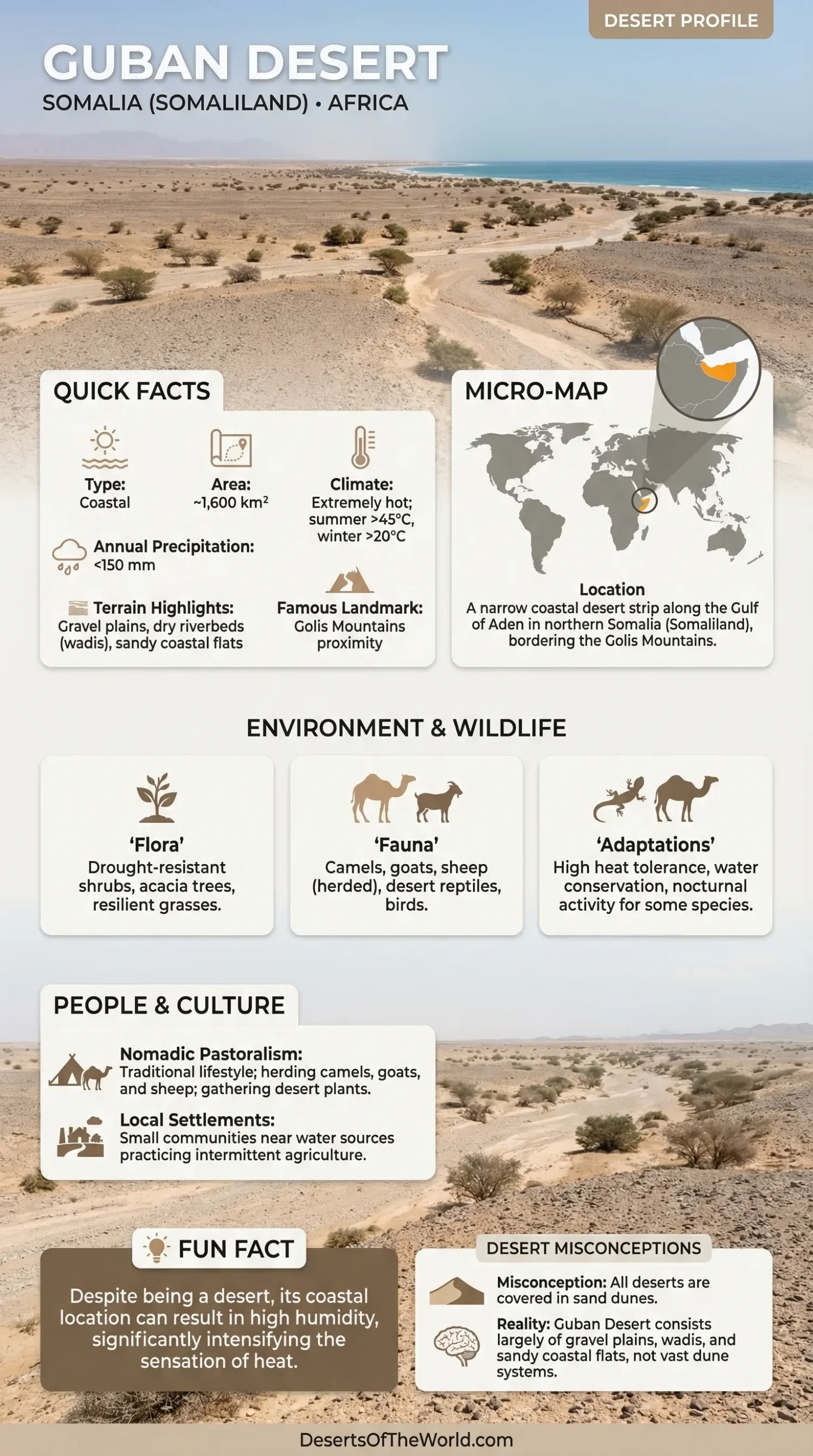
The Guban Desert is a narrow coastal desert located in northern Somalia (Somaliland), along the southern coast of the Gulf of Aden. Unlike vast inland deserts, the Guban forms a relatively small but extremely hot coastal plain covering approximately 1,600 square kilometers. It is characterized by arid conditions, seasonal dry riverbeds (wadis), and proximity to the Golis Mountains, which influence its climate and ecology.
Geography and Location
The Guban Desert stretches along the northern coastline of Somalia (Somaliland), between the Gulf of Aden to the north and the Golis Mountains to the south. Its approximate coordinates are 10°30′N latitude and 45°00′E longitude. The landscape consists mainly of gravel plains, sandy coastal flats, and dry riverbeds (wadis), rather than large dune systems.
Climate
The Guban Desert has an extremely hot arid climate, with very high daytime temperatures and minimal rainfall. Annual precipitation is typically below 150 mm, occurring during short seasonal rains. Due to its coastal location, humidity can be relatively high compared to inland deserts, intensifying the heat.
Temperature Range
Temperatures in the Guban Desert frequently exceed 45°C (113°F) during the summer. Unlike continental deserts, winter temperatures remain relatively warm, rarely dropping below 20°C (68°F), due to the moderating influence of the nearby sea.
Flora and Fauna
Despite its harsh conditions, the Guban Desert supports limited but resilient life. Vegetation mainly includes drought-resistant shrubs, grasses, and scattered acacia trees, adapted to saline soils and minimal rainfall.
Animal life is closely linked to pastoralism and desert adaptation, including:
- Camels – essential for transport and survival in arid conditions
- Goats and sheep – commonly herded by local communities
- Desert reptiles – such as lizards and snakes
- Bird species – adapted to coastal and arid environments
Comparison of Major Deserts
The Guban Desert can be compared to other major deserts of the world based on various factors, such as area, climate, and biodiversity. Below is a detailed comparison table:
| Desert | Area (sq km) | Average Rainfall (mm) | Temperature (Max/Min °C) | Biodiversity |
|---|---|---|---|---|
| Guban Desert | 1,600 | <150 | 45/20 | Moderate |
| Sahara Desert | 9,200,000 | 250 | 50/-10 | High |
| Atacama Desert | 105,000 | 15 | 28/0 | Low |
Human Activity
Human activity in the Guban Desert is limited primarily to nomadic tribes that have adapted their lifestyles to the harsh conditions. Traditional practices include herding and gathering of desert plants for food.
A few small settlements are also established near water sources, where agriculture is practiced intermittently, mainly focusing on crops that can withstand drought conditions.
Conclusion
The Guban Desert is an intriguing and unique destination that showcases the resilience of nature in extreme conditions. From its vast landscapes to its diverse life forms, the Guban Desert remains an area of immense ecological and geological interest.
For adventurers and researchers alike, this remarkable desert offers a plethora of opportunities to explore the natural wonders and study the adaptations that sustain life in such an unforgiving environment.