
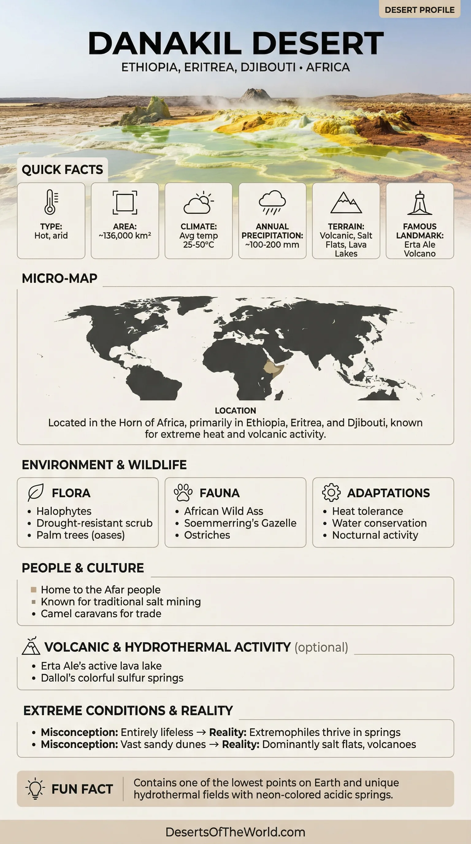
Location & Continent
Continent: Africa
Countries: Ethiopia, Eritrea, Djibouti
Coordinates: 13°N, 40°E
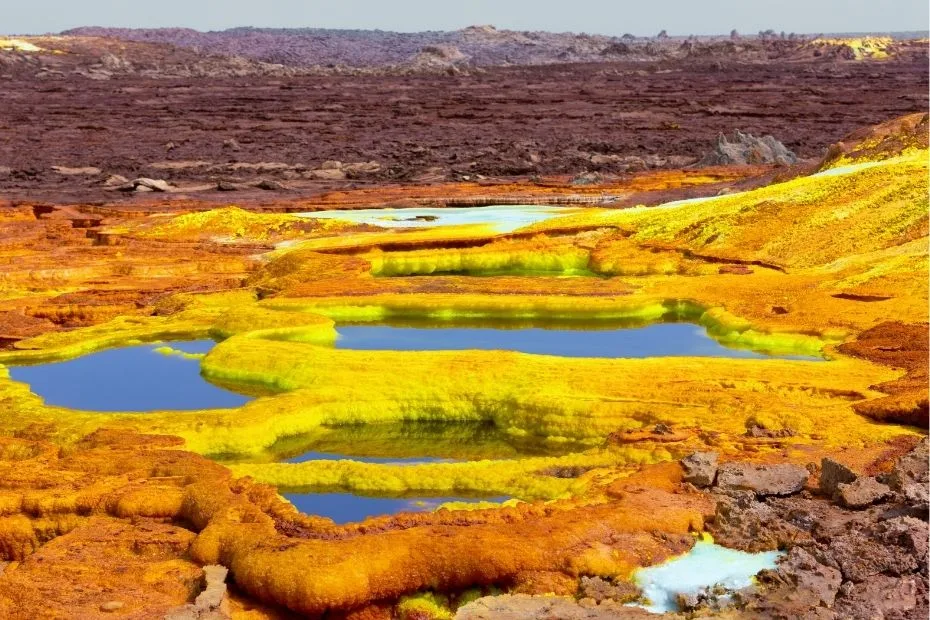
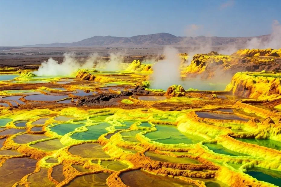
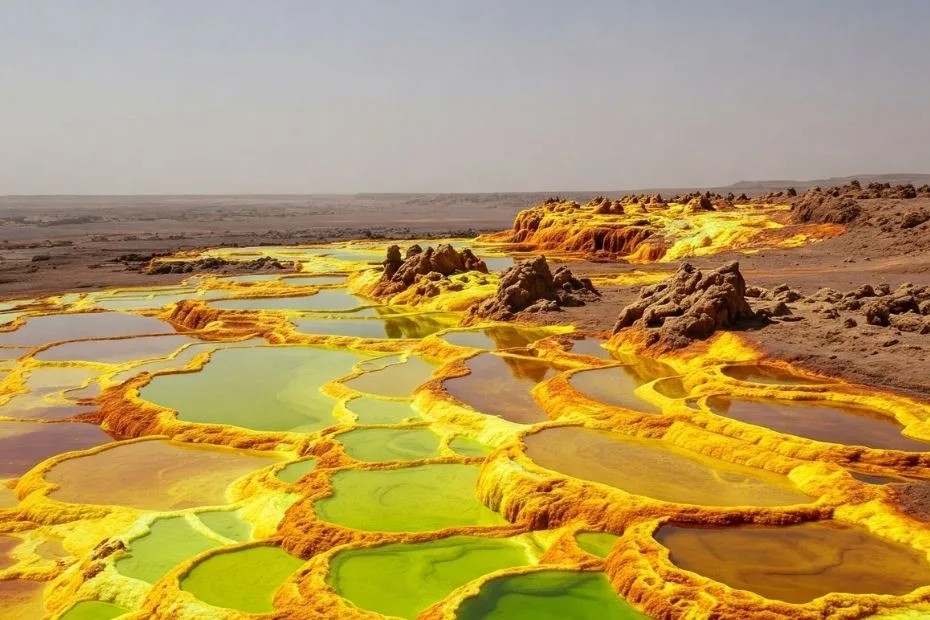
Photos of the Danakil Desert
Physical Features
Area: ~136,000 km²
Elevation: Ranges from about 200 m above sea level to roughly −125 m in parts of the Danakil Depression
Notable Landforms: Lava fields, salt pans, volcanic cones, fault-bounded depressions, and hydrothermal fields
Climate & Precipitation
Temperature: One of the hottest lowland regions on Earth; daytime temperatures commonly exceed 40°C in the hottest periods
Precipitation: Generally less than 200 mm annually; rainfall is low and highly irregular
Ecological Features
Biogeographic Realm: Afrotropical
Biome: Deserts and xeric shrublands
Ecoregions: Ethiopian xeric grasslands and shrublands and adjoining arid habitats of the Afar region
Flora & Fauna
Flora: Very sparse vegetation; drought- and salt-tolerant shrubs and grasses occur where water and soil conditions permit
Fauna: Domestic camels, desert-adapted reptiles, invertebrates, and birds able to use the region’s scattered suitable habitats
Geology & Notable Features
Geology: Part of the Afar rift system, where the Arabian, Nubian, and Somali plates are separating; volcanic and hydrothermal activity remains active
Notable Features: Erta Ale volcano, Dallol hydrothermal field, Lake Asale salt flats, and the Erta Ale volcanic range
Geography
The Danakil Desert forms part of the larger Afar Depression, a tectonically active region where the Arabian, Nubian, and Somali plates diverge. The landscape includes broad salt plains, fault-bounded basins, lava fields, volcanic ridges, and the chemically unusual hydrothermal pools around Dallol.
Covering approximately 136,000 square kilometers, the Danakil includes terrain both below and above sea level. One of its best-known volcanic features is Erta Ale, a basaltic shield volcano whose summit caldera has hosted long-lived lava-lake activity. The level and extent of exposed lava vary as volcanic activity changes.
The region remains volcanically active. On 23 November 2025, Hayli Gubbi in the Erta Ale volcanic range produced its first recorded explosive eruption, sending a high gas-and-ash plume above the Afar region. The event also deposited ash across areas near Erta Ale.
Climate
The climate of the Danakil Desert is hyper-arid and extremely hot. The Dallol area is often cited with a mean annual temperature of roughly 34°C (93°F), while daytime temperatures during the hottest periods can exceed 50°C (122°F).
Rainfall is scarce and irregular rather than confined to a dependable wet season. Many locations receive well under 200 mm per year. High evaporation rates, intense heat, saline soils, and limited surface water restrict vegetation across much of the depression.
Biodiversity
Terrestrial vegetation is sparse across the driest and most saline parts of the Danakil. Shrubs, grasses, and other drought-tolerant plants are more likely to occur around wadis, springs, oases, and areas with less saline soil. Reptiles, invertebrates, and several bird species use suitable habitats within the wider Afar region.
The Dallol hydrothermal system is also studied for the limits it places on microbial life. Extremophilic archaea have been detected in some saline and geothermal environments around Dallol, but microorganisms are not present in every extreme pool. Research has found that some hyperacidic, salt-saturated or magnesium-rich brines can exceed known limits for life even when liquid water is present. This makes Dallol useful for studying both microbial adaptation and environments where chemical conditions prevent life from functioning.
Geology, Resources and Afar Culture
The Danakil exposes an active continental rift where tectonic extension, volcanism, faulting, and hydrothermal activity can be observed within the same region. Salt deposits accumulated through repeated geological processes involving marine incursions, evaporation, subsidence, and later volcanic activity.
Salt extraction has long been associated with the depression, particularly around the large salt flats of northern Ethiopia. The region also contains substantial potash deposits.
The Danakil is part of the homeland of the Afar people, whose communities have adapted to dry conditions through pastoralism, livestock movement, and regional trade. Camels have traditionally been used to transport blocks of salt from extraction areas toward settlements and markets.
Comparison with Other Deserts
Danakil differs from many large deserts because active rifting, volcanism, below-sea-level salt basins, and hydrothermal activity occur within the same desert region.
| Desert | Location | Climate Character | Approx. Area (sq km) | Features |
|---|---|---|---|---|
| Danakil | Ethiopia, Eritrea, Djibouti | Hyper-arid and extremely hot | 136,000 | Active volcanism, salt flats, rifting, Dallol hydrothermal system |
| Sahara | North Africa | Predominantly hot desert climate | 9,200,000 | Ergs, gravel plains, rocky plateaus, mountains, and oases |
| Gobi | Mongolia and China | Cold desert with large seasonal temperature changes | 1,295,000 | Gravel plains, rocky terrain, dunes, and cold winters |
| Atacama | Chile | Hyper-arid coastal and high-elevation desert | 105,000 | Salt flats, volcanic terrain, high plateaus, and extremely low rainfall |
Rift, Salt Flats and Volcanism
The Danakil Desert is shaped by the interaction of tectonic extension, active volcanism, extreme aridity, and thick evaporite deposits. Erta Ale records ongoing basaltic volcanism, while Dallol contains acidic and hypersaline hydrothermal systems formed where geothermal fluids interact with salt-rich deposits. Vast salt plains occupy some of the lowest parts of the depression.
These features make Danakil distinct from deserts formed mainly by atmospheric aridity. Its present landscape is also controlled by the continuing separation of tectonic plates beneath the Afar region.