
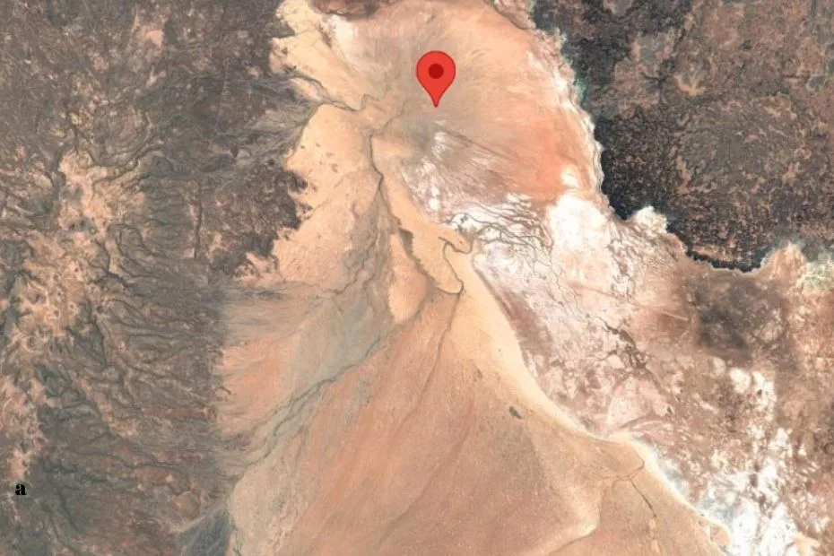
Location & Continent
Continent: Africa
Country: Kenya
Coordinates: 3°30′N, 37°30′E
Click to load the interactive map
Photos of the Chalbi Desert
Physical Features
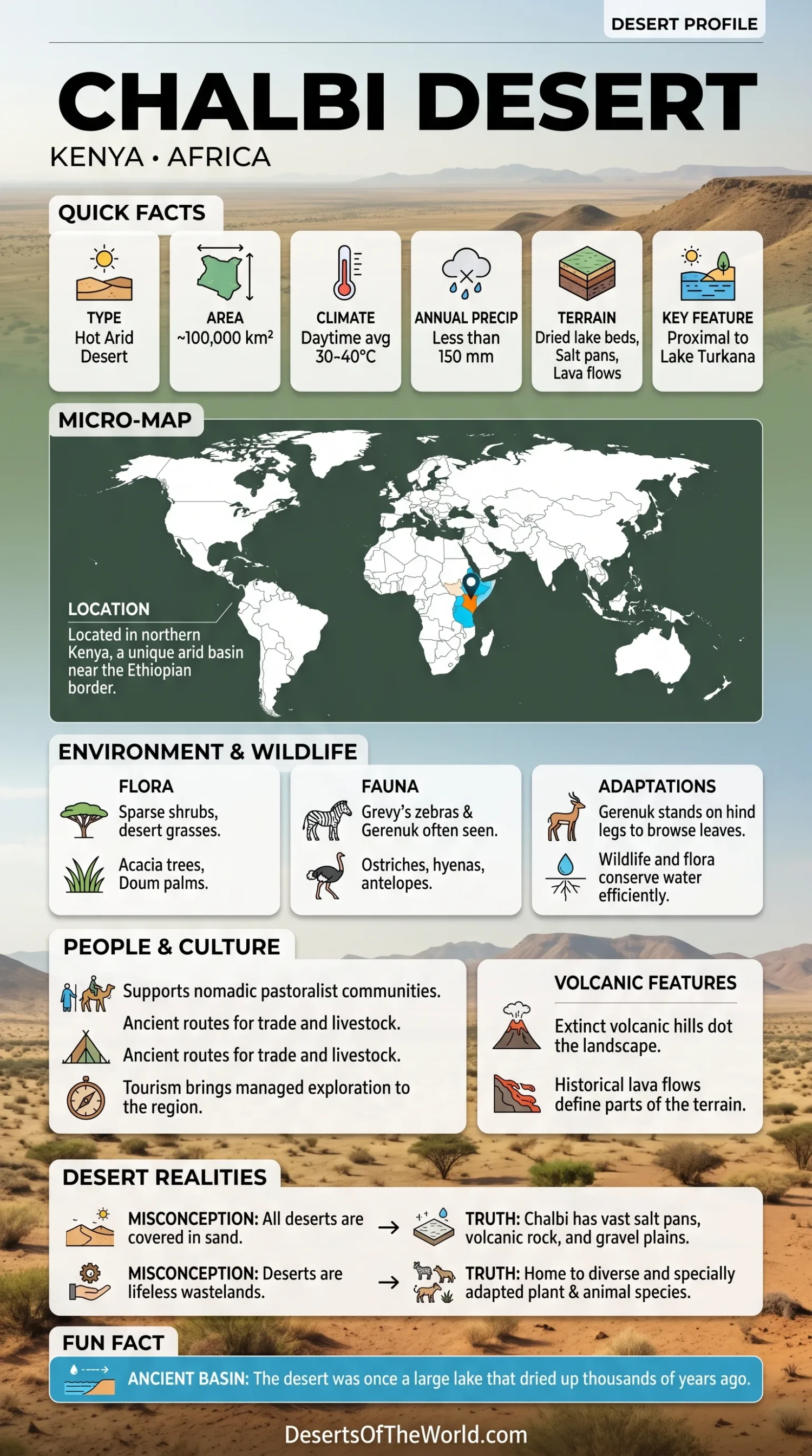
Area: ~100,000 km²
Elevation: Generally low-lying basin east of Lake Turkana
Notable Landforms: Lava flows, volcanic hills, ancient dried lake beds, salt pans
Climate & Precipitation
Temperature: Daytime often exceeds 35–40°C
Precipitation: Less than 150 mm annually; highly arid and prone to drought
Ecological Features
Ecozone: East African arid lands
Biome: Deserts and xeric shrublands
Ecoregions: Chalbi Desert forms part of the Northern Kenya semi-desert ecosystem
Flora & Fauna
Flora: Sparse shrubs, desert grasses, doum palm near oases
Fauna: Ostriches, Grevy’s zebras, hyenas, antelopes, camels (domesticated), and small reptiles
Geology & Notable Features
Geology: Former lake basin with volcanic deposits, saline soils, and sand plains
Notable Features: Close to Lake Turkana; volcanic Mount Kulal nearby (UNESCO Biosphere Reserve)
Geography
The Chalbi Desert, often referred to as a semi-arid desert, extends over an area of approximately 100,000 square kilometers. It is bordered by the Matthews Range to the east and the Baragoi Plateau to the south. The desert’s elevation varies, typically ranging from 500 to 900 meters above sea level, making it a unique geographical feature.
Climate and Weather Patterns
The climate of the Chalbi Desert is classified as hot desert, with average temperatures soaring during the day and dropping significantly at night. The region receives an annual rainfall of less than 150 millimeters, primarily falling between March and April during the long rains and again in October for the short rains.
Flora and Fauna
The Chalbi Desert is home to a variety of plants adapted to extreme conditions, including hardy species of Cacti and Acacia trees. These plants not only survive but thrive, showcasing nature’s resilience.
In terms of wildlife, the desert is inhabited by creatures such as the Gerenuk and Oryx, both of which have adapted to the harsh environment. The Chalbi Desert also serves as a migration route for several bird species, offering opportunities for birdwatching enthusiasts.
Desert Ecosystem Comparison
To provide a clearer perspective of the Chalbi Desert’s unique features, we’ve compiled a detailed table comparing it with other notable deserts.
| Feature | Chalbi Desert | Sahara Desert | Gobi Desert |
|---|---|---|---|
| Area | 100,000 km² | 9,200,000 km² | 1,295,000 km² |
| Annual Rainfall | < 300 mm | 100 mm – 200 mm | 100 mm |
| Average Temperature | Day: 30-40°C; Night: 10-20°C | Day: 30-50°C; Night: 0-25°C | Day: 20-40°C; Night: -40°C |
| Unique Fauna | Gerenuk, Oryx | Camels, Fennec Foxes | Bactrian Camel, Snow Leopard |
| Main Vegetation | Acacia, Cacti | Grasslands, Oasis | Shrubs, Grasses |
Human Interaction and Conservation
The Chalbi Desert has supported pastoralist communities for centuries. These communities use land management practices adapted to dry conditions. However, climate change and expanding human activity affect the region’s ecosystems.
Conservation programs aim to protect the biodiversity and cultural heritage of the Chalbi Desert. Public awareness campaigns and managed tourism practices are used to reduce environmental pressure and support long-term protection of the area.
Conclusion
The Chalbi Desert is not just a stretch of arid land; it is a vibrant ecosystem teeming with life and history. It reminds us of nature’s power and fragility, underscoring the importance of conservation. Future explorations into this least known desert will surely uncover more of its mysteries and treasures.