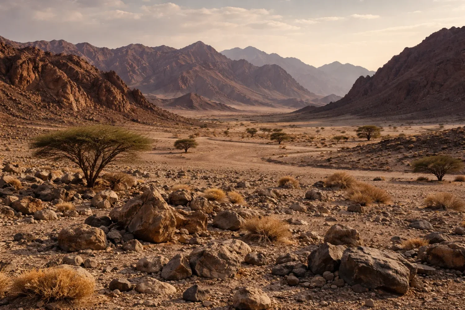
When people picture a desert, they usually picture dunes. Nice image. Just not the whole story. Across much of the dry world, the ground is not loose sand but stone-armoured land: gravel plains, bare rock benches, weathered plateaus, shattered bedrock, and dark pavements polished by time. In geomorphology, two of the most useful terms for these surfaces are reg and hamada.
Hami Desert
Location & Continent Continent: Asia Region: Eastern Xinjiang, northwestern China Desert System: Gobi Desert (often described as the...
Read More →Negev Desert
Location & Continent Continent: Asia Region: Southern Levant Country: Israel Nearby Landscapes: Sinai Peninsula, Mediterranean Coastal Plain (northwest),...
Read More →Judaean Desert
Location & Regional Setting Region: Southern Levant Primary Name: Judaean Desert (also written Judean Desert) Where It Sits:...
Read More →Sinai Desert
Location and Regional Context Continent: Asia (Western Asia) Country: Egypt Region: Sinai Peninsula Central Coordinates: 29.50°N, 33.83°E The...
Read More →Bayuda Desert
Location & Continent Continent: Africa Country: Sudan Region: Northeastern Sahara / Eastern Sahara Setting: Inside the Great Bend...
Read More →Eastern Desert
Location And Continent The Eastern Desert is a wide belt of arid land on Africa’s northeast edge, stretching...
Read More →Libyan Desert
Libyan Desert Location & Continent Continent: Africa Region: Eastern Sahara Countries: Libya, Egypt, Sudan Approximate Coordinates: 25°N, 25°E...
Read More →Tanezrouft
Location & Continent Continent: Africa Countries: Algeria, Mali Region: Tanezrouft (part of the Sahara Desert) Approximate Coordinates: 22.251°N,...
Read More →Sturt Stony Desert
Location & Continent Continent: Australia Country: Australia States: South Australia, Queensland, New South Wales Approximate Coordinates: 28°30′S, 141°00′E...
Read More →Colorado Plateaus
Location & Continent Continent: North America Country: United States (Arizona, Utah, Colorado, New Mexico) Coordinates: ~36°N, 111°W Colorado...
Read More →Kumtag Desert
Location & Continent Continent: Asia Country: China (Xinjiang Uyghur Autonomous Region) Coordinates: 40°N, 91°E Kumtag Desert – Map...
Read More →Dasht-e-Margo
Location & Continent Continent: Asia Countries: Afghanistan Coordinates: 30°N, 63°E Physical Features Area: Approximately 150,000 km² Length: About...
Read More →Gobi Desert
Location & Continent Continent: Asia Countries: China, Mongolia Coordinates: 42°N, 105°E Gobi Desert – Map & Street View...
Read More →Syrian Desert
Syrian Desert (Badiyat ash-Shām): Location, Climate, Ecology & Highlights A concise, research-backed guide to the Syrian Desert—its geography,...
Read More →Karoo Desert
Location & Continent Continent: Africa Country: South Africa Coordinates: 30°S, 22°E Photos of the Karoo Desert Physical Features...
Read More →Tabernas Desert
Location & Continent Continent: Europe Countries: Spain Coordinates: 37°N, 2°W Photos of the Tabernas Desert Physical Features Area:...
Read More →16 inventions in Rocky Deserts (Reg & Hamada)
A reg is usually a stony plain or desert pavement, where wind and short-lived water flows have removed the finer sediment and left behind a tight skin of gravel, pebbles, and cobbles. A hamada is rougher and harder: a rocky tableland, bedrock platform, or boulder-strewn plateau with very little soft cover. The difference sounds simple, yet on the ground the two often grade into one another. That is why many classic deserts contain both.
These surfaces matter far beyond vocabulary. They shape drainage, plant spacing, soil chemistry, travel routes, and even the survival of archaeological traces. They also correct a common myth. Dunes cover only about a tenth of the world’s desert area, while in the Sahara sand sheets and dune fields occupy roughly a quarter of the surface. Much of the rest is rocky, gravelly, or mixed terrain. In other words, a desert is more often a stone country than a sand sea.
One Useful Rule: If the ground looks locked together, crunches underfoot, reflects heat off stone rather than off soft sand, and sends rare rain racing through wadis instead of soaking in, you are probably standing in reg, hamada, or a close cousin such as serir in the Sahara or gibber in Australia.
What Makes a Rocky Desert Different
The first mark of a rocky desert is surface sorting. Fine dust, silt, and loose sand do not remain evenly spread for long. Wind lifts the smallest grains. Sheetwash from brief storms sweeps others downslope. Repeated heating and cooling cracks bedrock, but the new fragments do not stay random forever. Over long spans, the surface becomes organized. Large clasts stay. Finer material sinks, blows away, or gathers beneath the stone cover. What remains on top is a desert skin that can look almost paved by hand.
The second mark is low biological cover, though not total absence of life. Shrubs often grow in small islands where runoff collects, salts are lower, or fractures let roots travel deeper. Lichens, biological soil crusts, hardy grasses, tamarisk, halophytes, acacias, chenopods, and drought-tolerant succulents appear where local conditions allow. Animal life follows the same pattern: sparse in open pavement, richer along wadis, escarpment bases, springs, and alluvial fans.
The third mark is hard relief. Rocky deserts are places of pediments, inselbergs, mesas, escarpments, badlands, gravel fans, desert varnish, ventifacts, and dry channels cut by violent but brief runoff. Rain is rare, yet when it comes it can be forceful. That is one reason rocky deserts often look carved rather than buried.
| Surface Type | Main Material | Typical Relief | How It Usually Forms | Field Look |
|---|---|---|---|---|
| Reg | Gravel, pebbles, cobbles, tightly packed clasts | Flat to gently sloping plains, fans, pediments | Deflation, sheetwash, long-term surface stabilization | Crunchy, stony, often darkened by varnish |
| Hamada | Bedrock, blocky rubble, rock benches, boulders | Plateaus, rocky uplands, cliffs, dissected high ground | Bedrock exposure, stripping of fines, weathering of hard rock | Bare rock, broken slabs, very little loose sand |
| Serir | Stones and gravel, often Sahara stony plains | Broad plains and depressions | Very similar to reg | Stone-rich plains with fine material beneath |
| Gibber | Pebble armour in Australian deserts | Low stony plains | Surface concentration of resistant stones | Dark, closely packed pebbles over clayey ground |
| Erg | Sand | Dunes and sand seas | Aeolian transport and deposition | Loose, mobile, ripple-marked dune fields |
Why Sand Is Only Part of the Desert Story
Open sand is mobile, photogenic, and easy to remember, so it dominates popular imagination. Rocky deserts do the opposite. They hold still. They tend to look empty from a distance and subtle up close, yet geomorphically they tell a sharper story. A gravel plain can reveal old alluvial fans, abandoned channels, long periods of surface stability, and cycles of erosion and deposition that dunes often hide.
On many stable surfaces the stone cover works like a natural armour. Once the finer particles below are protected by a tight pavement of clasts, further wind erosion slows down. This is one reason desert pavements can remain intact for very long spans when vehicles, heavy trampling, or construction do not break them. Break that skin and the change can be fast: dust rises, runoff scars the surface, and the old balance is gone.
That protective role is not academic. In the Gobi sector around Hami, local monitoring has emphasized how gravelly desert surfaces help resist renewed sand movement. The same lesson appears in the Mojave, in parts of the Sahara, and across Australia’s gibber country. Rocky deserts may look fragile and durable at the same time. They are both.
How Reg and Hamada Form
No single process makes every rocky desert. Deflation is part of the story, but not the whole of it. Wind removes dust and fine sand, yes, yet sheetfloods, slope wash, salt weathering, thermal stress, and the quiet settling of windblown dust beneath surface stones all matter too. Some pavements form where clasts are left behind as fines are stripped away. Others mature as dust accumulates under pre-existing stones and locks them into place. On some old surfaces both processes have worked together.
In hamada terrain, the role of bedrock is more obvious. Hard limestones, sandstones, basalts, granites, and metamorphic rocks resist removal better than surrounding weaker materials. As adjacent fines vanish and slopes retreat, rock benches and plateaus stand out. That is why so many hamadas sit above surrounding basins or along uplifted desert blocks. They are not just stone-covered. They are structural landscapes.
Short-lived water matters even in very dry places. A rocky desert may go long periods without rain, then receive a sudden downpour that moves whole sheets of gravel, cuts a fresh channel, or dumps fan sediment at a mountain front. Rare events leave big signatures. Quiet years do not erase them.
Deflation
Wind removes dust and loose sand, exposing coarser fragments and tightening the surface.
Sheetwash
Thin storm runoff sorts and shuffles gravel, especially on fans and pediments.
Thermal Stress
Large day-night temperature swings crack exposed rock and add new debris.
Salt Weathering
Salt crystals grow in pores and joints, prying rock apart in dry climates.
Landforms That Belong to Reg and Hamada Country
Desert Pavement, Pediments, and Bajadas
Desert pavement is the classic reg surface: a closely packed mosaic of pebbles and cobbles resting over finer material, often a silt- and clay-rich vesicular horizon. It tends to develop on alluvial fans, terraces, pediments, and low-gradient rock-cut surfaces. Good pavements look almost deliberate, with stones fitting together like a rough puzzle. Walk across one and the surface can feel firmer than many rural roads.
Pediments are gently sloping rock-cut surfaces at mountain fronts. They are common in rocky deserts because scarce vegetation, episodic runoff, and exposed bedrock create the right setting for lateral slope retreat and sheet-like erosion. Where several alluvial fans merge along a mountain base, the result is a bajada. These broad aprons are not pure reg or pure hamada; often they carry both characters, with coarser stony sectors near the mountain front and finer or saltier zones downslope.
Many famous rocky deserts are built from these pieces. The stony downlands of Australia, the pediment belts of Iran, the volcanic and granitic plains of Sudan, the dissected plateaus of the Levant, and the gravelly sectors of the Gobi all show this same basic grammar. Different rocks, same dry logic.
Wadis, Playas, Yardangs, and Inselbergs
Rocky deserts are full of channels that carry water only briefly. These are wadis, and they are among the most active parts of any arid landscape. Even where annual rainfall is below 100 mm, a short storm over uplands can send a flash flood racing down a dry valley. Along wadis the surface changes quickly: coarse lag deposits, cut banks, fans, tamarisk clusters, fresh silt, and scattered acacia or scrub.
In closed basins, runoff may end in a playa, salt pan, sabkha, or clay flat. Around these low points, the stony character of a desert often shifts abruptly. A hard pavement may give way to cracked mud, gypsum crust, saline flats, or powdery evaporites. That contrast is one of the clearest ways to read an arid basin from the ground.
Wind can sculpt weaker sediment into yardangs, long ridges aligned with prevailing airflow. Resistant rock masses may stand above surrounding surfaces as inselbergs, mesas, buttes, or volcanic plugs. Rocky deserts are full of these shape contrasts. Flat, then jagged. Smooth, then shattered. A hamada rarely stays visually flat for long once you move through it.
Desert Varnish and Ventifacts
One detail tells you a lot about surface age and exposure: desert varnish. This thin dark coating, rich in clay with iron and manganese oxides, forms on stable rock surfaces over time. It is common on exposed stones in many reg landscapes, especially where the surface has not been disturbed for long periods. It can make a gravel plain shine brown-black under low sun.
Another marker is the ventifact, a stone faceted and polished by wind-driven grains. In places with persistent wind direction and open sediment supply, rocks develop sharp faces and edges. Ventifacts are small details, but they point to a large truth: even sparse sediment in a rocky desert can work like sandpaper when the wind is right.
Put desert varnish, ventifacts, a tight stone pavement, and a nearby wadi together, and the landscape starts to read almost like a text. Not loud. Clear.
Climate and Surface Physics of Rocky Deserts
Rainfall, Evaporation, and Flash Floods
Most deserts receive less than 250 mm of precipitation a year, and many rocky deserts sit far below that threshold. The driest sectors of the Libyan Desert, central Sahara, and parts of Afghanistan or inner Asia may go through long stretches with almost no effective rainfall. Yet annual totals alone do not explain the surface. Timing, intensity, and evaporation matter just as much.
A place that receives 80 mm in scattered misty events does not behave like a place that receives 80 mm in two violent storms. Rocky deserts often get the second pattern. Water runs off slopes instead of soaking in, then funnels into wadis and basin floors. That is why even a hard reg can sit next to a deep erosional channel. Dry year, then sudden flow. So it goes.
Potential evaporation usually outruns rainfall by a wide margin. Under that imbalance, salts build in soils, shallow moisture vanishes fast, and plants cluster where runoff collects or bedrock traps water. Many rocky deserts are not only dry; they are hydrologically extreme, with long empty intervals broken by short, concentrated movement of water and sediment.
Heat, Cold, and Rock Breakdown
Hot rocky deserts can produce fierce daytime surface temperatures because dark stones absorb and re-radiate heat efficiently. But not all rocky deserts are hot all year. The Gobi and high continental basins of Central Asia are cold deserts with harsh winters, wide annual temperature ranges, and freeze-thaw activity in some sectors. In parts of the Gobi, average January lows can reach around -40 C, while summer highs in warmer sectors climb above 40 C.
Those swings matter. Repeated expansion and contraction open fractures. Salt crystals grow in pores and joints. Thin outer layers peel off as exfoliation flakes. Over time, cliffs shed angular debris onto slopes, pavements receive fresh clasts, and hamada surfaces keep renewing their rubble cover even when rainfall remains scarce.
Rarely does a rocky desert feel static once you learn how to look. The broad form changes slowly, yes, but at the scale of stone faces, channel edges, salt crusts, and talus toes, motion is constant.
Soils, Salts, and Dust
Under many desert pavements lies a fine-textured layer often called a vesicular horizon. It forms as dust accumulates and the soil develops tiny pores that reduce infiltration. This makes runoff more likely, which in turn helps preserve the stone cover above. Surface armour and subsurface fines work together. Break the pavement and the soil below becomes far more vulnerable.
Salinity also shapes rocky deserts. Basin floors can trap dissolved minerals, forming gypsum crusts, calcrete, saline flats, or hardpans. In some places, a single landscape sequence may run from bedrock hamada on uplands, to reg on pediments and fans, to playa or sabkha on the basin floor. That chain appears again and again from North Africa to inner Asia.
Dust, too, is part of the rocky desert system. Fine material stripped from one place settles elsewhere, feeding loess margins, soil crusts, or downwind basins. A reg is not only what remains after dust leaves. It is also part of a larger exchange across the dryland atmosphere.
Life on Stone-Dominated Ground
Plants That Fit Rocky Desert Conditions
Plant cover in reg and hamada landscapes is usually sparse, patchy, and highly local. That does not mean simple. Rocky deserts often support micro-habitats tied to cracks, ephemeral drainage lines, alluvial pockets, shade from boulders, and slightly finer soils trapped behind stones. Low shrubs, halophytes, saltbushes, saxaul relatives, ephemeral grasses, wormwoods, and thorny acacias can all appear where the surface allows.
In the Negev and Judaean country, shrubs and ephemeral annuals track runoff and winter rain. In Australian gibber plains, hardy chenopod communities exploit fine-textured substrates beneath the stone armour. In the Karoo, succulent and dwarf shrub communities fit a semidesert setting where rainfall is low but not absent. In the Eastern Desert and Sinai, wadi floors can hold scattered trees and shrubs while nearby rocky slopes remain nearly bare.
The visual effect is subtle. A dune field may show plant patterns from far away; a reg often reveals them only when you slow down. A few tufts. A line of shrubs in a drainage seam. Tiny annuals after rain. Life, but on a tight budget.
Animals and Movement Across Stony Ground
Rocky deserts favor animals that can use crevices, burrows, and shade. Reptiles, arthropods, small mammals, foxes, hares, ungulates on broader desert margins, and birds that exploit cliffs or wadis all use these landscapes. The open ground may look empty at noon and busy at dawn. Tracks often tell more than direct sightings.
Stony surfaces also shape movement. Hoofed mammals can cross some gravel plains more easily than soft dune belts. Early travel routes, caravan corridors, and modern roads have often preferred firmer rocky or gravelly ground for exactly that reason. A reg can be harsh, but it is often more passable than a loose erg.
There is a trade-off, though. Hard surfaces warm fast, reflect heat, and offer little cover. Many animals shift activity to night, to cooler seasons, or to the edges of drainage lines. In arid country, place is everything.
Micro-Life, Crusts, and Surface Stability
Not all desert life is obvious. Rocky deserts can host biological soil crusts, microbial films, and lichen communities on stable ground. They help bind fine sediment, influence infiltration, and slightly alter surface color. Their effect can be easy to miss and easy to destroy. One pass of a tire or repeated trampling can undo what took years to build.
This is one of the quiet lessons of reg country: hard ground is not always tough ground. A pavement may look permanent, yet once disturbed it can unravel. Dust increases, runoff bites deeper, and the old stone fit is lost. Somtimes the damage reads on the land for decades.
How to Read a Rocky Desert Surface
Many articles stop at definition. They say reg is gravel and hamada is rock, then move on. Real landscapes deserve better. To read a rocky desert well, look for five things at once: grain size, surface packing, slope position, bedrock exposure, and runoff pattern.
- Reg usually sits on broad, low-relief surfaces and looks tightly packed, pebbly, and laterally continuous.
- Hamada more often shows exposed bedrock, block fields, scarps, benches, and a rougher texture.
- Mixed Rocky Desert is common near escarpment toes, fan systems, volcanic fields, and dissected plateaus where one surface grades into another.
- Erg Margins often appear where mobile sand accumulates against rocky barriers, mountain fronts, or basin edges.
Also watch the color. Dark varnished stones often suggest stability. Fresh pale rock may signal recent breakage, flood reworking, or human disturbance. The plant pattern helps too. Widely spaced shrubs on stony plains usually point to runoff concentration and shallow, restrictive soils; denser vegetation in a line usually marks a channel or fracture-controlled moisture path.
This field-reading angle fills a gap found in many short desert articles. Names alone do not tell you how a surface behaves. Structure does.
How Rocky Deserts Change Over Time
A rocky desert is never just a snapshot. It is a surface with memory. Some pavements sit on old alluvial fans or terraces that formed under climates not quite like today’s. Others belong to younger flood deposits, fresh volcanic fields, or newly exposed bedrock. That means age is uneven even within one valley. A dark, tightly packed pavement may be old and stable, while the pale wash next to it may have been rearranged by the last strong storm.
Over longer spans, rocky deserts pass through repeating stages. Bedrock breaks down. Coarse fragments spread out. Finer sediment is removed, stored downslope, or trapped below the stone skin. Channels incise, then partly fill. Fans expand, merge, and are cut again. Dunes may briefly invade a stony surface, then retreat. Salts build in low ground, then get broken by floodwater. A desert may look permanent, but its details are always being edited.
Some of the clearest long-term records sit where tectonics and aridity meet. Uplift creates new relief. Relief generates fresh sediment and stronger runoff gradients. Then the desert sorts the material into recognizable zones: hamada on resistant uplands, reg on lower stable surfaces, and playa or sabkha in the basin floor. The pattern is simple on paper and messy in life, which is exactly why these landscapes are so interesting.
Surface disturbance can speed that editing up fast. Off-road driving, quarrying, repeated trampling near popular viewpoints, pipeline corridors, and poorly managed construction can break mature pavement and expose the fine layer underneath. Once that happens, wind lifts more dust and runoff cuts deeper rills. In many drylands, the visible scar lasts far longer than the original activity.
Rocky Deserts and Human Geography
People have always interacted with rocky deserts in selective ways. Not by trying to occupy every surface equally, but by following water routes, mineral belts, firm travel ground, and sheltered edges. This is one reason many old caravan paths, mining zones, and modern roads cross gravel plains or stony valley floors rather than large dune seas. A reg can be punishing, but it is often more legible and more stable under load than soft sand.
Water decides almost everything. Springs at fault lines, perched water in fractured bedrock, runoff-fed pockets in wadis, shallow groundwater near basin margins, and river corridors at desert edges all create nodes of use. Around those nodes, human geography thickens: camps, wells, quarries, seasonal movement, cultivation patches, transport routes, religious sites, rock art, and fortified stops. Move away from them and the density drops sharply.
Rocky deserts also preserve traces well. In many places, low vegetation, low soil turnover, and slow biological disturbance keep old trackways, cairns, hearth scatters, quarry marks, inscriptions, and field systems visible at the surface for long periods. That preservation is not universal, but it is common enough that archaeologists pay close attention to stable reg and hamada ground. A stony plain can behave like an archive.
Mining history is another recurring theme. The Eastern Desert is a classic case because hard-rock geology and old trade corridors overlap. The Negev, Sinai, the Colorado Plateau, and parts of inner Asia show similar links between exposed bedrock and resource use. Rocky deserts make geology readable, and readable geology often draws people in.
Why Rocky Deserts Often Carry Roads Better Than Dune Fields
- Firm Ground: tightly packed gravel and exposed bedrock deform less than loose dune sand.
- Clearer Relief: wadis, plateaus, fans, and escarpments give route planners stronger reference lines.
- Less Mobile Surface: stone pavements usually shift more slowly than active dune corridors.
- Trade-Off: flash floods, sharp rock, and isolated topography can still make travel difficult.
Modern energy and research use these landscapes too. Solar installations favor clear skies and open land, though not every rocky desert is suitable. Desert science stations value exposed surfaces because soil processes, erosion, and atmospheric dust are easier to monitor there. In hyper-arid sectors, rocky deserts even serve as analog environments for planetary studies, especially where saline crusts, extreme dryness, and old stable surfaces occur together.
Still, these lands are not empty blanks waiting for use. They are living drylands with local ecological rhythms and fragile surface structure. That matters. A place can look hard and still be easy to damage.
Patterns Shared Across the World’s Rocky Deserts
Set the Sahara, the Gobi, inland Australia, the Levant, the Colorado Plateau, and southeastern Spain side by side and a few patterns return again and again. First comes topographic sorting. Resistant rock holds the highs. Gravel and cobbles dominate stable middle slopes and fans. Finer sediments settle in basin lows. The names vary by region, but the sequence is familiar.
Second comes surface contrast. Rocky deserts are rarely uniform for long distances. A hamada-like bench may end abruptly at a wadi head. A gravel plain may grade into gypsum flats. A dune tongue may rest directly against varnished bedrock. This patchiness is not a flaw in description. It is the actual structure of dryland terrain.
Third comes episodic water. Even the driest rocky deserts are shaped by rare runoff. When rain arrives after a long gap, the response can be immediate: sheetwash on pediments, gravel movement on fans, fresh incision in wadis, debris transfer from scarps, and salt redistribution across basin floors. Long stillness, short action. That rhythm is nearly universal.
Fourth comes the role of surface armour. Whether the stones are called reg, serir, or gibber, the effect is similar. The coarse cover protects finer ground below, reduces direct deflation, and helps a surface stay recognizable through time. Not perfectly. Not forever. But enough to shape the whole landscape.
Fifth comes ecological concentration. Rocky deserts spread life thinly across the open surface and more densely in specific micro-sites: channel margins, fracture zones, shadowed slopes, rocky hollows, and fan toes. This gives them a very different ecological feel from some sandy deserts, where root penetration and subsurface moisture can be distributed in another way.
Those shared patterns are useful because they let you compare deserts that at first seem unrelated. The Tabernas badlands and the Bayuda volcanic core are not twins. Neither are the Colorado Plateaus and the Libyan Desert. Yet each belongs to the same larger conversation about aridity, exposed rock, episodic flow, and stone-controlled surface behavior.
Common Misreadings of Reg and Hamada Landscapes
One common misreading is that rocky means lifeless. In reality, many stony deserts support more localized plant diversity than first impressions suggest, especially along wadis, piedmonts, and runoff-fed pockets. Another misreading is that a rocky desert is just “what is left when sand blows away.” That phrase captures only part of the process. Bedrock structure, fan deposition, weathering style, dust accretion, and flood reworking all matter.
A third misreading is scale. Many short articles make reg and hamada sound tiny, specialized subtypes inside large sand deserts. The opposite is often closer to the truth. In many major desert systems, stone-dominant surfaces make up the majority of the terrain. Sand gets the photographs. Rock carries the map.
A fourth misreading is to treat all rocky deserts as identical. They are not. A cold gravel plain in the Gobi, a basaltic lava desert in the Syrian interior, a marl badland in Tabernas, a granitic wadi system in Sinai, and a gibber plain in Australia each behave differently in detail. Their rainfall seasonality, sediment source, weathering mode, soil chemistry, and plant strategy can differ a lot even while they belong to the same broad family.
And one more. Rocky deserts are often presented as secondary scenery around famous sites. Yet many of the world’s most revealing desert processes are easiest to see on these hard surfaces: pavement development, varnish formation, ventifact shaping, slope retreat, flash-flood incision, calcrete accumulation, and the long persistence of stable geomorphic surfaces. Strip away the stone story and you miss the skeleton of the desert.
World Survey of Rocky Desert Landscapes
The deserts below show how reg and hamada landscapes appear under different climates, rock types, and tectonic settings. Some are classic hot stony deserts. Others are cold, high, volcanic, or semidesert. Together they show why “rocky desert” is a broad family rather than a single look.
| Desert | Continent | Approximate Area | Typical Rocky Character | Annual Rainfall Pattern |
|---|---|---|---|---|
| Hami Desert | Asia | Hami Gobi sector about 94,600 km² | Gravel plains, clay uplands, yardang-rich sectors | Usually only tens of millimeters |
| Negev Desert | Asia | About 16,000 km² | Rocky plateaus, loess plains, erosional basins | About 25 to 200 mm, falling southward |
| Judaean Desert | Asia | Regional desert belt east of the Judean highlands | Limestone escarpments, marl badlands, wadis | Roughly 50 to 100 mm in many parts |
| Sinai Desert | Asia | Peninsular desert region | Rocky plateaus, mountains, gravel fans, wadis | North near 125 mm, drier inland and south |
| Bayuda Desert | Africa | About 100,000 km² | Gravel plains, rocky plateaus, volcanic field | Generally very low, near or below 100 mm |
| Eastern Desert | Africa | Large desert belt between Nile and Red Sea | Basement rocks, wadis, rugged hills, stony plains | Often less than 25 mm, local mountain effects |
| Libyan Desert | Africa | About 1,300,000 km² | Bare plateaus, stony plains, depressions | Extremely low, in places near zero |
| Tanezrouft | Africa | Plateau region within the Sahara | Classic hamada-like plateau and stony waste | Hyper-arid, often around or below 50 mm |
| Sturt Stony Desert | Australia | About 29,750 km² | Gibber plains over fine-textured ground | About 100 to 150 mm in many sectors |
| Colorado Plateaus | North America | About 337,000 km² | Rock benches, mesas, canyonlands, desert pavement | Dry to semiarid, roughly 100 to 400 mm by zone |
| Kumtag Desert | Asia | About 22,900 km² | Gravel plains with dune accumulations and rocky margins | Very low, arid basin setting |
| Dasht-e-Margo | Asia | About 150,000 km² | Rocky-clay plains, takirs, saline flats | Often below 50 mm |
| Gobi Desert | Asia | Vast transboundary desert | Cold gravel plains, rocky basins, sparse dunes | About 50 to 200 mm |
| Syrian Desert | Asia | Broad plateau desert | Rocky pavement, basalt fields, wadis | Usually below 125 mm |
| Karoo Desert | Africa | Large semidesert region | Rocky plains, mesas, pediments, gravel fans | About 100 to 400 mm depending east-west position |
| Tabernas Desert | Europe | About 280 km² | Badlands, marl and gypsum slopes, stony channels | About 150 to 250 mm |
Asia
Hami Desert
The Hami Desert sits in eastern Xinjiang within the broader Gobi system, between mountain barriers that help maintain a very dry continental setting. Recent local reporting has put the Gobi desert area of Hami at about 94,600 km², covering roughly two-thirds of the prefecture-level territory. That figure matters because it shows scale: this is not a small stony basin but a major gravel-dominated desert region.
In ground character, Hami is an excellent lesson in why rocky deserts deserve separate treatment from dune deserts. Much of the surface is gravelly to clay-rich, with stony plains, low plateaus, and yardang-like erosional forms where wind and sparse runoff have cut weaker materials. Annual rainfall is typically only in the tens of millimeters, while evaporation and temperature contrast stay high. The result is a landscape where fines are easily mobilized and resistant clasts help form protective desert pavement.
Hami also shows the management side of reg landscapes. Disturb the gravel skin and dust risk rises. Keep it intact and it acts like armour. Few places show that relation more clearly.
Negev Desert
The Negev Desert covers about 16,000 km² in the southern Levant and includes one of the clearest rocky-desert transitions anywhere in West Asia. Rainfall drops sharply from north to south, with around 200 mm in northern sectors, roughly 76 to 102 mm on parts of the central plateau, and near-zero conditions at the far southern tip near the Gulf of Aqaba.
Geomorphically, the Negev is not one thing. It includes loess plains, limestone and chalk uplands, gravelly surfaces, wadis, and the famed makhteshim, large erosional basins sometimes called erosion craters. For a rocky-desert study, the important part is how often the Negev behaves like hamada country: hard plateaus, exposed bedrock, thin soils, and runoff focused into deeply cut channels.
It is also a good reminder that drylands can be varied within short distances. A surface may shift from stone pavement to chalk badland to sandy pocket in a few kilometers. That mixed texture makes the Negev one of the most instructive rocky deserts on the planet.
Judaean Desert
The Judaean Desert lies east of the Judean highlands and drops sharply toward the Dead Sea basin. It is a rain-shadow desert, and that setting is everything. Moisture falls on the higher western slopes first, leaving the eastern side dry, broken, and strongly dissected. In many parts of the Dead Sea margin, annual rainfall is only around 50 to 100 mm, with some nearby low sectors averaging even less.
This is not a gravel plain in the broad Saharan sense. It is a steep rocky desert made of limestone, dolomite, marl, and chalk, cut by short but deep wadis that descend fast toward one of the lowest land surfaces on Earth. Cliffs, scree, badlands, dry channels, and exposed bedrock dominate the visual field. The desert reads more like a dissected hamada than a classic flat reg.
Because relief is strong and rainfall events can be intense, the Judaean country also shows how flash floods shape rocky deserts with speed. A dry gorge can become an active channel in a very short time, then return to silence just as fast.
Sinai Desert
The Sinai Desert brings together several rocky-desert worlds inside one peninsula. The north is lower and more open, the center contains broad limestone plateaus and gravelly expanses, and the south rises into rugged granitic mountains. Rainfall in the northern sector averages about 125 mm a year, but interior and southern parts are much drier and more topographically controlled.
From a reg-and-hamada perspective, Sinai is valuable because it shows how bedrock geology changes surface character. Hard crystalline rock in the south produces sharp relief, coarse debris, and steep wadis. Carbonate plateaus farther north create broad stony surfaces, escarpments, and gravel fans. Between them lie many mixed desert surfaces where pavement, rubble, and alluvium sit side by side.
Sinai is also a place where travel lines, oases, and settlement patches have long been constrained by water storage in wadis and fractures rather than by any wide belt of soft dune sand. Stone governs the map here.
Kumtag Desert
The Kumtag Desert in northwestern China is often described through its dunes, yet that is only part of its shape. The broader desert covers about 22,900 km² and lies in a dry basin setting east-southeast of Lop-related desert country. Around the dune accumulations are wide sectors of gravelly and rocky ground, low hills, watercourse traces, and hard desert margins that fit the reg tradition more than the postcard idea of a pure sand sea.
Kumtag works as a transition landscape. Sand builds up against topographic traps and at the foot of ranges, but stony surfaces still control runoff and sediment routing. This edge condition matters because many deserts are mixed systems rather than pure categories. Hamada here, reg there, dunes against the slope, salts in the basin floor.
Seen that way, Kumtag is less a contradiction and more a lesson: rocky deserts and sandy deserts are often neighbors, not rivals.
Dasht-e-Margo
The Dasht-e-Margo of southern Afghanistan is one of the most severe drylands in Asia, covering about 150,000 km² at elevations near 500 to 700 m. Its name is dramatic, but the landform story is even more striking: large sectors consist of rocky-clay plains, saline flats, takirs, and sparse desert surfaces where mobile sand is only one component.
Annual rainfall is often below 50 mm, pushing the desert deep into hyper-arid behavior. Under those conditions, evaporation dominates, salts accumulate, and surface crusts matter. The combination of rocky-clayey ground, solonchaks, and takir-like flats places Dasht-e-Margo firmly inside the wider family of stony desert landscapes, even if it lacks the better-known name recognition of Sahara examples.
This is a good case of a content gap often missed in general desert writing: many of the world’s rock-dominant deserts sit in inner Asia, not only in North Africa.
Gobi Desert
The Gobi Desert is one of the clearest proofs that a desert can be cold, vast, and still mostly rock-and-gravel country. Stretching across Mongolia and China, the Gobi receives about 50 to 200 mm of precipitation a year, with some western sectors below that and some northeastern sectors above it. Winters can be severe, with average January lows around -40 C in the coldest parts, while summer highs in warmer sectors can reach 45 C.
Unlike many hot deserts, the Gobi often presents broad gravel plains, rocky basins, low mountain blocks, dry valleys, and sparse dune fields rather than endless sand seas. In fact, its stony surface character is so strong that the word “Gobi” is often mentally linked with gravel desert. The surface armour helps limit sediment motion in some areas, while exposed bedrock and basin-floor clays create sharp local contrasts.
For any world survey of reg and hamada landscapes, the Gobi is indispensable. It widens the concept beyond the Sahara and shows how continental cold can produce a rocky desert every bit as convincing as tropical heat.
Syrian Desert
The Syrian Desert is a broad plateau desert linking the Levant and Mesopotamian margins with the northern Arabian interior. Average rainfall is usually below 125 mm, and large areas are open rocky or gravelly pavement rather than sandy dune terrain. Basaltic fields, dry valleys, tablelands, and broad stone-covered surfaces give the desert a hard visual texture.
This is classic reg-and-hamada country on a regional scale. Some sectors look like stony plains; others are lava-covered plateaus or limestone deserts broken by wadis. The variation matters because it shows how “rocky desert” can be built from very different materials. Basalt produces one surface logic. Limestone another. Gravel fans another again.
Because the Syrian Desert spans such a large transition zone, it also shows how rocky surfaces connect with steppe margins. A desert does not end with a neat line. It thins, changes, and returns.
Africa
Bayuda Desert
The Bayuda Desert lies inside the great bend of the Nile in Sudan and covers roughly 100,000 km². Much of the surface is a blend of gravel plains, rocky plateaus, and volcanic terrain, making Bayuda one of Africa’s most interesting mixed rocky deserts. At its center stands the Bayuda volcanic field, where more than 90 eruptive centers have been identified.
That volcanic core changes the desert’s feel. Instead of a simple stony plain, Bayuda includes cinder cones, lava flows, blocky ground, and rugged local relief rising from an already arid setting. Rainfall is low, often near or below 100 mm, and runoff is strongly episodic. Wadis drain toward the Nile, giving the desert a networked structure rather than a random spread of bare ground.
Bayuda is a near-perfect example of why rocky deserts should not be treated as dull background between dune fields. Here, stone is the story.
Eastern Desert
The Eastern Desert of Egypt stretches between the Nile Valley and the Red Sea. It includes rolling stony highlands, wide wadis, and the rugged Red Sea Hills, whose summits reach about 2,187 m at Jabal Shayib al-Banat. In many sectors annual rainfall is below 25 mm, though mountains can locally modify the pattern.
This desert is strongly tied to basement geology. Precambrian rocks, volcanic belts, metamorphic terrains, and intrusive masses create a landscape of tough ridges and narrow drainage routes. The surface is often a mix of hamada-like rocky uplands and reg-like valley floors or pediments. Old mining zones and travel corridors developed here not because the desert was easy, but because wadis and mountain gaps gave it a readable structure.
From a geomorphic point of view, the Eastern Desert is one of northeast Africa’s clearest studies in how tectonics, bedrock resistance, and aridity work together. Few dune fields are needed when the mountains already do the sculpting.
Libyan Desert
The Libyan Desert forms the northeastern sector of the Sahara and covers around 1,300,000 km². This is big-scale rocky desert: bare plateaus, stony plains, isolated dune fields, closed depressions, escarpments, and some of the driest conditions on Earth. Its highest point, Jabal al-Uwaynat, reaches about 1,934 m, while the Qattara Depression falls to around 133 m below sea level.
Many people know the Libyan Desert through its sand seas, but the broader physiography is far more varied. Bare rock and stone-dominant surfaces are everywhere. In some sectors rainfall is so low that decades may pass with almost no meaningful precipitation. Under that dryness, weathering is slow but relentless, and exposed surfaces can preserve old geomorphic forms with unusual clarity.
If you want a desert where hamada, reg, depression basins, and ergs all coexist inside one huge arid province, this is one of the strongest examples on the map.
Tanezrouft
The Tanezrouft of southern Algeria and northern Mali is one of the Sahara’s most severe stony regions, often described as a place with almost no water, almost no landmarks, and very little vegetation. That description is not literary fluff. It reflects a true hamada-dominant character: hard plateau surfaces, barren expanses, and a stripped-down desert geometry.
Tanezrouft is better understood as a plateau desert than as a dune desert. Hyper-aridity, exposed bedrock, and the absence of sustained surface water make it one of the clearest African examples of a desert where rock governs almost everything. Rainfall is extremely low, often around or below 50 mm a year, and the lack of vegetation leaves landforms starkly visible.
Because it is so stripped back, Tanezrouft makes the reg-hamada distinction easy to feel. The softer, pebbly plains sit beside much harder plateau sectors. The desert teaches through contrast.
Karoo Desert
The Karoo Desert in South Africa is not a classic hyper-arid desert, yet it belongs in any serious discussion of rocky drylands. The wider Karoo is a semidesert plateau with annual rainfall ranging broadly from about 100 mm in drier western sectors to around 400 mm farther east. Even with that higher range, many surfaces remain unmistakably stony, open, and erosion-shaped.
Dolerite-capped hills, mesas, rocky plains, gravel fans, and sparse shrublands define much of the region. It is a desert of structure and exposure rather than of giant dunes. The Karoo also shows the ecological side of rocky drylands very well: soils are thin, plant cover is patchy, and relief controls moisture in a fine-grained way. One slope holds succulents, the next looks almost bare.
For readers who think rocky deserts must always be hyper-arid, the Karoo is a useful correction. Stone-dominant desert landscapes can persist in semidesert climates too.
Australia
Sturt Stony Desert
The Sturt Stony Desert is one of the best-known gibber plain landscapes in Australia. Geoscience Australia lists its area at about 29,750 km². Unlike a hamada of exposed bedrock, this is a classic stony desert pavement built from tightly packed pebbles over finer ground, the Australian cousin of reg.
Rainfall across the wider inland basin is low and erratic, often around 100 to 150 mm a year, though totals swing widely. The dark gibber cover protects clayey substrate beneath and gives the plain its hard, resonant feel. In some light the surface looks metallic. In others it looks almost black.
Sturt Stony Desert matters because it proves that rocky desert systems are not regionally restricted Arabic labels. The language changes, but the process does not. Desert pavement in Australia behaves much like desert pavement elsewhere: armour on top, finer material below, runoff concentrated into channels, sparse vegetation wherever moisture briefly lingers.
North America
Colorado Plateaus
The Colorado Plateaus cover about 337,000 km² across the interior American Southwest. This is not a single desert in the narrow sense but a huge rock-dominated dryland province that contains mesas, buttes, canyons, slickrock domes, desert pavements, badlands, volcanic fields, and wide pediment-like surfaces. Rainfall varies a lot by elevation and exposure, but many sectors fall into the dry to semiarid range of roughly 100 to 400 mm.
What makes the Colorado Plateaus essential in a reg-and-hamada article is the visibility of bedrock. In sandstone country especially, the desert surface is often bare or thinly mantled, showing the architecture of strata, joints, cliffs, and runoff pathways with unusual clarity. Desert varnish is common. So are talus cones, ephemeral washes, and stony benches that behave much like hamada surfaces.
This province also broadens the rocky-desert idea beyond the Old World terms. Even where Arabic labels are not used, the landform family is familiar: rock, gravel, sparse cover, and water that works in bursts.
Europe
Tabernas Desert
The Tabernas Desert in southeastern Spain covers about 280 km² and is often described as the only true desert-climate area on the European mainland. Annual rainfall usually falls between about 150 and 250 mm, enough to produce sudden runoff but not enough to soften the overall arid character. The result is a landscape of badlands, stony channels, marls, and gypsum-rich slopes.
Tabernas is not a broad gravel sea like the Gobi and not a giant plateau like Tanezrouft. Its value lies in erosional texture. Soft sediments and dry climate combine to create gullies, ravines, barren slopes, and hard-packed channels that read as a European answer to classic rocky desert terrain. It is smaller than the deserts above, much smaller, but geomorphically it punches well above its size.
For a world survey, Tabernas adds one final point. Rocky deserts are not confined to the hottest, biggest, or most famous arid regions. Give a landscape low rainfall, strong runoff events, sparse vegetation, erodible strata, and enough time, and stone will take over the scene.