Libyan Desert
Location & Continent
Continent: Africa
Region: Eastern Sahara
Countries: Libya, Egypt, Sudan
Approximate Coordinates: 25°N, 25°E
Map & Satellite View
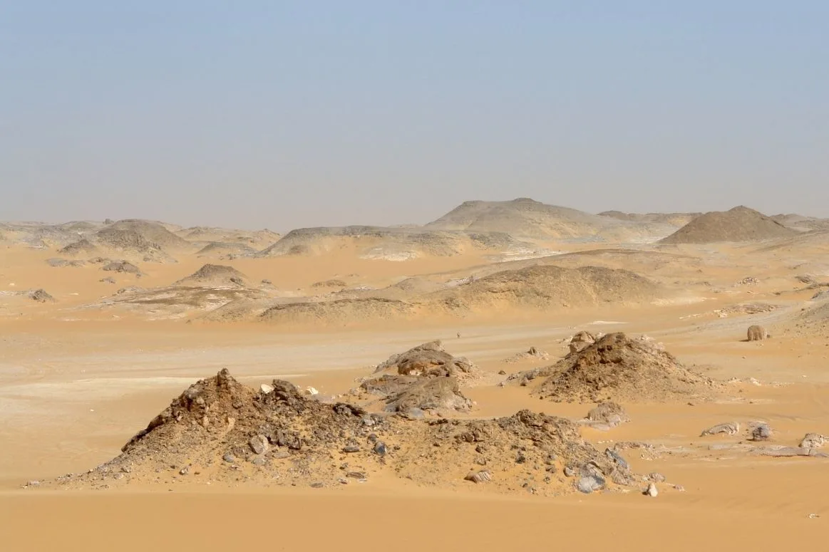
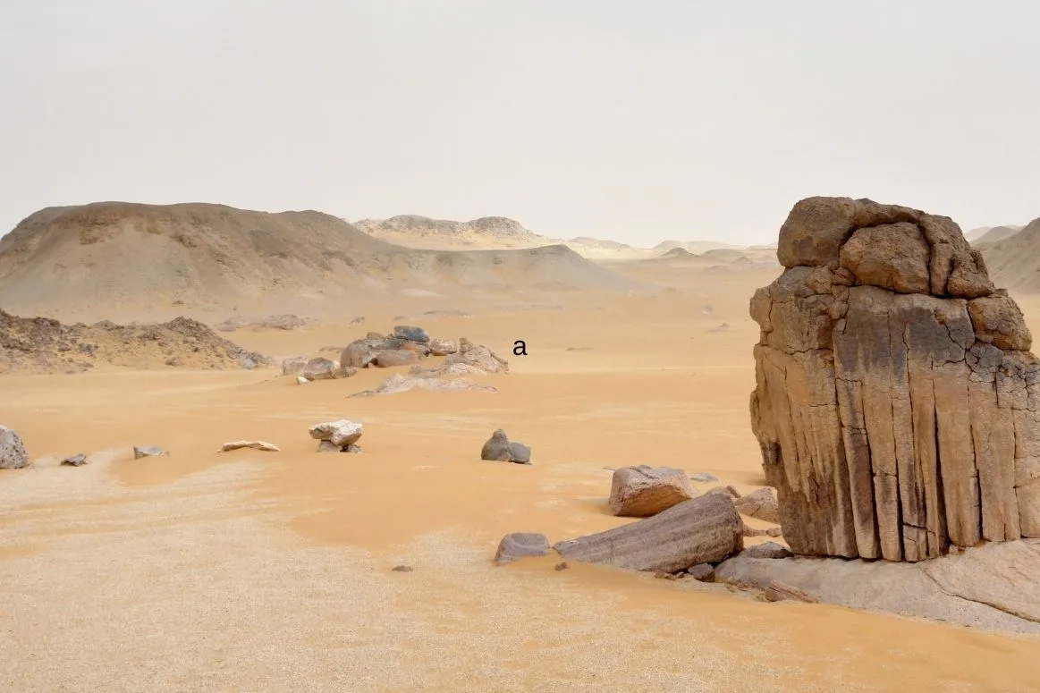
Photos of The Libyan Desert
The Libyan Desert looks different depending on where the camera lands: rippled dunes, stone plains, and dark mountain outcrops that feel like islands in an ocean of sand.
Physical Features
| Feature | Details |
|---|---|
| Area | About 1.3 million km² (commonly cited for the broader desert region) |
| Span | Roughly 1,100 km east–west and 1,000 km north–south |
| Signature Landforms | Sand seas (ergs), hamadas (rock plateaus), regs (gravel plains), basins, and isolated massifs |
| High Points | Jebel Uweinat reaches about 2,000 m above sea level |
Think of the Libyan Desert as a huge natural mosaic: one tile is soft sand, the next is hard rock, and then a sudden patch of cliffs and mesas breaks the pattern. It sits inside the Eastern Sahara, so the scale is big and the horizons feel even bigger.
Major Sand Seas And Plateaus
- Great Sand Sea – a famous erg stretching across western Egypt into eastern Libya, with dune fields that read like frozen waves.
- Calanshio Sand Sea – a vast Libyan dune region where some dunes rise to around 110 m, aligned by persistent winds.
- Gilf Kebir Plateau – a sandstone “table” rising roughly 300 m above surrounding plains, with steep edges and hidden wadis.
- Jebel Uweinat – a rugged mountain complex near a border junction, standing out as a stone fortress in a mostly level desert.
Climate & Precipitation
The Libyan Desert climate is hyper-arid. Rain is rare, skies are often clear, and the air can feel so dry that wood and cloth seem to tighten. Many locations average only a few millimeters of rain per year, and some stretches can go a long time without meaningful precipitation.
Temperatures swing like a pendulum. Summer days commonly push into the 40°C range, while nights can cool fast, especially over open sand where heat escapes quickly. In winter, nighttime cold can feel surprisingly sharp, and in higher terrain it may approach near-freezing.
Wind As The Main Architect
In a place with little rain, wind becomes the sculptor. It sorts grains by size, stacks dunes into ridges, and carves streamlined features in softer rock. The result is a landscape that can look calm from afar but is quietly active up close, with sand grains acting like tiny chisels.
Some dune types are remarkably organized. In parts of the Great Sand Sea, long ridges form parallel lines that can run for many kilometers, shaped by consistent wind directions and steady sand supply.
Ecological Features
The ecosystems of the Libyan Desert are built around scarcity. Life works on a strict budget: save water, avoid midday heat, and make the most of brief, favorable windows. The desert’s core is often nearly vegetation-free, while edges and uplands can hold pockets of surprising diversity.
Habitats You’ll Meet Across The Region
- Ergs – dune seas with shifting surfaces, where many species rely on burrows and nighttime activity.
- Regs – gravel plains that can look like a stone pavement, often stable for long periods.
- Hamadas – rocky plateaus and hard ground where sparse shrubs may appear after rare moisture.
- Massifs And Highlands – isolated mountains such as Jebel Uweinat, which can create small microclimates and varied terrain.
- Oases – islands of water and greenery that support people, palms, and migratory birds.
Water is the true boundary line. Where groundwater reaches the surface, an oasis can form a living ribbon of palms and gardens surrounded by bare sand and rock.
Flora & Fauna
Calling the Libyan Desert “empty” misses the point. It is more like a quiet library: fewer “books” on the shelves, but each one is specialized. Plants and animals here are built for low water, high heat, and long distances between resources.
Plant Life
- Date palms – strongly tied to oases, forming shaded groves where humidity stays a little higher.
- Tamarisk and hardy shrubs – often found near salty soils or shallow groundwater, with salt-tolerance as a key advantage.
- Ephemeral grasses – may appear briefly after rare rain, completing life cycles fast, almost like nature’s pop-up shops.
Animal Life
- Desert foxes and other small predators – typically most active at night, using cool darkness as cover.
- Gazelles in suitable fringes and plains – adapted to travel efficiently and manage heat.
- Reptiles – including lizards that regulate temperature with shade, posture, and timing.
- Birds – from residents around oases to seasonal visitors, using green pockets as stop points.
Many desert animals rely on the same simple trick: timing. Move at dawn, rest at midday, and become active again when the sand cools. It’s efficient, and it works.
Geology & Landscape Formation
The Libyan Desert is a story written in sandstone, older basement rocks, and layers of sediment that lie like pages stacked flat. In many areas, horizontal beds create stepped plateaus, while wind and rare runoff cut channels and cliffs into the edges.
Why The Land Looks So Different From Place To Place
Where sand dominates, dunes behave like slow-moving water: they crest, spill, and rebuild, leaving patterns that change over years. Where rock dominates, erosion is more selective, trimming softer layers and leaving harder bands behind. The contrast can be dramatic, with a smooth dune field ending abruptly at a cliff line.
Sand In Motion
Satellite images show dune belts and ridges with strong alignment, revealing the “invisible hand” of prevailing winds. In parts of the region, dunes can form long, narrow ridges; elsewhere, star dunes build where wind directions vary. The surface may look still, but it is always rearranging grain by grain.
In and around Kufra, research using radar and satellite data has helped outline ancient drainage paths beneath the sands. That hidden geometry matters because it shapes how groundwater moves today, and why some places can support oasis life while others cannot, wich feels almost mysterious until the maps are seen.
Introduction To The Libyan Desert
The Libyan Desert forms a vast part of the Eastern Sahara, stretching across eastern Libya and linking naturally with adjacent desert lands in Egypt and Sudan. It is famous for its sand seas, wide stone plains, and isolated highlands that rise suddenly from the flat.
This is not a single “look.” One area feels like an endless beach without water; another looks like a paved courtyard of gravel; another stands tall in cliffs and mesas. Together, they form a desert landscape that is simple in color yet rich in structure, like a minimalist painting with deep texture.
Oases And Natural Water Systems
Oases are the life nodes of the Libyan Desert. They appear where groundwater reaches the surface or sits close enough for wells to tap it. Around these waters, human settlement, agriculture, and wildlife all cluster, creating a strong contrast: green against tan.
Notable Oasis Regions Connected To The Libyan Desert
- Kufra Oasis – a major oasis basin in southeastern Libya, linked to deep groundwater systems.
- Jaghbub and nearby oasis points – northern desert lifelines in Libya’s eastern side.
- Siwa (nearby, in Egypt) – an iconic oasis at the desert’s northern reaches, showing how water can reshape local ecology.
Many oases depend on groundwater stored in sandstone aquifers laid down long ago. That water can be ancient, held underground like a sealed reservoir. Where it reaches the surface, it creates a stable base for palms, gardens, and small-scale wetlands.
Notable Landscapes And Natural Highlights
Several places inside the Libyan Desert stand out because they show the desert’s range in a single glance: dunes, cliffs, and mountains in one connected region. These landmarks are also important to science because their geology and landforms preserve clues about older climates and landscape shifts.
Great Sand Sea
The Great Sand Sea is one of the best-known dune systems in the Sahara. It contains long ridges of sand and broad corridors between them. From above, it can look like a giant fingerprint, with lines repeating across the surface in rhythmic bands.
Gilf Kebir And Hidden Valleys
The Gilf Kebir Plateau rises above surrounding desert like a massive stone counter. Along its edges, erosion reveals steep faces and deep wadis. Some sheltered areas preserve evidence of earlier, wetter phases in the Sahara, including landscapes that feel less like “bare desert” and more like a stone canyon country.
Jebel Uweinat
Jebel Uweinat is a rugged mountain complex that breaks the desert’s flatness. Its height and rough terrain create local variation in temperature, shade, and wind exposure. It is also a striking visual marker: a rock island surrounded by sand and gravel.
Cultural Heritage In A Desert Setting
The Libyan Desert also holds important cultural heritage, especially in rocky regions where sheltered surfaces preserve ancient markings. One of the best-known examples is the Rock-Art Sites of Tadrart Acacus in western Libya, recognized internationally for the depth and range of its imagery.
Rock art offers a gentle, human-scale counterpoint to vast dunes. It shows that the Sahara’s story includes changing environments over long time spans, and it highlights how people expressed daily life and surroundings in durable materials. In a landscape that feels timeless, these records add a vivid sense of continuity.
Why The Libyan Desert Matters In Global Desert Geography
Within the world’s deserts, the Libyan Desert is a classic example of a hyper-arid core inside a larger desert system. Its mix of sand seas, rock plateaus, and isolated massifs makes it especially useful for understanding how wind, geology, and water scarcity interact.

It also supports a clear lesson in desert variety: a “desert” is not one surface. Here, sand can dominate for hundreds of kilometers, then vanish into gravel and stone, then rise again into cliffs. That variety is part of what keeps the region so visually distinct and scientifically valuable.
References
NASA Earth Observatory – Jebel Uweinat
NASA Earth Observatory – The Great Sand Sea
UNESCO World Heritage Centre – Rock-Art Sites of Tadrart Acacus
Egyptian Environmental Affairs Agency – Gilf Kebir National Park Expedition Report (PDF)
Egypt State Information Service – Gilf El-Kebir Reserve
Universität zu Köln – Archaeology of the Gilf Kebir National Park (PDF)
British University in Egypt Repository – Radar Study Around Kufra Oasis