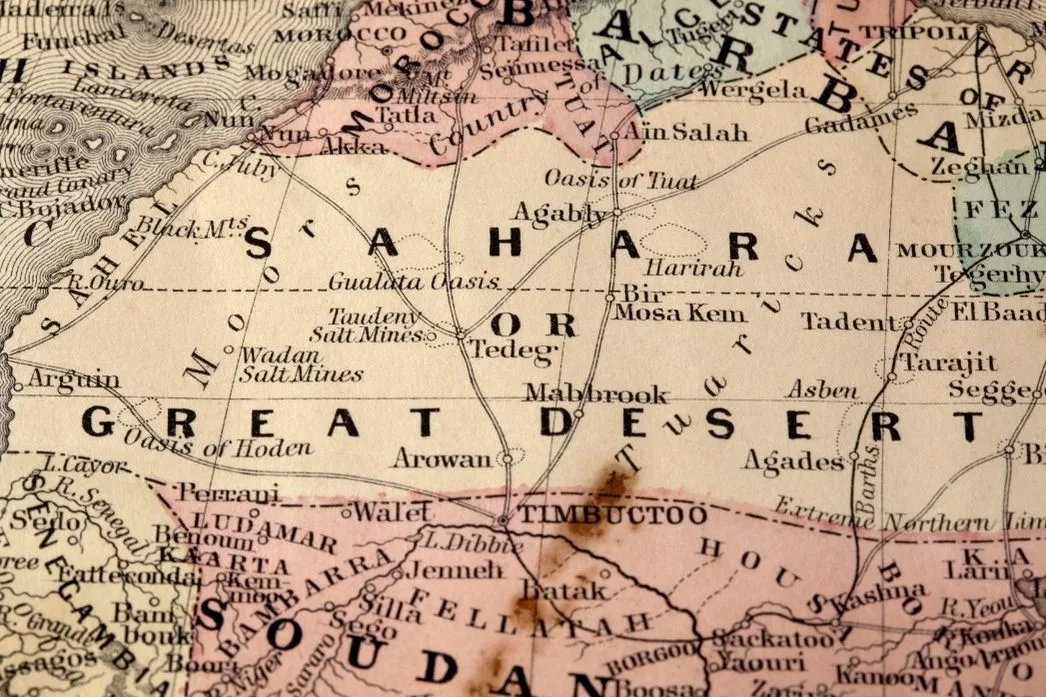
Location & Continent
Continent: Africa
Countries: Algeria, Chad, Egypt, Libya, Mali, Mauritania, Niger, Western Sahara, Sudan, Morocco, Tunisia
Coordinates: 23°N, 13°E
Sahara Desert – Map & Street View
Click to load the interactive map
Click to load the interactive map
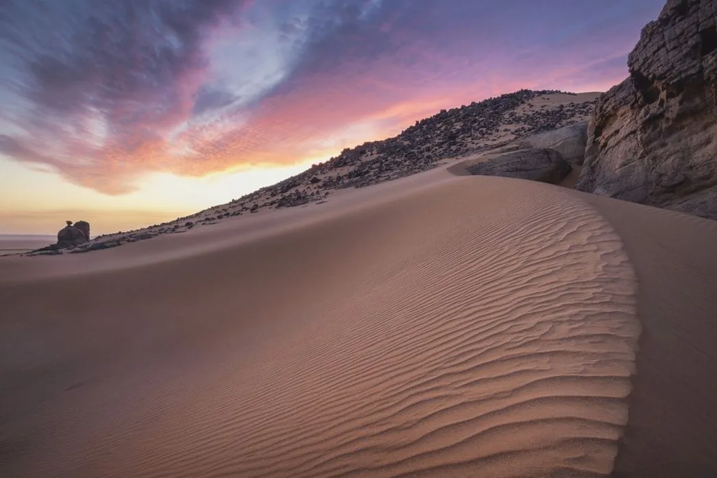
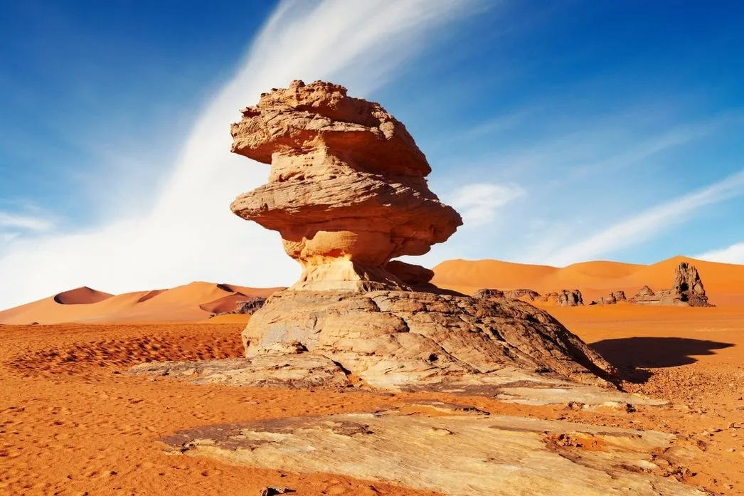
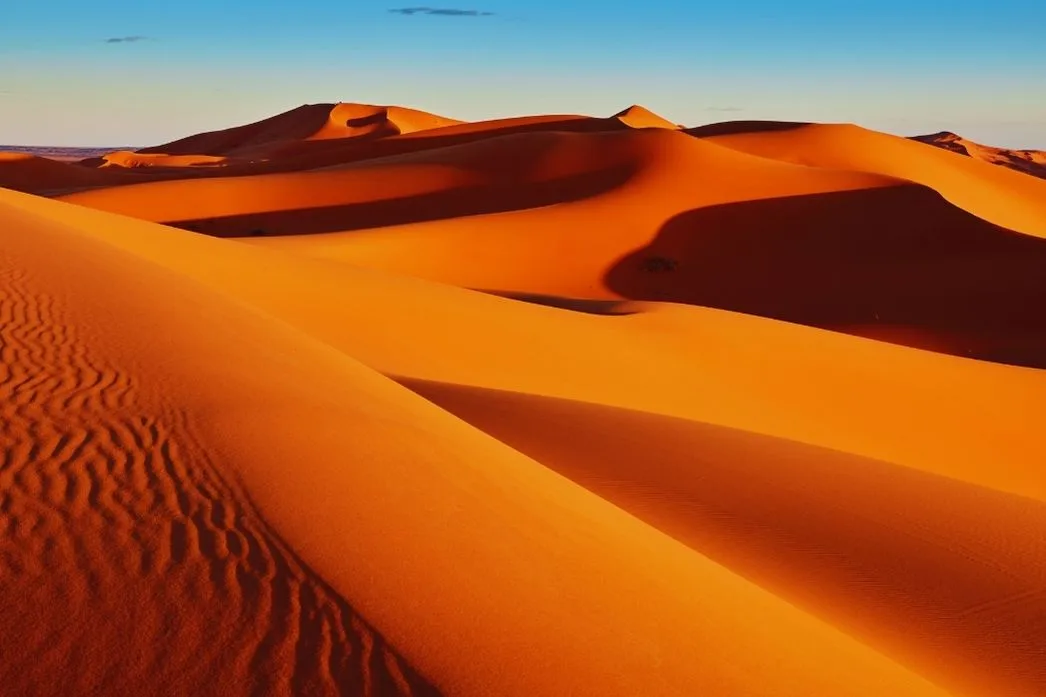
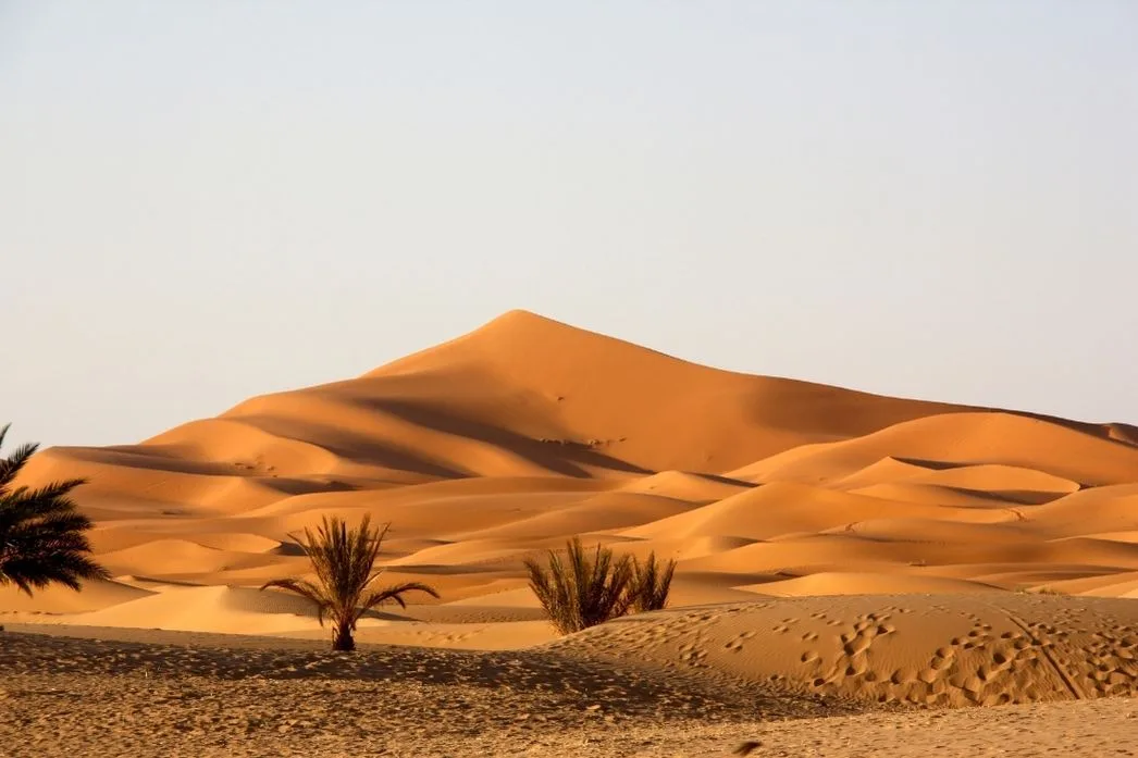
Photos of the Sahara Desert
Physical Features
Area: 9.2 million km² (largest hot desert in the world)
Length: Approximately 4,800 km
Width: 800–1,200 km
Elevation: Emi Koussi Volcano – 3,415 m (Chad), Qattara Depression – 133 m (Egypt)
Climate & Precipitation
Temperature: Daytime 38–40°C, night 13–20°C; winter nights can drop below 0°C
Precipitation: Average annual 10 mm; some areas below 5 mm
Ecological Features
Ecozone: Hot desert and hyper-arid
Biome: Deserts and xeric shrublands
Ecoregions: Western Sahara Montane Xeric Woodlands, Sahara Desert Ecoregion, Southern Sahara Desert Ecoregion
Flora & Fauna
Flora: About 2,800 vascular plant species; around a quarter are endemic
Fauna: Addax, scimitar-horned oryx, bustards, and other species, some threatened by overhunting
Geology & Notable Features
Geology: Volcanic mountains, sand and gravel plains, salt pans, ergs (sand seas), hamadas (rock plateaus), regs (gravel plains), oases
Notable Features: Emi Koussi Volcano (Chad), Qattara Depression (Egypt)
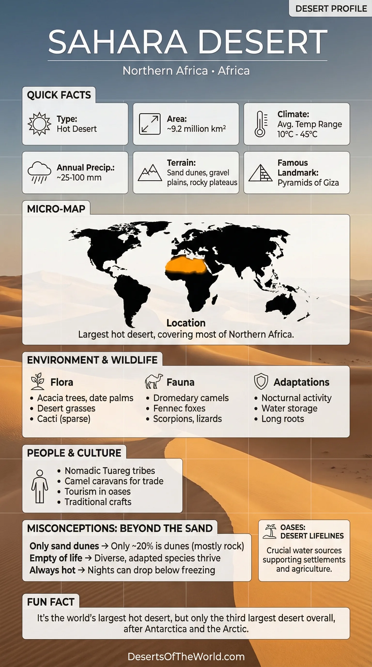
Introduction to the Sahara Desert
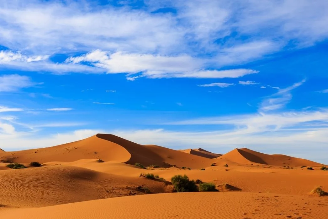
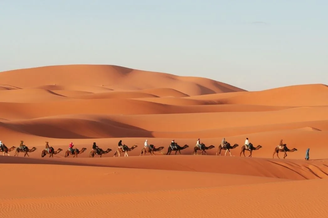
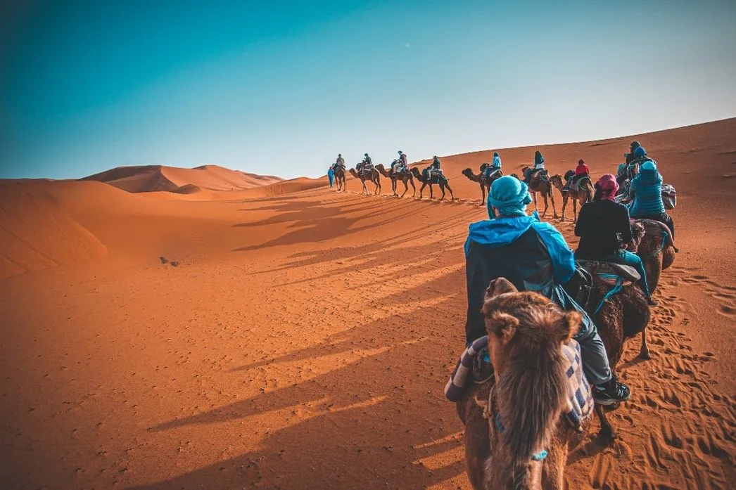
The Sahara Desert is the largest hot desert in the world, stretching across North Africa for more than 9.2 million square kilometers. Its landscapes are dominated by endless sand dunes, rocky plateaus, and arid plains. Despite its harsh conditions, the Sahara has been home to human civilizations for thousands of years, with nomadic tribes such as the Tuareg and Bedouins adapting ingeniously to the environment.
Geography and Physical Features
The Sahara’s terrain is diverse. It includes large sand seas, known as ergs, stony plains called regs, and rocky plateaus referred to as hamadas. Mountain ranges such as the Ahaggar Mountains in Algeria and the Tibesti Mountains in Chad rise above the surrounding desert. Depressions, including the Qattara Depression in Egypt, lie below sea level. These landforms create strong environmental contrasts and support adapted plant and animal species.
Climate and Weather Patterns
The Sahara experiences extreme climate conditions. Daytime temperatures can soar above 50°C in summer, while winter nights may drop below 0°C. Rainfall is scarce, often under 50 millimeters annually, and some regions remain virtually rainless for years. Winds, such as the harmattan, can carry fine sand over hundreds of kilometers, shaping dunes and causing sandstorms. Seasonal variations create localized microclimates that support life in certain areas.
Flora of the Sahara
Plant life in the Sahara is adapted to extreme drought. Acacia trees and date palms are common near oases, while hardy shrubs and grasses cover rocky areas. Some plants have deep roots to access underground water, and many produce seeds that can remain dormant for years until rainfall occurs. These resilient species form the foundation of the desert’s fragile ecosystems.
Fauna and Wildlife
Despite the arid environment, the Sahara hosts remarkable wildlife. Iconic species include the addax antelope, fennec fox, dromedary camels, and desert monitor lizards. Birds such as the sandgrouse and migratory raptors traverse the desert skies. Many animals exhibit nocturnal behaviors to avoid daytime heat, and several are critically adapted to survive with minimal water. Human activity and hunting have threatened some populations, highlighting the need for conservation efforts.
Oases and Human Habitation
Oases are lifelines in the Sahara. They provide water, vegetation, and shelter to both humans and wildlife. Settlements near oases often feature palm groves, cultivated fields, and small villages. Nomadic tribes rely on camels to transport goods and traverse vast distances between these fertile spots. Historically, oases were also critical trade hubs for caravan routes connecting sub-Saharan Africa with the Mediterranean.
Historical and Cultural Significance
The Sahara has a rich history and cultural heritage. Archaeological sites reveal ancient rock art, burial grounds, and remnants of early civilizations. Nomadic cultures developed sophisticated knowledge of desert survival, navigation, and resource management. Languages, music, and rituals have been shaped by the desert environment, and trade across the Sahara influenced economies and cultural exchanges for centuries. The desert remains a symbol of resilience and human ingenuity.
Geology and Landscape Formation
The geological history of the Sahara includes volcanic formations, sedimentary basins, and extensive sandstone plateaus. Wind and occasional flooding continue to shape dunes, forming patterns that shift over time. Salt flats, known as chotts, and gravel plains are widespread, and erosion has cut canyons and valleys into the rock. These formations record past climatic and tectonic processes in the region.
Challenges and Conservation
The Sahara faces modern challenges including climate change, desertification, and habitat loss. Overgrazing and human encroachment threaten fragile ecosystems, while water scarcity affects both wildlife and human populations. Conservation programs aim to protect species, preserve oases, and promote sustainable use of resources. Education and ecotourism offer pathways to maintain the desert’s unique ecological balance while allowing humans to experience its beauty responsibly.
Tourism and Exploration
Adventure tourism has increased interest in the Sahara. Visitors take part in camel treks, dune surfing, and star-gazing under clear desert skies. Guided tours introduce local cultures and historical sites and explain the surrounding environment. Many photographers focus on dune formations, changing light at sunset, and desert wildlife. Tourism supports local economies but requires regulation to limit environmental damage.